Selski most - Babji zob (via Kupljenik)
Starting point: Selski most (427 m)
| Lat/Lon: | 46,3459°N 14,1026°E |
| |
Name of path: via Kupljenik
Time of walking: 2 h 40 min
Difficulty: easy marked way
Altitude difference: 701 m
Altitude difference po putu: 745 m
Map: Karavanke - osrednji del - 1:50.000
Recommended equipment (summer):
Recommended equipment (winter): ice axe, crampons
Views: 7.380
 | 1 person likes this post |
Access to the starting point:
a) From the motorway Ljubljana - Jesenice take the exit Lesce and then continue to Bled. At Bled, "overlook" the left turn-offs in the direction of Koritno, Bodešče, Ribno and Sel, and continue driving to the traffic lights where the road to Gorje and Pokljuka turns off to the right. At this junction, continue straight ahead and start descending towards Lake Bled. When you see the Peking Chinese Restaurant on the left, leave the main road towards Bohinjska Bistrica and follow the road behind the restaurant to the left onto Narodnih herojev Street. At a few small junctions continue along the main road, then arrive at Cankarjeva cesta, which you then drive along for a while, or to the junction by the chapel, where you continue slightly right in the direction of Sela and Dobra gora (continue along the main road Ribno). Continue driving along the gradually narrowing road, which takes you along meadows and fields for a while, then turns into a forest through which it begins to descend. Lower down the forest ends, and we arrive in the village of Selo and a little further on at a small crossroads, where we continue straight on (left and then immediately right) down towards Sava and Kupljenik (left Ribno, right Bled). There is some more downhill on the still relatively narrow road, and then the asphalt ends and we take a slightly wider macadam road to the Selo Bridge over the Sava Bohinjka. Park in a convenient place by the bridge.
b) First drive to Podbrdo and from there to Bohinjska Bistrica (by car-train or via Soriška mountain pasture). From Bohinjska Bistrica continue driving to Bled, and when you reach the lake turn right towards Sela. Continue along the narrow Mill Road. Bled soon ends, and the still relatively narrow road leads to the village of Selo, where at a small crossroads in the middle of the village we continue to the right in the direction of Sava and Kupljenik (left Bled, straight Ribno). There is some more downhill on the still relatively narrow road, and then the asphalt ends, and we take a slightly wider macadam road to the Selo Bridge over the Sava Bohinjka River. Park in a convenient place by the bridge.
Path description:
From the starting point, cross the bridge over the Sava Bohinjka River, which offers a beautiful view of Ribenska Gora, and after the bridge, continue to the right in the direction of Bohinjska Bela, Kupljenik and Taleža. Continue along the macadam road for a short distance, then arrive at a small crossroads where the road to Talež turns left, and we continue straight on in the direction of Kupljenika. Continue along the road, then at the next junction, which is not marked, continue slightly left, walking along the right edge of the nearby fence. Further on, the road, still curving, changes to cart track, which is followed at the crossroads in the direction of Kupljenika. A few minutes further on, when the path passes onto the slopes of Homa (675 m), it begins to climb steeply to the right, taking us over quite steep slopes. Higher up, the forest ends and the path leads us to a beautiful viewpoint at the chapel of Na Koren, where we can stop for a short while and enjoy the beautiful views.
The path then returns to the woods and then leads along the edge of the meadows. A little beyond the NOB memorial, which can be seen on the left hand side, the path turns slightly to the left and starts to climb towards the Kupljenik settlement, taking in the views of Babji zob. The asphalt road leading through Kupljenik is reached a few steps above a small chapel, and we follow it to the left in the direction of Jama. The road continues past a relatively new cross, and then slowly begins to turn more and more to the right. At a small crossroads located between the houses we continue to the right (left Talež), and then we continue along the gently sloping asphalt road, from which we have beautiful views towards Karawanks and Lake Bled. Passing another NOB memorial and the fire station, you soon reach the place where a short path branches off to the left towards the Church of St. From the church it is possible to continue through the hay meadows to the marked path Kupljenik - Babji zob, as there are also signs for the cave under Babji zob in that direction, but the locals prefer to see that a path a few minutes longer is being used, which leaves the hay meadows), and we continue straight ahead along the road, which first turns slightly right, then turns left and descends to the right serpentine. Leave the road on the right serpentine and continue straight on to the marked parking area where the marked footpath Kupljenik - Babji zob begins.
From the marked parking area, continue along the lesser road towards the caves below Babji zob and Babji zob. The road first leads us along the edge of the pasture, from where a beautiful view opens up to the highest peaks of Karawanks, and then, after a left turn, where we see the mountain direction signs, it gradually turns into the forest. Walk along the road for a few minutes, then at a relatively new crossroads of dirt roads continue slightly left (the crossroads was not marked at the time of the description) to cart track, which after a few metres turns even more to the left (straight ahead to the cave below Babji zob). A climb through the forest follows, and a few minutes higher up, cart track leads us to a hay meadow, where a wooden hut is located at its lower edge, and we have a beautiful view towards Lake Bled and part of Karawanks around Golice. Cart track takes us just a little higher to another hayfield, where the markers lead us to the right, to an initially less visible path that turns into a forest. Once in the woods, the path becomes easy to follow and starts to climb more steeply. A few minutes higher, you cross a new, not yet fully completed forest road, and above it, the waymarked path climbs quite steeply through the forest. As the path turns right, it flattens out a little, then climbs steeply to the right across steeper and steeper slopes. The slope becomes steeper as you get higher up, but the path is relatively wide, so there are no major problems crossing it, but a little more caution is needed in wet conditions, snow or leaves, especially when descending. After passing a few rock columns, the path turns left, passes into a valley, and a few steps further on out of the forest on mountain pasture Prihodi, which has just the right name, as we have arrived at the edge of Jelovice.
When you reach mountain pasture, continue straight on or slightly to the right, then get on cart track, where you join the path with mountain pasture of Vršan and Dane's mountain pasture. Cart track soon turns into a footpath which, with the "help" of a signpost, takes us to a precipitous ridge. The path mostly runs a few metres to the left of the precipice, so there is no major danger of slipping, but we must be careful especially when we take a few steps to the right off the marked path to get a good view. The path, which offers beautiful views between the treetops towards Bled, Bohinjska Bela and the highest peaks of Julian Alps, leads to the foothill, where a less visible path branches off to the left towards the nearby mountain pasture Ricman. Continue straight ahead, following the path as it visibly begins to descend. After a few minutes, the descent ends, and we are only a short, moderate climb away from the lookout point and the Babji zob registration box.
Selski most - Na Koren Chapel 30 minutes, Na Koren Chapel - Kupljenik 35 minutes, Kupljenik - mountain pasture Prihodi 1:05, mountain pasture Prihodi - Babji zob 30 minutes.
Description and figures refer to 2015 (April).

Pictures:
 1
1 2
2 3
3 4
4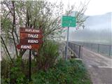 5
5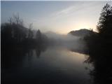 6
6 7
7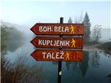 8
8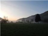 9
9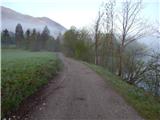 10
10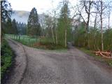 11
11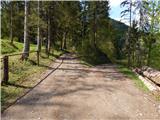 12
12 13
13 14
14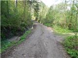 15
15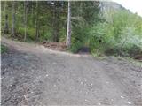 16
16 17
17 18
18 19
19 20
20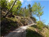 21
21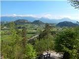 22
22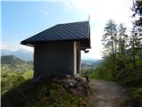 23
23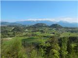 24
24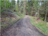 25
25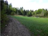 26
26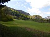 27
27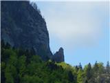 28
28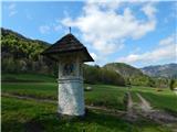 29
29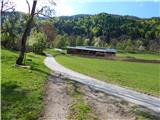 30
30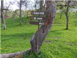 31
31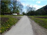 32
32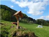 33
33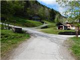 34
34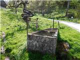 35
35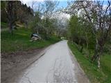 36
36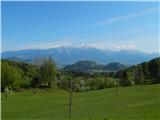 37
37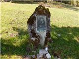 38
38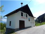 39
39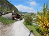 40
40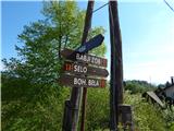 41
41 42
42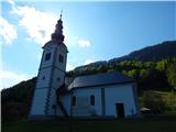 43
43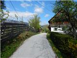 44
44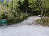 45
45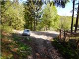 46
46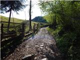 47
47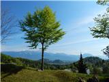 48
48 49
49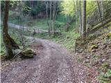 50
50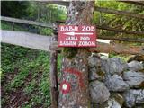 51
51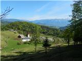 52
52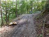 53
53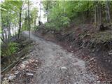 54
54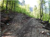 55
55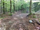 56
56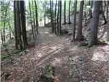 57
57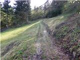 58
58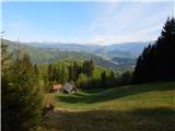 59
59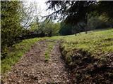 60
60 61
61 62
62 63
63 64
64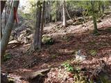 65
65 66
66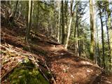 67
67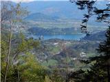 68
68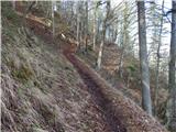 69
69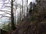 70
70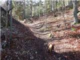 71
71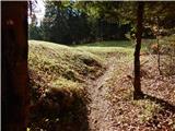 72
72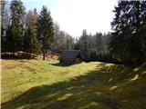 73
73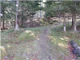 74
74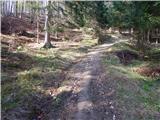 75
75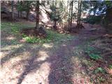 76
76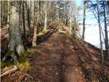 77
77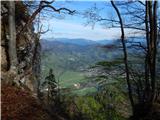 78
78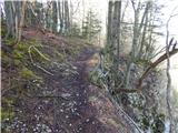 79
79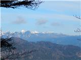 80
80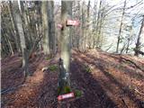 81
81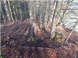 82
82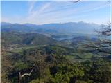 83
83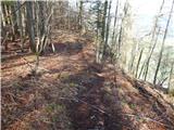 84
84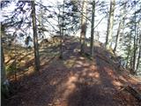 85
85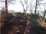 86
86 87
87
Discussion about the trail Selski most - Babji zob (via Kupljenik)
|
| tango9. 02. 2019 |
Današnja tura ni ravno ne vem kakšen podvig, bila pa je čudovita. Bled z Blejskim jezerom je res podoba raja, sploh s kuliso zasneženih Karavank in lepo zeleno Savo. Edino Julijci in Bohinjske gore so bile bolj slabo vidne, saj je nebo prekrivala tanka koprenasta oblačnost. Za navzdol so bile male derezice kar dobrodošle, čeprav bi šlo tudi brez njih, a malo bolj počasi.Priporočam.
|
|
|
|
| čara30. 09. 2021 12:18:01 |
Lepa pot. Zahvaljujoč se lokacij iizhodišča na google maps se nisem izgubila. Je pa na poti proti Babjemu zobu precej zastavic in to tudi polomljenih.
|
|
|