Slovenske Konjice - Skala (gentle path)
Starting point: Slovenske Konjice (333 m)
| Lat/Lon: | 46,3372°N 15,4204°E |
| |
Name of path: gentle path
Time of walking: 1 h 30 min
Difficulty: easy marked way
Altitude difference: 417 m
Altitude difference po putu: 450 m
Map:
Recommended equipment (summer):
Recommended equipment (winter): ice axe, crampons
Views: 22.321
 | 3 people like this post |
Access to the starting point:
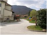
From the Ljubljana - Maribor motorway, take the Slovenske Konjice exit and follow the road to the point. In the centre of Slovenske Konjice, leave the main road (continue left) and head towards the church, near which you will park in a large marked parking lot.
Path description:
From the church parking lot, continue along the pavement (westwards), which leads us after a few dozen metres to the school, where we see the mountain signs for Stolpnik. Continue left on the pavement, which climbs slightly and after a short ascent leads to the mountain signs in the immediate vicinity of the cemetery.
Here, continue straight ahead towards the Old Castle along the path that leads along the left side of the cemetery. At the top of the cemetery, leave the road and continue your ascent along the marked footpath, which climbs steeply. After a few minutes of ascent, the steepness eases and the path leads us out of the forest onto a macadam road, which we only cross (right Konjice Castle 5 minutes). The wide cart track path we walk on leads us in a few steps to a crossroads on the path, where the signpost directs us upwards to the left. After a few dozen steps, the situation repeats itself, the only difference being that the ascent is not continued along the cart track but along a footpath that climbs through the forest. Higher up, the path leads to the next road, where you continue left along the footpath in the direction of Skala. After a short further ascent, the path crosses the road mentioned a short time ago. The path that continues to climb crosswise quickly leads us to the next crossroads of the path, where we have two options for continuing. Chose the right easier (left very difficult climbing route), which after a further few minutes of cross-climbing with the help of a rope (not difficult) quickly leads us to the Skala lookout point.

We can extend the trip to the following destinations: Stolpnik
Pictures:
 1
1 2
2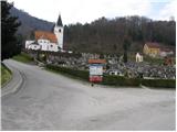 3
3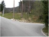 4
4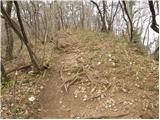 5
5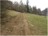 6
6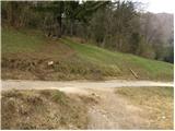 7
7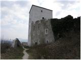 8
8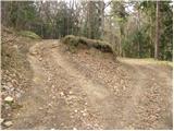 9
9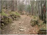 10
10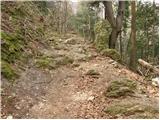 11
11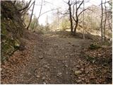 12
12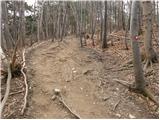 13
13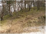 14
14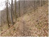 15
15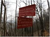 16
16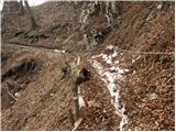 17
17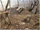 18
18 19
19
Discussion about the trail Slovenske Konjice - Skala (gentle path)
|
| gasilec25. 03. 2009 |
Moram pohvaliti skrbnike te poti (menda PD Konjice), pot dobro označena, varovala nova in brezhibna, nova vpisna knjiga z priloženimi pisali, pri klopci 2 toplomerja (da veš, ali ti je vroče ali te zebe). Upam, da bomo obiskovalci znali ohraniti to stanje in tako poplačali vloženi trud markacistov.
|
|
|
|
| jan d17. 10. 2011 |
VREDU SO VSE POTI NA SKALO IN SEVEDA SO SKRBNIKI KI UREJEJO POTI NA SKALO SEVEDA VESNI IN RESNA POHVALA NJIM IN PD KONJICE JAN
|
|
|
|
| pohodnik3817. 10. 2011 |
če bo čez veekend res kaj lepega vremena si pridem pogledat in potem še na sam vrh Stolpnik 
|
|
|
|
| Nastasja26. 11. 2011 |
Po novih meritvah je skala visoka 777 m.
|
|
|
|
| jany198026. 11. 2011 |
Ja megla je bila dolgo... pa veliko vlage... pa je zrastla za 17 m  nemogoče
|
|
|
|
| tuna.iris15. 05. 2015 |
Moji sodelavci se povzpnejo po tej poti v 40 minutah .
|
|
|
|
| jprim15. 05. 2015 |
No lepo, da se hvališ s tvojimi sodelavci. Kaj pa ti @tuna.iris  ?
|
|
|
|
| tuna.iris15. 05. 2015 |
50 minut, ni mi jasno zakaj pise da je pot dolga 1 uro in 30 minut?
|
|
|
|
| T00349781. 06. 2023 08:13:19 |
Pozdravljeni! Mene zanima,ker se nisem.bila.n ateh skalah,imam namen v kratkem.casu iti.Ali je ta čas hoje ,ki piše 1.30 ure v obe smeri,ali v eno smer? Računajte na.pocasno hojo,ker bi iskala vmes.Hvala
|
|
|
|
| lepenatka1. 06. 2023 09:57:00 |
Čas pohodov se nanaša za v eno smer, razen če je kje opisana/navedena krožna pot.
|
|
|
|
| čebejla3. 06. 2023 12:41:09 |
Če štartate nad cerkvijo Sv. Ane, imate 1 uro, več kot dovolj časa do vrha. Če pa izberete izhodišče od gradu, pa približno 10min manj.
|
|
|