Sopot - Vrh Svetih Treh Kraljev
Starting point: Sopot (600 m)
| Lat/Lon: | 46,0008°N 14,1514°E |
| |
Time of walking: 1 h 25 min
Difficulty: easy marked way
Altitude difference: 284 m
Altitude difference po putu: 285 m
Map: Škofjeloško in Cerkljansko hribovje 1:50.000
Recommended equipment (summer):
Recommended equipment (winter):
Views: 3.495
 | 1 person likes this post |
Access to the starting point:
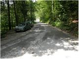
First, drive to Žiri, from where you follow the road in the direction of Logatec. At the end of Žiri, the road crosses the river Sovra and then continues along the left side of the river (right bank). When the road towards Logatec crosses the river Sovra again after 5km from Žiri, leave the main road and continue straight on (before the bridge). Continue for a few dozen metres to a roadside parking lot, where you park.
It is also possible to access the road from the Logaška side, where you drive towards Žire. Shortly after the hamlet of Brnikov Log, the road crosses the river Sovra and just after the bridge, take a sharp right and park a few ten metres further on.
Path description:
There is a crossroads by the parking lot, where you take the upper road on the left. The tarmac road, which climbs steeply at first, soon leads to a crossroads where you continue straight ahead. The road on which the steepness gives way leads us a little further through the small hamlet of Hleviše. The road continues to climb the valley partly through meadows and partly through the forest. Next, the road leads us to the next hamlet, where we continue in the direction of Vrh-a Svetih treh kraljev. The road then leads past a chapel to the village of Vrh-a Svetih Treh kraljev, where you continue to the right. There is a slight climb past the fire house to the hut.
At the cottage, turn right on the road which, after a short climb, leads out of the forest. The next few minutes are just a short walk along the increasingly scenic mountain slope. The top of the hill on which the church stands can be reached easily in about ten minutes of gentle ascent from the mountain hut.

Pictures:
 1
1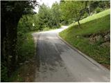 2
2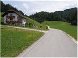 3
3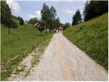 4
4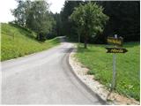 5
5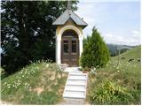 6
6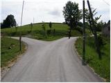 7
7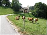 8
8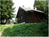 9
9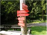 10
10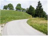 11
11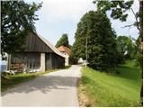 12
12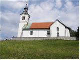 13
13 14
14
Discussion about the trail Sopot - Vrh Svetih Treh Kraljev
|
| mirze18. 10. 2020 |
Prava hribovska tura (brez hoje po (asfaltnih) cestah) je tista markirana pot, ki je označena na zemljevidu "Nanos". Začetek je tam, kjer je opisano zgoraj, nato pa nas puščica "Logaška pot" po nekaj metrih asfalta usmeri desno na dobro markirano hribovsko stezo. Asfalt se pojavi samo pred nekaterimi hišami. Gremo mimo kmetij Pavle, Rodof ter Čakovec in pridemo na cesto nekaj metrov pod cerkvijo. (Stanje: 18. oktober 2020.)
|
|
|
|
| GregorD21. 11. 2020 |
Danes isto izhodišče in isti cilj. Za pot sem izbral tisto, ki jo je opisal @mirze. Luštna, le kratka. Zmerne hoje slabo uro.
|
|
|