Sovodenj - Planinska koča Mrzl'k
Starting point: Sovodenj (593 m)
| Lat/Lon: | 46,085°N 14,0386°E |
| |
Time of walking: 1 h 40 min
Difficulty: easy marked way
Altitude difference: 378 m
Altitude difference po putu: 385 m
Map: Škofjeloško in Cerkljansko hribovje 1:50.000
Recommended equipment (summer):
Recommended equipment (winter):
Views: 2.500
 | 1 person likes this post |
Access to the starting point:
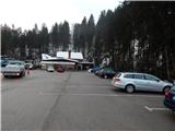
a) First, drive to Gorenjska vas in the Poljane valley (reachable from Škofja Loka, the new bypass road that bypasses Škofja Loka Horjul or Polhov Gradec), then continue driving towards Žire and Cerkno. After Trebija and just before the bridge over the Poljane Sora River, leave the main road towards Žire and turn right towards Cerkno. Continue along a slightly more winding road, which quickly leads to the settlement Sovodenj, where you park in the middle of the settlement in a large parking lot near the Mercator shop.
b) Drive to Žiri (to get here from Vrhnika or Logatec), then continue driving towards Škofja Loka. Before Trebija, turn left onto the road towards Cerkno. Continue along a slightly curvier road, which will quickly take you to Sovodenj, where you will park in the middle of the settlement in a large parking lot near the Mercator shop.
c) Leave the main road Idrija - Straža-Želin at the turnoff for the settlement Jazne, then climb up to the above-mentioned settlement, from where you continue driving towards Sovodnje. After a small pass, where the marked trail to Bevkov vrh branches off to the left, the road starts to descend and we follow it to the settlement Sovodenj, where we park in a larger parking lot near the Mercator shop.
d) We drive to Cerkno, and from there we continue in the direction of Škofja Loka. We continue along the ascending road, which takes us through Planina pri Cerknem, along a winding road to the pass Kladje, after which we start descending towards Sovodnje. When we arrive in Sovodenj we park in a large parking lot near the Mercator shop.
Path description:
From the starting point, we walk to the fire house of PGD Sovodenj and the Cooperative House Sovodenj, where we can already see the first yellow signs for Mrzli vrh. The signs direct you to the road that continues along the Javorščica stream. Soon we reach a crossroads where we continue straight along the main road towards Mrzli vrh and Sivka (chicken farm on the left, Korenine-Kržišnik farm). The asphalt road then leads us past the road branch to the right towards the house with house number Laniše 6, and the valley we are walking through widens and the road leads us to part of the settlement of Koprivnik. Continue straight through the settlement, and when the settlement ends, the path leads you past an information board on the path along the Rapallo border. A little further on, you arrive at a marked crossroads where you continue left in the direction of Mrzlega vrha, Sivka, the mountain hut and Javorjev Dol (right Jazne-Otalež). The path continues along the asphalt road, and higher up you arrive at a few houses in the settlement of Javorjev Dol.
When the asphalt road turns left and goes up the slope from the valley, we continue to the right on a side road in the direction of Mrzli Peak and the Likar homestead. Follow the macadam road ascending crosswise to the right, and beyond a belt of forest you will reach a house with the house number Mrzli Vrh 12, where you leave the road and continue sharp left on the path towards Mrzle Mhor. After only a few 10 steps the path turns right and climbs parallel to the road for a short distance, then turns left into the forest, through which it begins to climb steeply on the cart track. Cart track quickly lays down and then leads to a small pass to the south-east of Likarjeva Sivka, where it joins the waymarked path.
Continue left towards Mrzlemi vrh (right Bevkov vrh), passing the Tušar homestead on the left. A little further on, the path forks and we continue along the left-hand path with a yellow signpost for Mrzli vrh (straight ahead Mrzli vrh and Sivka). There is a short crossing to the left and then we reach an asphalt road which we follow to the left (right Mrzli vrh and Sivka), descending slightly to a nearby crossroads.
From the crossroads, go right towards the mountain hut, which is reached within a minute's walk on a steep macadam road. Description and figures refer to the situation in 2018 (March).

Pictures:
 1
1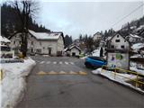 2
2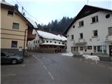 3
3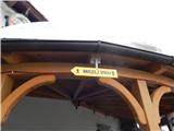 4
4 5
5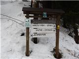 6
6 7
7 8
8 9
9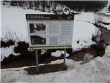 10
10 11
11 12
12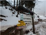 13
13 14
14 15
15 16
16 17
17 18
18 19
19 20
20 21
21 22
22 23
23 24
24 25
25 26
26 27
27 28
28 29
29 30
30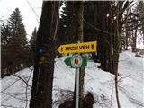 31
31 32
32 33
33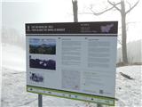 34
34 35
35 36
36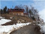 37
37 38
38
Discussion about the trail Sovodenj - Planinska koča Mrzl'k