Strahomer - Krim (via Kramarca)
Starting point: Strahomer (309 m)
| Lat/Lon: | 45,9424°N 14,4878°E |
| |
Name of path: via Kramarca
Time of walking: 2 h 10 min
Difficulty: easy marked way
Altitude difference: 798 m
Altitude difference po putu: 798 m
Map: Ljubljana - okolica 1:50.000
Recommended equipment (summer):
Recommended equipment (winter):
Views: 21.106
 | 1 person likes this post |
Access to the starting point:
From the southern Ljubljana ring road, take the Rudnik exit and follow the road towards Ig. At the intersection at Igo, turn right towards Iška vas, then in Staje village turn right towards Vrbljene village. In Vrbljene, turn left towards Strahomer, and park there in the asphalted parking lot by the Iška River.
Path description:
From the parking lot, follow the asphalted road, which crosses the Iška River via a bridge. The road starts to climb slightly and leads us past the church to a marked crossroads, where we continue straight in the route Krima across Kramarca (right Krim across Strmec).
Continue along the gently sloping cart track, which crosses the slopes to the south. After a few minutes of walking, cart track turns slightly to the right and starts to climb steeply. The cart track mentioned above turns sharp right, and we leave it just at this point and continue left along the slightly narrower cart track (this branch is slightly less well marked). The ascent continues along the sometimes quite overgrown cart track, which crosses the power line twice and then returns to the forest.
Higher up, the path leads to a junction of forest roads, where you continue straight on towards the Krim. Follow the road for only about 100 m, then continue right along the marked footpath, which begins to climb above the village of Gornji Ig (some views of the village open up between the treetops). Higher up, the path climbs a little more steeply and leads to a forest road, which you follow to the left. After a few steps along the above-mentioned road, we reach a well-marked crossroads, where we continue sharp right along the ascending cart track in the direction of Krimo (straight ahead Iški Vintgar and Iška village). There follows a cross-country climb along the wide cart track, which leads us higher up to the large parking area or turning-off point below the top of Krimo. From here, we continue past the cross along an increasingly scenic mountain path, which takes us to the summit in less than 5 minutes of further walking.

Pictures:
 1
1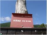 2
2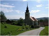 3
3 4
4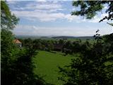 5
5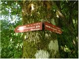 6
6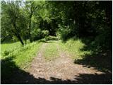 7
7 8
8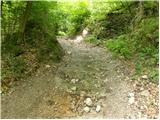 9
9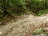 10
10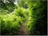 11
11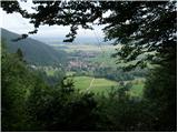 12
12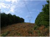 13
13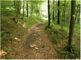 14
14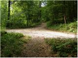 15
15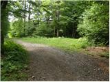 16
16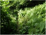 17
17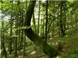 18
18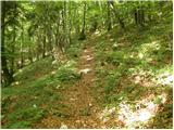 19
19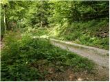 20
20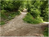 21
21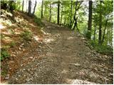 22
22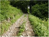 23
23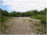 24
24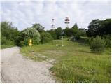 25
25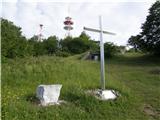 26
26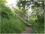 27
27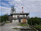 28
28 29
29
Discussion about the trail Strahomer - Krim (via Kramarca)
|
| erikaleon3. 03. 2011 |
šel gor po opisani poti vračal pa sem se čez strmec
|
|
|
|
| BlazG15. 10. 2013 |
24.8.2013 šel po tej poti, super pot, je pa druga polovica kar strma, vendar se jo da vseeno v celoti preteči tako pri vzponu kot tudi pri sestopu. Razgled je super, je pa res da so antene kar malo moteče. Vsaj meni. Ker ne znam urediti GPS sledi si jo lahko pogledate tule: http://www.strava.com/activities/77116015
|
|
|
|
| Mikens23. 06. 2019 |
POMEMBNO!
Vse pohodnike naprošam, naj imajo pse na vrvici! (območje medveda.)
Lep lovski pozdrav.
Klement Mal, LD Tomišelj
|
|
|