Strmica - Toško Čelo (via Brezarjevo brezno)
Starting point: Strmica (349 m)
| Lat/Lon: | 46,0788°N 14,4406°E |
| |
Name of path: via Brezarjevo brezno
Time of walking: 45 min
Difficulty: easy unmarked way
Altitude difference: 241 m
Altitude difference po putu: 250 m
Map: Ljubljana - okolica 1:50.000
Recommended equipment (summer):
Recommended equipment (winter):
Views: 4.250
 | 2 people like this post |
Access to the starting point:
a) From the Ljubljana bypass, take the Ljubljana - Podutik exit, then continue driving towards Podutik. At the traffic lights near the parish church in Podutik, continue straight ahead and then gradually start climbing towards the Preval preval. About 100 m before the Podutik quarry, turn sharp right onto the Andrej Bitenec road, along which you will also see signs for the Brezarjevo brezno (Brezar's Abyss). Follow this road for another 200 m, and then on the left-hand side of the road you will see the signs for Brezarjevo brezno (Brezar's Abyss), where the footpath described above begins. There are no parking spaces at the starting point.
b) From the motorway Ljubljana - Koper take the exit Brezovica, then continue in the direction of Dobrova and Polhovo Gradec. At the end of Dobrova, the signs for Šentvid direct you to the right onto a narrower road. The road continues through Stranska vas, after which it begins to climb towards Preval. After Preval, descend towards Podutiko, and then, about 100 m after the quarry, turn left onto the Andrej Bitenec road, along which you will also see signs for the Brezarjevo brezno (Brezar's Abyss). Follow this road for another 200 m, then on the left side of the road you will see signs for Brezarjevo brezno (Brezar's Abyss), where the footpath described above begins. There are no parking spaces at the starting point.
Path description:
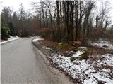
From the starting point, we focus on the forest path in the direction of the Brezar's Abyss, which leads us without major changes in altitude to the contact with a slightly better-beaten path, which we follow to the right (left Kucja dolina). The right path splits after a few steps, and we continue slightly to the left (following the slightly right path, we can reach the Big Brezar's Abyss in a few steps). There is a slight climb through the forest, and then the path leads under a high-voltage power line. On the other side of the power line, cross a short lane of forest, and then the path leads through a slightly larger clearing, where you continue straight ahead, back into the forest. Through the woods, climb briefly on the wider cart track, then the beaten track turns slightly to the right and begins to climb moderately. The path quickly flattens out and gets quite close to the asphalt road leading to Toško Čelo.
When you reach the edge of the road, you also reach a better marked trail with Preval (so far only a few old faded markings have been seen along the trail), which continues slightly to the right of the road. Follow the markings, and when you emerge from the woods, continue slightly right, then climb across the meadow. Then you will cross a belt of scrub, and then you will reach the hunting lodge at Toško Čel.
Description and pictures refer to the situation in 2016 (February).

Pictures:
 1
1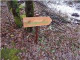 2
2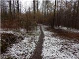 3
3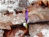 4
4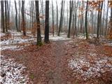 5
5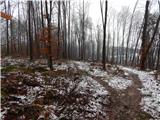 6
6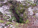 7
7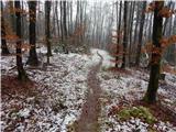 8
8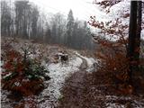 9
9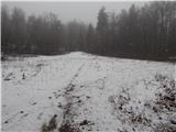 10
10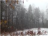 11
11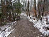 12
12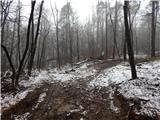 13
13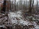 14
14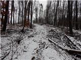 15
15 16
16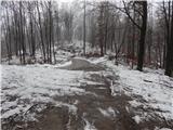 17
17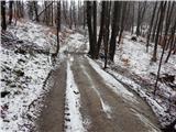 18
18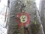 19
19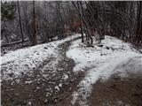 20
20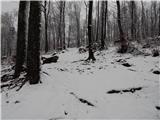 21
21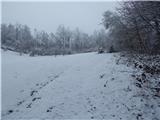 22
22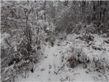 23
23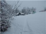 24
24 25
25
Discussion about the trail Strmica - Toško Čelo (via Brezarjevo brezno)
|
| oldtimer 5527. 02. 2016 |
Opisana pot je zelo zanimiva in jo večkrat prehodim. Opis je dober, opozoril bi le na poimenovanje izhodišča. To je Strmica, domačini pa ji pravimo "Strnca". Čas hoje v zapisu pa je nekoliko "raztegnjen". 
|
|
|