Tinčkova koča - Srednji vrh (above Završnica) (via Zagon)
Starting point: Tinčkova koča (1070 m)
| Lat/Lon: | 46,4228°N 14,1991°E |
| |
Name of path: via Zagon
Time of walking: 2 h
Difficulty: easy unmarked way
Altitude difference: 726 m
Altitude difference po putu: 726 m
Map: Karavanke - osrednji del 1:50.000
Recommended equipment (summer):
Recommended equipment (winter): ice axe, crampons
Views: 2.221
 | 1 person likes this post |
Access to the starting point:
From the Ljubljana - Jesenice motorway, take the Lesce exit and follow the road towards Žirovnica and Jesenice. After a few km of driving, you will come to a crossroads where the road to Žirovnica and Moste turns right (from Jesenice, left). Just a few metres further, at the next crossroads, turn left into Moste (right into Žirovnica). Continue past the memorial to the fallen fighters, where the road starts to climb uphill under the railway line. At the top of the hill, turn right (at the Vila Karin sign) and we continue towards Završniškem jezero and Valvasor's home. The road then bends and leads to a crossroads where the road to Valvasor's home branches off to the left, and we continue straight ahead on the initially still asphalted road. The road soon becomes macadam, and we follow it to a parking area near Tinček's hut. The road is often in quite bad condition in the upper part.
Path description:
From the starting point, the signs for Valvasor's House and Hochstuhl direct us left to the wide cart track, which turns into a forest. After a few 10 metres, the marked path towards Valvasor's House and Hochstuhl turns left, and we continue slightly to the right, following cart track, which leads us past a few more huts. We continue along the unmarked cart track, which climbs moderately at first, but relatively steeply higher up, through the forest. A little further on, cart track turns into a forest track, which splits into two parts before crossing a torrent. Continue on the lower right-hand path, which crosses the torrent and then climbs gently through the forest for a few minutes. The path soon becomes quite steep and a little difficult to follow in parts. The path through the Zagon valley has a few forks in the upper part, and we take right forks at all of them (even if we continue straight on one of them, we join the path leading from the Šija saddle towards Hochstuhl higher up, only to reach it further west).
Higher up, at an altitude of about 1500 metres, the trail takes us right into the valley, from which it soon retreats slightly to the right. At this point, we reach another less prominent crossroads, where we go right again, and continue ascending cross-country with fine views of Hochstuhl, Srednja peč and the surrounding mountains. The trail, which is traceable but more overgrown in parts, gradually flattens out and returns to the torrential valley. Climb for a short distance along a small torrent before reaching the lower trail on Hochstuhl.
Follow this path slightly right to a nearby fallen concrete bay, and from there right towards the Šija and Zelenice saddles. There is a short climb, then the path turns left and continues cross-climbing along the north-western slopes of Srednji vrh. After a few minutes, the crossing ends and the path leads to the Šija saddle, where there is a marked crossroads.
From the Šija saddle, continue right (left Zelenica, Vertatscha and the upper path to Hochstuhl, straight Dom pri izviru Završnice and Zelenica) and past a small bench start climbing along the ridge. Climb the ridge for a few minutes, surrounded mainly by dwarf pines to the left, but also by occasional unpaved slopes to the right. Higher up, the path turns slightly to the left from the ridge and then ascends through dwarf pines to the summit lookout. Description and figures refer to the situation in 2017 (June).

Pictures:
 1
1 2
2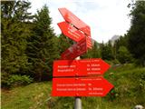 3
3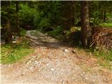 4
4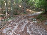 5
5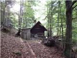 6
6 7
7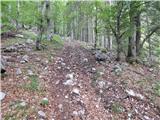 8
8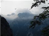 9
9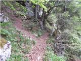 10
10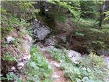 11
11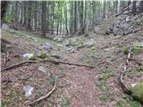 12
12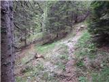 13
13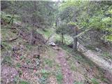 14
14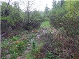 15
15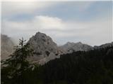 16
16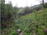 17
17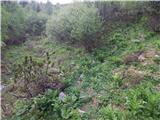 18
18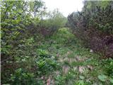 19
19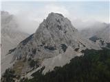 20
20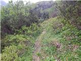 21
21 22
22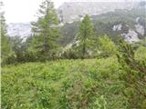 23
23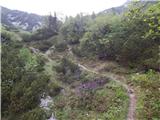 24
24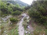 25
25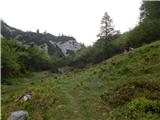 26
26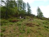 27
27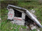 28
28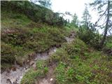 29
29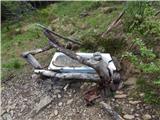 30
30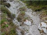 31
31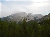 32
32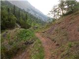 33
33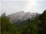 34
34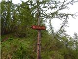 35
35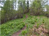 36
36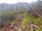 37
37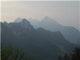 38
38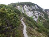 39
39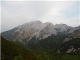 40
40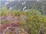 41
41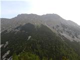 42
42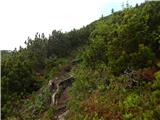 43
43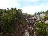 44
44 45
45 46
46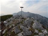 47
47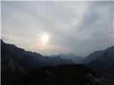 48
48
Discussion about the trail Tinčkova koča - Srednji vrh (above Završnica) (via Zagon)
|
| crocs12. 08. 2019 |
Zgornji del poti je trenutno res precej zaraščen, tla pa dokaj vlažna, tako da je nevarno tudi za zdrs. Sicer lepa kratka tura 
|
|
|