Tinčkova koča - Vertatscha/Vrtača (via Zagon)
Starting point: Tinčkova koča (1070 m)
| Lat/Lon: | 46,4228°N 14,1991°E |
| |
Name of path: via Zagon
Time of walking: 3 h 30 min
Difficulty: easy unmarked way, partly demanding marked way
Altitude difference: 1111 m
Altitude difference po putu: 1111 m
Map: Karavanke - osrednji del 1:50.000
Recommended equipment (summer):
Recommended equipment (winter): ice axe, crampons
Views: 5.380
 | 2 people like this post |
Access to the starting point:
From the Ljubljana - Jesenice motorway, take the Lesce exit and follow the road towards Žirovnica and Jesenice. After a few km of driving, you will come to a crossroads where the road to Žirovnica and Moste turns right (from Jesenice, left). Just a few metres further, at the next crossroads, turn left into Moste (right into Žirovnica). Continue past the memorial to the fallen fighters, where the road starts to climb uphill under the railway line. At the top of the hill, turn right (at the Vila Karin sign) and we continue towards Završniškem jezero and Valvasor's home. The road then bends and leads to a crossroads where the road to Valvasor's home branches off to the left, and we continue straight ahead on the initially still asphalted road. The road soon becomes macadam, and we follow it to a parking area near Tinček's hut. The road is often in quite bad condition in the upper part.
Path description:
From the starting point, the signs for Valvasor's House and Hochstuhl direct us left to the wide cart track, which turns into a forest. After a few 10 metres, the marked path towards Valvasor's House and Hochstuhl turns left, and we continue slightly to the right, following cart track, which leads us past a few more huts. We continue along the unmarked cart track, which climbs moderately at first, but relatively steeply higher up, through the forest. A little further on, cart track turns into a forest track, which splits into two parts before crossing a torrent. Continue on the lower right-hand path, which crosses the torrent and then climbs gently through the forest for a few minutes. The path soon becomes quite steep and a little difficult to follow in parts. The path through the Zagon valley has a few forks in the upper part, and we take right forks at all of them (even if we continue straight on one of them, we join the path leading from the Šija saddle towards Hochstuhl higher up, only to reach it further west).
Higher up, at an altitude of about 1500 metres, the trail takes us right into the valley, from which it soon retreats slightly to the right. At this point, we reach another less prominent crossroads, where we go right again, and continue ascending cross-country with fine views of Hochstuhl, Srednja peč and the surrounding mountains. The trail, which is traceable but more overgrown in parts, gradually flattens out and returns to the torrential valley. Climb for a short distance along a small torrent before reaching the lower trail on Hochstuhl.
Follow this path slightly right to a nearby fallen concrete bay, and from there right towards the Šija saddle and Zelenica. There is a short climb, then the path turns left and continues to climb crosswise along the north-western slopes of Srednji vrh. After a few minutes the crossing ends and the path leads to the Šija saddle, where there is a marked crossroads.
Continue left in the route Vertatscha (right Srednji vrh, straight Dom pri izviru Završnice) along the path which ascends through lane of dwarf pines and after a few minutes of further walking leads us to the upper path Zelenica - Hochstuhl.
Here continue left in the direction of Hochstuhla, but only for a few steps, and then you will notice a less well-trodden path that continues up the slope almost straight up (if you do not find the trail branch, you can also continue in the direction of Zelenica and then at the marked crossroads left up). The way forward starts to climb steeper and steeper and after a few minutes of further walking joins the wide marked path from Zelenica. Continue left and follow the path as it climbs steeply towards the side ridge of Vrtača. Higher up, the path turns slightly to the left, crosses steep, partly rocky slopes and after a few minutes of further walking leads to the aforementioned ridge, where the path turns sharply to the right (straight down Hochstuhl past Vatelce or Sklede). The way forward begins to climb steeply on quite steep and dangerous slopes. Higher up the path leads us to the main ridge Karawanks, where it is only laid. This is followed by about 20 minutes of walking on and along the ridge, which is slightly exposed in places and dangerous for slipping throughout. Follow this scenic route all the way to the top of Vrtača.
The steep grasses make it a slip hazard, especially in wet conditions.
Starting point - Šija 1:40, Šija - Vertatscha 1:50.

Pictures:
 1
1 2
2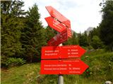 3
3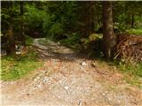 4
4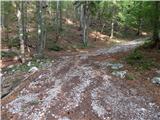 5
5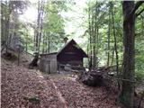 6
6 7
7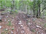 8
8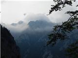 9
9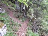 10
10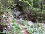 11
11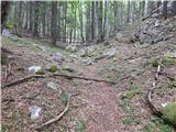 12
12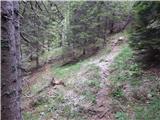 13
13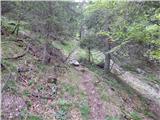 14
14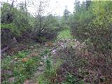 15
15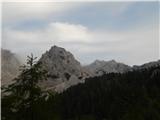 16
16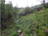 17
17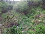 18
18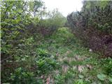 19
19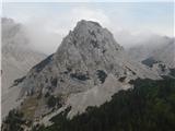 20
20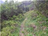 21
21 22
22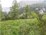 23
23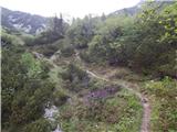 24
24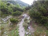 25
25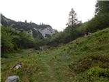 26
26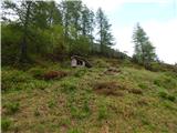 27
27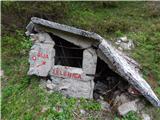 28
28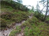 29
29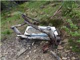 30
30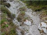 31
31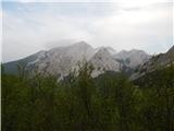 32
32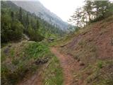 33
33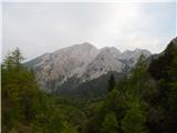 34
34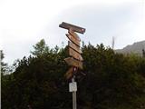 35
35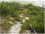 36
36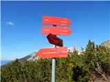 37
37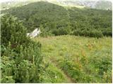 38
38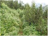 39
39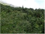 40
40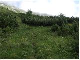 41
41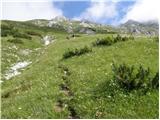 42
42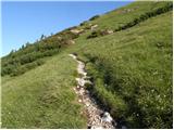 43
43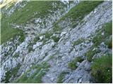 44
44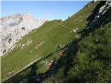 45
45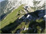 46
46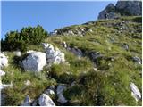 47
47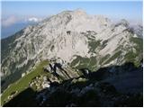 48
48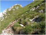 49
49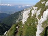 50
50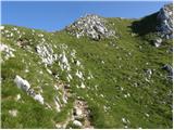 51
51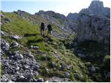 52
52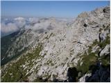 53
53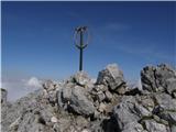 54
54 55
55
Discussion about the trail Tinčkova koča - Vertatscha/Vrtača (via Zagon)
|
| Kanjavec1231. 10. 2017 |
Danes sva se s prijateljem povzpela na Vrtaco. Gor hodila priblizno 4 ure (ker sva startala pes se nizje od Tinckove koce), dol 3h15min. Na delu poti, ki ga kazejo slike 17, 18, 19 je treba biti res pozoren, da te kaka napacna pot ne zavede - midva sva malo zasla po eni, za katero sva na koncu ugotovila, da je od kakih zivali/crede in ne pelje nikamor  Bila je dobro uhojena, tko da na zacetku ni tako izgledalo. Se vrnila in lepo nadaljevala naprej. Na zalost se v jeseni v teh koncih pogosto zadrzuje megla/nizka oblacnost, vsaj pri vrhu, tako da razgleda nisva videla. Na vrhu bilo dosti ljudi ko sva prisla (kake 6) in tudi na poti jih kar nekaj srecala. Nevarnost zdrsa je, se zlasti zato, ker sonce ne pride do tal in je pot vlazna in na predelih rahlo blatna. Snega je bilo cisto malo se, samo nekaj otockov sem ter tja. Lepa tura, sva ze razmisljala da bi naslednjic turo povezala s Stolom
|
|
|
|
| Ulmus6. 08. 2018 |
Včeraj sem pot prehodil z 8-letnim sinom. Od Tinčkove koče do vrha Vrtače 3 ure. Pot skozi Zagon je dobro uhojena, ključno je le razpotje pred hudournikom, kjer je treba iti naravnost (desno) čez hudournik. Opis poti omenja mnoga razpotja, ki jih midva niti nisva opazila. Če se sledi najbolj uhojeni stezi, prideš do podrte betonske bajte na planini Za Šijo (slika 28), potem pa je vse označeno in markirano. Lep izlet, primeren tudi za otroke z malo več kondicije. Vrnila sva se čez Zelenico, med spustom pa s Šije skočila še na Srednji vrh, s katerega je krasen razgled na Vrtačo.
|
|
|