Tržič - Kamnek (Radetzky way)
Starting point: Tržič (530 m)
| Lat/Lon: | 46,3647°N 14,3103°E |
| |
Name of path: Radetzky way
Time of walking: 1 h
Difficulty: easy marked way
Altitude difference: 343 m
Altitude difference po putu: 343 m
Map: Storžič in Košuta, 1: 25.000, PZS
Recommended equipment (summer):
Recommended equipment (winter):
Views: 16.839
 | 3 people like this post |
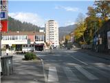
Access to the starting point:
Take the Tržič and turn left at the crossroads in front of the Raj restaurant over the bridge into the old part of the city (Trg Svobode). Follow the narrow street straight to the church, which you will pass slightly to the left and continue along the same road. Shortly afterwards, we see a sign saying "Pizzeria" and a path branches off to our right through a large, old courtyard dor into the hillside above us. We pass a sign saying "Pizzeria guest parking" for a few metres to the parking lot under the castle, where we park.
Path description:
From the parking lot, follow the dirt track to the crest of the hill a few metres away, where you parked. On the ridge, we have a nice view of Tržič below us, and a few steps to the right, a plaque is fixed on the wall, where we can read the history of the hill, which was once the property of Count Radetzky (Strauss's "Radetzky March", which can be heard at every New Year's Eve concert of the Vienna Philharmonic Orchestra, is dedicated to him). To start our route, we turn left at this lookout point and start climbing up a pleasant forest path on the slope of Kamnek. A few metres later, another path joins us from the bottom right, leading to this ridge from the parking lot in front of the Hall of the Market Olympians (where there is another option for parking and starting the climb).
Then follow the well visible and well worn path, the path is marked several times with markings and directional arrows. After a few minutes of walking, you will reach a small garden with a few garden sheds and small cottages, where a large marker attached to a sign on the garden fence directs you to follow a wide path up the middle of the hill. The second half of the path is a little steeper, and after about an hour's walk along the slope we reach a ridge, from where the view is not particularly good because, as throughout the route, we are in a thin mixed forest. The path from the ridge onwards climbs a little more steeply, the last few 10 metres below the summit very steeply. Soon we reach the top, where there is a bench and a registration book, and a Slovenian flag flutters on a high pole. The view on all sides is very beautiful, we can see Dobrča, Hochstuhl, Begunjščica, the whole of Košuta, Dovžanovo gorge, Lomska valley, Storžič, Kriška gora and much more.
We can return the same way, but it is even better if we make a small detour from the route, so that we continue the way from the top in the direction of Pirmanci. The path runs along the ridge and descends a little, and soon (after a few minutes) you reach a crossroads. The path continues straight along the ridge, leading us on to Pirmanci, Kala and Kofc, and we turn onto a path that branches off to the left downhill (not marked). We follow this path all the way down the slope, and a few times other paths branch off from it, either to the right downhill, or uphill to the left, but we keep to the most steep one all the time. The trail leads us all the way down the slope, in the sparse mixed forest above the area of Tržič called "na fabriki" by the locals, until it joins the trail we took earlier to Kamnek, quite low down. From here we return to the starting point, which is about 10 minutes' walk away.

Pictures:
 1
1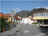 2
2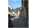 3
3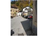 4
4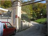 5
5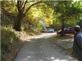 6
6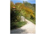 7
7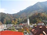 8
8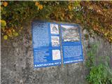 9
9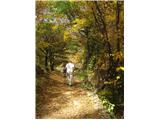 10
10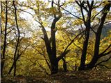 11
11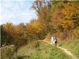 12
12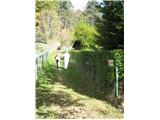 13
13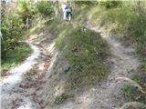 14
14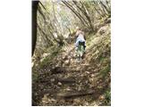 15
15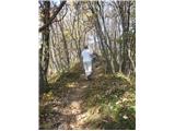 16
16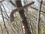 17
17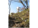 18
18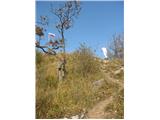 19
19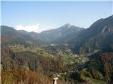 20
20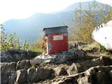 21
21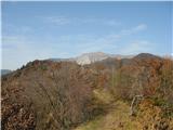 22
22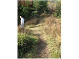 23
23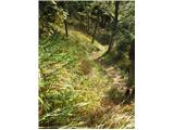 24
24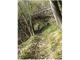 25
25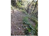 26
26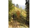 27
27 28
28
Discussion about the trail Tržič - Kamnek (Radetzky way)
|
| grega_p26. 09. 2009 |
Trenutno je v Tržiču popolno zapora, tako da je potreben obvoz naprej po glavni cesti in nato levo čez most...
Drugače pa lep izlet, ravno pravšnji za nekaj znoja in lepe razglede. Časovnico bi pa spustil na 45min, toliko sem jih nabral ob fotografiranju. Pa vzemite kakšen nož - z dobrim pogledom si prislužite gobjo večerjo:-)
Grega
|
|
|
|
| Kriška26. 09. 2009 |
Časovnica vzpona je napisana na osnovi starega pravila, ki pravi: za 300 m višinske razlike = 1 ura hoje. To je seveda okvirno, odstopanja navzgor/navzdol so zelo individualna.
|
|
|
|
| korosec123420. 03. 2010 |
Predlagam tudi pot da greš do Podljubela čez počivnk na Kamnjek in se potem spustiš po poti do Tržiča
|
|
|