Turracher Höhe - Eisenhut
Starting point: Turracher Höhe (1763 m)
| Lat/Lon: | 46,9146°N 13,8749°E |
| |
Time of walking: 5 h 15 min
Difficulty: easy marked way
Altitude difference: 678 m
Altitude difference po putu: 1000 m
Map:
Recommended equipment (summer):
Recommended equipment (winter): ice axe, crampons
Views: 525
 | 1 person likes this post |
Access to the starting point:
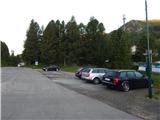
a) Via Border crossing Ljubelj, drive into Austria, then follow the road to Klagenfurt / Klagenfurt. In Klagenfurt, go straight on at all junctions, but when the main road turns sharp right, leave it just a little further and continue left towards Dhovše near Klagenfurt / Lendorf and Trg am Carinth / Feldkirchen in Kärnten. When you reach the motorway junction, turn left towards Trg na Koroškem and when you reach the point, follow the signs for the Turracher Höhe Alpine pass. After about 90 km from Border crossing Ljubelj, you will reach the pass, from which you will descend to parking lot No. 1, where you will park.
b) Drive through the Karavanke tunnel into Austria, then follow the motorway to the motorway junction, from where you continue to Spittal an der Drau and continue on the A10 motorway. Leave the A10 quickly and take the exit for Ossiacher See, take the third exit at the nearby roundabout (if there was no roundabout, you would have gone left) and continue along Millstätter Strasse. Follow this road to Radenthein, where you turn right towards Bad Kleinkirchheim. Continue through the above-mentioned town for a few kilometres and turn left at Patergassen towards the Alpine pass and the Turracher Höhe ski resort. Once you reach the pass, there is a short descent to parking lot 1, where you park. From Border crossing Karawanks to the starting point is approximately 78 km.
Path description:
From the parking lot, first cross the main road carefully, then walk to the Hotel Hochschober, after which continue along the dirt road towards Lake Schwarzsee, Peak Eisenhut and other peaks. At first, the path offers a beautiful view of Lake Turrachsee, but then you gradually move away from the lake. Soon we reach the tourist village of Meizeit Hüttendorf, where we get the last view of Lake Turrachsee and where the trail splits.
The path turns right towards Grünsee, and we continue straight on towards the Eisenhut and Schoberrigel peaks and the Schwarzsee lake, turning slightly left at the next crossroads towards the Eisenhut peak (slightly right towards Schoberrigel and Eisenhut over the aforementioned peak).
A short climb up a dirt road leads to a former hotel located at the south-western end of Lake Schwarzsee, and we descend gently to the northern shore of the lake.
From the lake we continue along the marked road, which we continue to follow towards the top of Eisenhut. The road, which mostly leads us alongside fine views, only occasionally through a short lane of forest, descends gently for the most part, and after crossing a slightly larger stream, the road turns northwards, where we reach the lower part of the mountain pasture of Gesgeralm. Just 10 paces further on, after crossing a pasture fence, leave the road and continue right, crossing over a steeper slope. After a short climb, a small hut is quickly reached, and we follow a slightly muddy and overgrown path up to the top of mountain pasture, where another hut stands on the right.
Just before the cottage, from the crossroads, continue along a slightly left-hand road which begins to climb cross-country. After a few minutes' walk on the worse road, leave it and continue to the right in the direction of the waymarked trail. The marked path leads past a spring with an older trough, and then at a marked crossroads at Engeleriegel, where there is also a registration box with a registration book and a stamp, cross the road we have recently left.
Continue straight on to the top of Eisenhut (Gruft and Schoberriegel to the right) and climb for a short distance before the path crosses over to the other side of the ridge where it flattens out and we cross a wire fence at the marked part. There follows an easy traverse down a slightly harder to follow path. When we reach the nearby forest, the track becomes more distinct and the descent continues. Lower down, the forest thins out and the trail crosses a few streams, but in a few places the trail disappears again, and we follow the markings carefully. In a moderate descent, then in a few minutes we reach two huts on mountain pasture Gillendorferalm.
From the huts, walk to the mountain direction signs and continue towards the Rapitzsattel saddle and the Eisenhut summit. At first you walk along a winding grassy path, which turns into a forest on the other side of mountain pasture. Climb gently to moderately through the forest, crossing a few streams a little further on, after which you will come to cart track, which you will follow cross-wise to the left. Cross another stream a little further on, then climb up to the next pasture, where there is an animal feeding trough, and we go around it on the right-hand side and continue to climb cross-country. The path ahead takes us through the last of the lane woods, and then, as the views get better and better, we climb up to where the path from the village of Turrach joins us on the left.
Continue right on the increasingly faint cart track, and soon take a slight left (continuing on cart track Lattersteig, Lattersteighöhe and Bretthöhe), and then start climbing up a small valley, with a small spring flowing through it. Then climb the western grassy slopes, following a barely visible path up to the Rapitzsattel saddle, where there is a marked crossroads.
From the saddle, continue left towards the Eisenhut and Wintertalernock peaks (Flattnitz to the right, Lattersteighöhe to the right), and the path along the ridge, or slightly to the left of it, splits.
Slightly to the right, the path leads to Wintertalernock and Eisenhut via the Straßburger Spitz summit, and we continue slightly to the left towards Eisenhut.
There is a cross-climb over a grassy slope, then a short scree slope, over which the path is a little less well trodden in early summer. After crossing two more streams, we continue along the wire fence for a while, with views stretching as far as High Tauern, and with every step backwards, a better view of the Julian Mountains opens up. The fence soon ends, and a fine view opens up in front of us towards the summit head of Eisenhut. After a few more minutes, as we climb up to a small saddle, the path leading over the top of the Strassburger Spitz joins from the right.
Continue straight ahead, passing a watering point, and then start climbing steeply towards the highest peak of the Krkonoše Alps. A good 20-minute climb along the edge of the southern ridge takes you to the 2441-metre summit.
Turracher Höhe - Schwarzsee 0:25, Schwarzsee - Gesgeralm 0:50, Gesgeralm - Gillendorferalm 1:00, Gillendorferalm - Rapitzsattel 1:40, Rapitzsattel - Eisenhut 1:20.
Description and figures refer to 2019 (June).

Pictures:
 1
1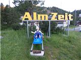 2
2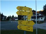 3
3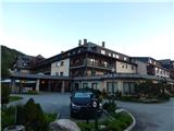 4
4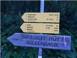 5
5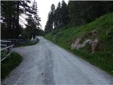 6
6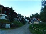 7
7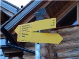 8
8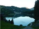 9
9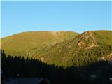 10
10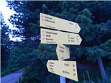 11
11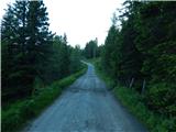 12
12 13
13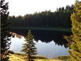 14
14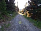 15
15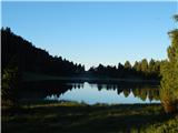 16
16 17
17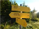 18
18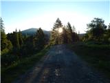 19
19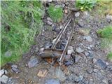 20
20 21
21 22
22 23
23 24
24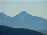 25
25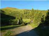 26
26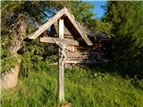 27
27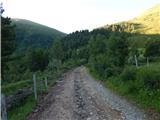 28
28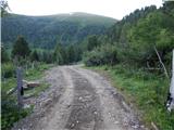 29
29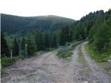 30
30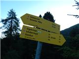 31
31 32
32 33
33 34
34 35
35 36
36 37
37 38
38 39
39 40
40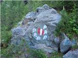 41
41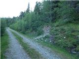 42
42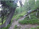 43
43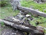 44
44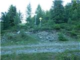 45
45 46
46 47
47 48
48 49
49 50
50 51
51 52
52 53
53 54
54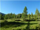 55
55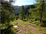 56
56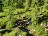 57
57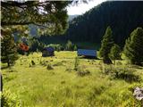 58
58 59
59 60
60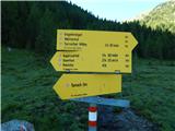 61
61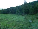 62
62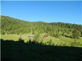 63
63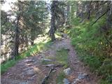 64
64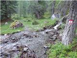 65
65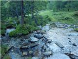 66
66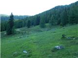 67
67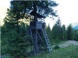 68
68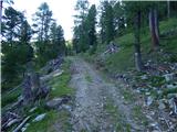 69
69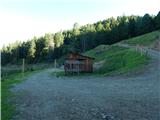 70
70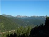 71
71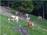 72
72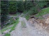 73
73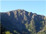 74
74 75
75 76
76 77
77 78
78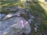 79
79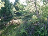 80
80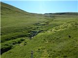 81
81 82
82 83
83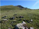 84
84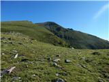 85
85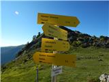 86
86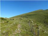 87
87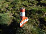 88
88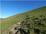 89
89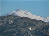 90
90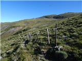 91
91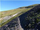 92
92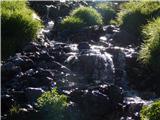 93
93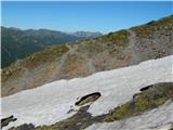 94
94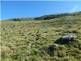 95
95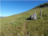 96
96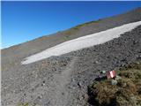 97
97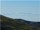 98
98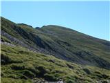 99
99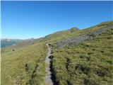 100
100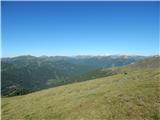 101
101 102
102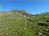 103
103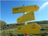 104
104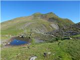 105
105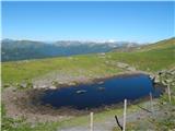 106
106 107
107 108
108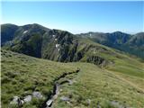 109
109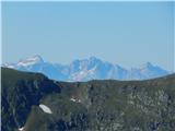 110
110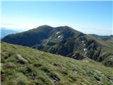 111
111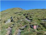 112
112 113
113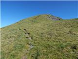 114
114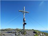 115
115 116
116
Discussion about the trail Turracher Höhe - Eisenhut