Tuškov Grič - Medrce (by road)
Starting point: Tuškov Grič (1010 m)
| Lat/Lon: | 46,1711°N 14,0421°E |
| |
Name of path: by road
Time of walking: 2 h 20 min
Difficulty: easy marked way
Altitude difference: 400 m
Altitude difference po putu: 540 m
Map: Škofjeloško in Cerkljansko hribovje 1:50.000
Recommended equipment (summer):
Recommended equipment (winter): ice axe, crampons
Views: 4.935
 | 1 person likes this post |
Access to the starting point:
a) First drive to Škofja Loka, then continue driving in the direction of Železniki and Podbrdo. After Železniki, or just before the start of Zali Log, signs for Davča and the ski centre Cerkno direct you to the left onto a road that begins to climb along the Davča River. Follow the road, which has several junctions higher up, in the direction of the Cerkno ski centre. Once you reach the ski centre, continue for another 100 metres to the large gravel parking area Tuškov Grič.
b) From Bohinjska Bistrica or Podbrdo, first drive into the valley of the Selška Sora River, then turn right at the junction after the end of Zali Log in the direction of Davča and continue along the road that begins to climb along the Davča River. Follow the road, which has several junctions higher up, in the direction of the ski centre Cerkno. When you reach the ski centre, continue driving for another 100 metres to the large macadam parking lot at Tuškov Grič.
c) From the Poljane valley, first drive to Hotavlje, and from there continue in the direction of the Cerkno Ski Centre. Continue through the villages of Kopačnica, Leskovica and Robidnica. After passing through all these villages, you will arrive at the large parking lot of Počivalo (the parking lot next to the Cerkno Ski Centre), after which the road starts to descend. After a short descent, we reach the next crossroads, where we continue to the right (left down Cerkno). We continue along the road, which ascends crosswise, and we quickly reach the Tuškov Grič parking lot.
d) From the road Idrija - Tolmin, head towards Cerkno, then continue towards the ski centre Cerkno. At a junction, the road turns right to the nearby Počivalo parking lot, and we turn left in the direction of Davča. There is only a short cross-country climb and the road leads to the Tuškov Grič parking lot.
Path description:
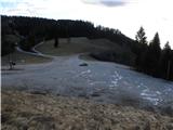
From the parking lot, head along the road in the direction of Davški Falls, Porezno and the sport fishing. The road climbs moderately at first, then flattens out and leads you for a while through meadows with views. There is a short descent and then a few minutes crossing to the crossroads at Razpotje (1068 m).
From here, continue in the direction of Porezno (Kopa slightly to the left) and continue the ascent along the macadam road, which climbs slightly to the right. After a few minutes you reach a small hamlet, after which the road goes into the forest. The ascent follows the forest road, which quickly splits into two parts. Take the road to the left, which is also marked Porezen (to the right, Davški falls). The road then gradually becomes flat, and another path branches off to the right, leading to Davški falls. Continue straight on, and we follow the road, which initially still passes through the forest, to the grassy hamlet of Vrše. A few minutes before this meadow or saddle, a path from Kopa joins us on the left, and we continue along the road, which begins to climb the slopes of nearby Hum (1423 m). After a 20-minute climb up the increasingly scenic slopes, we reach the ridge of Hum, where the path turns left and starts descending towards the saddle Velbnik (1331 m). With a view of Porezen and the nearby peak Medrce, we descend in a few minutes to the above-mentioned saddle, where the path from the Franja Hospital or from Poljan joins us from the left.
Leave the road here and continue straight on the footpath towards Porezno. The way forward is initially moderate, then steeply climbs over the partly grassy slopes of Medrc. After a few minutes of further walking, you will reach a small bunker, above which is a viewpoint with a bush-covered peak at the highest part.

Pictures:
 1
1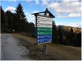 2
2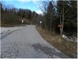 3
3 4
4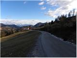 5
5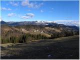 6
6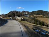 7
7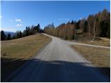 8
8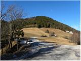 9
9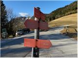 10
10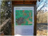 11
11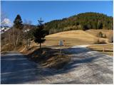 12
12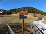 13
13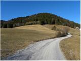 14
14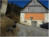 15
15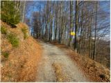 16
16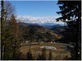 17
17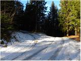 18
18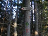 19
19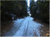 20
20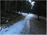 21
21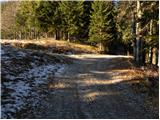 22
22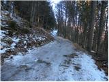 23
23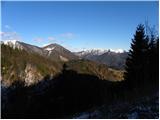 24
24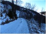 25
25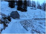 26
26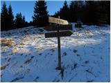 27
27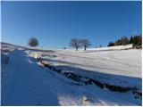 28
28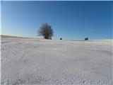 29
29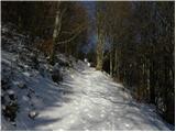 30
30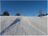 31
31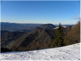 32
32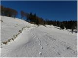 33
33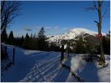 34
34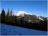 35
35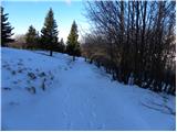 36
36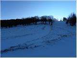 37
37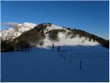 38
38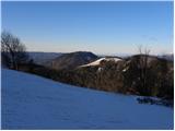 39
39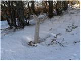 40
40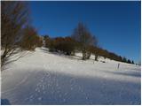 41
41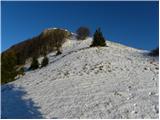 42
42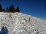 43
43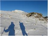 44
44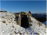 45
45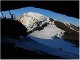 46
46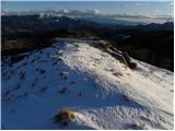 47
47 48
48
Discussion about the trail Tuškov Grič - Medrce (by road)