V Koncu - Brana (via Turska gora)
Starting point: V Koncu (900 m)
| Lat/Lon: | 46,342°N 14,5682°E |
| |
Name of path: via Turska gora
Time of walking: 5 h 45 min
Difficulty: very difficult marked way
Altitude difference: 1353 m
Altitude difference po putu: 1600 m
Map: Kamniške in Savinjske Alpe 1:50.000
Recommended equipment (summer): helmet, self belay set
Recommended equipment (winter): helmet, self belay set, ice axe, crampons
Views: 28.413
 | 2 people like this post |
Access to the starting point:
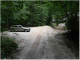
Drive into Kamnik and follow the road towards the Kamniška Bistrica valley. From your home in Kamniška Bistrica, continue driving along the forest road, which takes you higher up to a crossroads where you continue straight ahead (right Jermanca, starting point for Kamniško sedlo). The road then takes you past Žagana peči to the parking lot at the lower station of the cargo cableway to Kokrsko sedlo.
After the new traffic sign, driving from the Kamniški Bistrica hut to the V Koncu parking lot is forbidden, which extends the journey by almost an hour.
Path description:
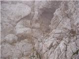
From the parking lot at the cargo cableway, continue along the deteriorating road, which turns into cart track after 10 minutes of walking. Cart track splits into two parts, and we take the right one (the left cart track is lost, or leads towards Gams' Hide), which turns slightly further to the right at a small boulder covered with moss (a large rock). It is at this point that cart track is abandoned and you continue straight on the initially less visible path, which later climbs steeply in the keys. The steep and, especially in wet conditions, slippery path leads over steep slopes, which in some places are protected by a steel cable. The steep path, which also crosses some ravines, leads us higher up to a less steep slope. After a good hour's walk, the path leads us out of the forest, where it starts to climb steeply again. The path initially leads us over grassy slopes surrounded by sparse forest, and then, with the help of a few fixed safety gear, it takes us a step higher. The path then moves on to a rough slope, which makes the ascent a little more difficult, and then turns left onto a steep grassy slope rising above vast scree fields. At the top of this grassy section, turn slightly right and the path transitions from the grass to the high mountain area of high-lying plateau below Skuta. Continue along the cairns path and in a few minutes you will reach the pleasant bivouac below Skuta.
From the bivouac, continue along the poorly visible and still unmarked path along the undistinguished ridge, which leads us after 15 minutes' walk from the bivouac to the marked path Kamniško sedlo - Kokrsko sedlo. Here we continue to the right and after a few minutes we arrive at the crossroads of the trail, where we continue along the lower right trail in the direction of Turska gora (left Rinke). The trail then starts to descend and after a few minutes leads us to the top of Turski žleb. Continue straight on (left down Okrešelj) along the increasingly scenic path, which leads us with the help of a few wedges to the top ridge Turska gora which we then follow to the top. Walking on the ridge on land does not present any major problems, but in the snow there is a high risk of slipping on the top ridge.
From the summit, continue along the path which starts to descend (direction Kamniško sedlo). The path, which starts to descend steeply after a few steps, is well guarded, but in some places quite exposed. The path, which is constantly exposed to falling rocks, then leads to a natural vent (a barrel without a bottom). Next we come to a sharp notch called Kotliči, after which the path begins to gradually climb and after a while leads us to a crossroads where we continue right steeply up towards Brana (straight Kamniško sedlo). The way forward is increasingly climbing up the axial slopes of Brana. The steep and in key places guarded path, which is not particularly difficult, soon leads us into a small ravine, after which we climb with some free climbing to a beautiful viewpoint. Here we continue sharp right along the path, which after a few further 10 steps leads us to the top slope of Brana. Here the steepness eases and a beautiful view of the easy path leads us in a few minutes to the spacious summit. In Konec - bivouac under Skuto 3:00, bivouac under Skuto - Turska gora 1:15, Turska gora - Brana 1:30.

Pictures:
 1
1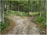 2
2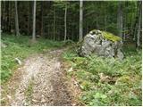 3
3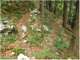 4
4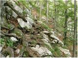 5
5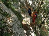 6
6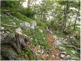 7
7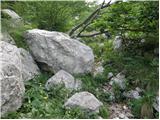 8
8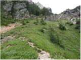 9
9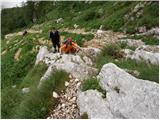 10
10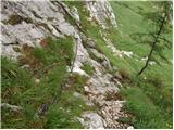 11
11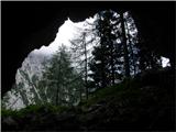 12
12 13
13 14
14 15
15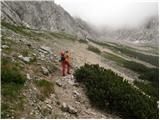 16
16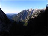 17
17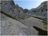 18
18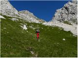 19
19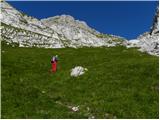 20
20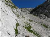 21
21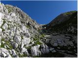 22
22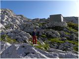 23
23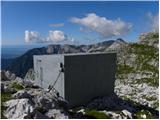 24
24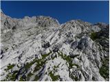 25
25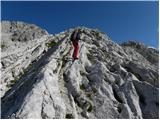 26
26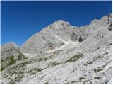 27
27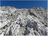 28
28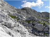 29
29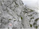 30
30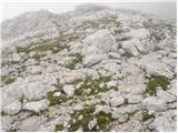 31
31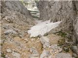 32
32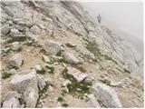 33
33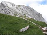 34
34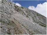 35
35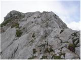 36
36 37
37 38
38 39
39 40
40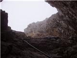 41
41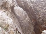 42
4243
 44
44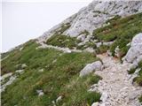 45
45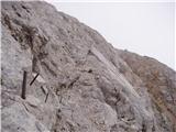 46
46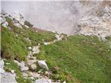 47
47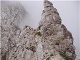 48
48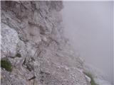 49
49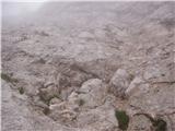 50
50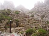 51
51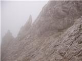 52
52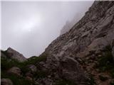 53
53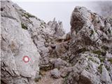 54
54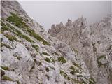 55
55 56
56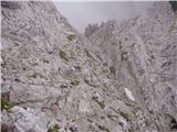 57
57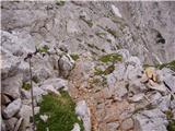 58
58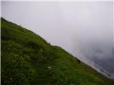 59
59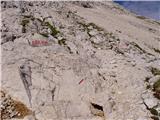 60
60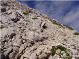 61
61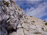 62
62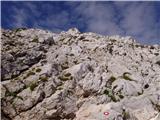 63
63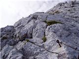 64
64 65
65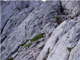 66
66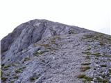 67
67 68
68
Discussion about the trail V Koncu - Brana (via Turska gora)
|
| fpetel125. 08. 2008 |
Čez Žmavčarje pelje lovska neoznačena pot, v vršnem delu brezpotje. Pot oziroma smer gibanja ni težko določiti, če je le vreme lepo. V megli izberite drug pristop. Sestop iz Turske gore je strm in zahteven.
|
|
|
|
| the dancer10. 11. 2008 |
Včeri sm jo piču iz Kamn.Bistrice čez Žmavčarje do bivaka pod Skuto (še nič snega), naprej na Tursko goro, že zimske razmere, naprej spust na Kotliče (na posameznih mestih precej napihanega snega), do stene Brane (posamezne snežne zaplate, nič posebnega), pot pod severno stene Brane je praktično suha, vzpon na Brano, pa dobesedno snežni vzpon je šlo še brez derez, uporabljal sem cepin, kot tudi iz Turske. Vidljivost je na momente bila lepa, čez minutko pa že megla, visoka obačnost je šibala...
|
|
|
|
| nata246. 09. 2009 |
Če grem po tej poti na Brano in bi se vračala čez Kamniško sedlo do Jermance, koliko je približno za pešačit od Jermance do V koncu in ali ima kdo kakšen boljši predlog, da ne bi šla po isti poti nazaj. Hvala vnaprej. Nataša
|
|
|
|
| rober6. 09. 2009 |
Normalne hoje Jermanca-Konec imaš največ za pol ure normalne hoje,mogoče kako minuto več,odvisno,kako utrujene so noge,če pa bi poznala bljižnico,ki pa gre mimo plazu pod Brano-Sivnica-Lepi Kamen-Konec,pa še manj...vse odvisno od telesne pripravljenosti in veselja do raziskovanja zanimivih novih poti...
|
|
|
|
| nata248. 09. 2009 |
Če prav razumem pot do bivaka pod Skuto oz. še malo dlje ni nič markirana. Ali tudi na izhodišču - V koncu nič ni označeno, so vsaj možici kje? Lp, Nataša
|
|
|
|
| Gorazd G8. 09. 2009 |
Nataša, prav razumeš. Na izhodišču V koncu ne piše, da se pride do Bivaka pod Skuto (in še malo naprej do markirane poti nad njim), steza ni označena, kakšno sled boš pa vseeno našla. Med drugim tudi kakšnega možica. 
|
|
|
|
| nata248. 09. 2009 |
To se pravi da V koncu nadaljujem po cesti po kateri sem se pripeljala naprej in ne proti Kokrskemu sedlu.
|
|
|
|
| Gorazd G8. 09. 2009 |
Tako je. Opisovanje od "drevesa do drevesa" mi ne gre najbolje od roke, a uvod iz zgornjega opisa se mi zdi kar dober, le tistih 10 min bi skrajšal na vsega minuto ali dve. 10 min je kvečjemu od Žagane peči.
"S parkirišča pri tovorni žičnici nadaljujemo po vse slabši cesti, ki se po 10 minutah hoje spremeni v kolovoz. Kolovoz se razcepi na dva dela, mi pa se usmerimo na desnega (levi kolovoz se izgubi, oz. vodi proti Gamsovemu skretu), ki pri manjšem balvanu poraščenim z mahom (velika skala) zavije še nekoliko bolj v desno. Prav na tem mestu kolovoz zapustimo in nadaljujemo naravnost na sprva slabše vidno stezico, ki se kasneje strmo vzpenja v ključih."
Bi pa bilo morda bolje, da te spremlja kdo, ki pot pozna.
|
|
|
|
| juhejnaprej18. 06. 2012 |
Včeraj sem opravil tole turo. Stanje mislim da se najbolje vidi kar iz slik:
|
|
|
|
| juhejnaprej18. 06. 2012 |
Sem opazil, da slik k izletom ne moreš pripet, kakorkoli, pod čez Žmavčarje ni preveč zahtevna in precej dobro vidna, edino pri zgoraj omenjenemu balvanu ter na vrhu pod bivakom je malce teže razločiti, kam je treba it.
|
|
|
|
| alina18. 10. 2013 |
Ali mogoče kdo ve,če se z avtom lahko pride do parkirišča v Koncu ali je pot zaprta za promet?
|
|
|
|
| Marx4. 08. 2014 |
Tisto snežišče na sliki 56 je bilo tukaj tudi ko sam bil na turi 02.08.2014. In je ovira! Ophodil sam ga po skalami zgoraj. Zelo je nevarno. Tu mi je tudi ispala boca tekučine. Če je ko najde... naj jo spije
|
|
|
|
| redbull5. 08. 2014 |
marx ze naslednji dan se je kamot dalo. zdaj pa zagotovo tega snezisca ni vec.
brez panike
lp
D
|
|
|