Starting point: Vodel (1086 m)
| Lat/Lon: | 46,249°N 13,8974°E |
| |
Time of walking: 2 h 45 min
Difficulty: easy pathless terrain
Altitude difference: 881 m
Altitude difference po putu: 915 m
Map: TNP 1:50.000
Recommended equipment (summer):
Recommended equipment (winter): ice axe, crampons
Views: 1.070
 | 3 people like this post |
Access to the starting point:
a) Take the Bohinjska Bistrica exit from the roundabout in the direction of Soriška planina and Tolmin. Continue through Bohinjska Bistrica, then at the beginning of the left-hand bend continue straight on towards Ravne v Bohinju. From the crossroads onwards we start to climb steeply, and when the road is laid, it leads us to the above-mentioned village. At the end of the village the asphalt ends, and we take the macadam road first across the meadow, and then the road passes into the forest, where it first leads us past the former Mountain Home of dr. We then drive for some time and cross the Polje - Črna prst path, and after the crossing we arrive on the slopes of Pezdenica, where we go round the ridge in a semicircle. When on the other side of the ridge the road turns more sharply to the right for the first time, we become alert as we then park at the first suitable place along the road. From where the asphalt ends to the starting point is 6. 5 km.
b) From Rovtarica or Soriška planina descend to Bohinjska Bistrica, then at the beginning of the above-mentioned place continue left in the direction of Ravne v Bohinju. From the crossroads onwards we start to climb steeply, and when the road is laid, it leads us to the above-mentioned village. At the end of the village the asphalt ends, and we take the macadam road first across the meadow, and then the road passes into the forest, where it first leads us past the former Mountain Home of dr. We then drive for some time and cross the Polje - Črna prst path, and after the crossing we arrive on the slopes of Pezdenica, where we go round the ridge in a semicircle. When on the other side of the ridge the road turns more sharply to the right for the first time, we become alert as we then park at the first suitable place along the road. From where the asphalt ends to the starting point is 6. 5 km.
Path description:
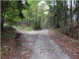
From where you parked, follow the road back to the bend, and a few 10 metres after the bend, cross a metal steel cable (a cross drain across the dirt road), after which you continue sharp right up the bank (there is usually a cairn at the point where you leave the road). There is a minute or two long climb up the slope straight ahead, with individual cairns pointing the way, and then you reach a clearly visible old hunting track, which you just cross, as the cairns point you straight up onto a fainter, but mostly traceable, path, which climbs steeply with the help of individual cairns. At the part where there are more fallen trees, you have to follow the path more carefully, and then you arrive at the edge of a rather overgrown torrential gully. In the last part of the gully, climb steeply across a partly exposed passage, then join the better-beaten path, which you follow in a straight direction (to the right in the descriptions, the starting point is Pod Debelo glavo).
The way forward leads through the valley between Pezdenica on the left and Ventijami on the right. Walk along the valley for a few minutes and then arrive at a clearing, at the edge of which is the Ventije hunting lodge.
After the hut, we continue along the valley for a few more minutes, and then the path climbs steeply and, with occasional fine views that reach all the way to Triglav, leads us a step higher, to a flatter world where the path splits into two parts.
Continue on the right-hand path (the left-hand path leads to the watering-hole and meadow at Dolga Planja), which then climbs gently up a series of small valleys surrounded by dwarf pines. A little higher up, another path branches off to the left towards the watering-place mentioned above, and we continue to the right, where we can already see mountain pasture Poljana in front of us, and Raskovec above it. A slight descent follows, and when we reach mountain pasture, another path joins us from the right from the starting point Pod Debelo glavo.
Continue left here and walk to the nearby shepherd's hut.
From the shepherd's hut, continue along the right (western) edge of mountain pasture, but only as far as where a path branches off slightly to the right into dwarf pines. The clearly visible path then climbs more steeply and, after about 15 minutes of climbing, leads to a less visible crossroads. Continue left on a significantly worse track, which is still traceable. From the track, which is getting worse, a passage soon opens up towards a hollow, which ends on the other side with a scree slope. After a short descent through tall grasses surrounded by dwarf pines (the passages are beautiful), we come to the foot of an uninviting scree slope. However, the "path" to Raskovec will lead us along this very scree (it is also possible to go right and then along the foot of Mali Raskovac, but this "path" is often impassable due to dwarf pines), which is full of large rocks in the lower part, but they are not the most stable (caution). The slightly higher rocks are replaced by steep grasses, which quickly turn into a cobbly scree on which to climb. About 50 metres before the direct ascent to the summit is stopped by a wall, a beautiful passage (manic) opens up to the right. Then cross the mostly rocky slope at the foot of the north face of Raskovec. Next, a beautifully passable but slightly steeper passage opens up to an undistinguished saddle between Maly and Veliki Raskovec (if we have chosen the right-hand option in the basin below, the two paths merge here). From the saddle onwards, the route is easier in terms of orientation.
From the saddle, continue left along and along the initially indistinct Raskovec ridge, which becomes more visible with each step and a little precipitous higher up. This relatively steep ridge is then followed all the way to the summit.
You can descend the south-west ridge, which will lead you to the marked Črna prst - Rodica trail in just over 5 minutes. If you choose to descend via one of these two peaks, you will have to walk along a dirt road to the starting point in the lower part (see map).
Vodel - mountain pasture Poljana 1:15, mountain pasture Poljana - Raskovec 1:30.

Pictures:
 1
1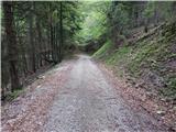 2
2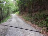 3
3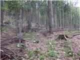 4
4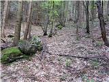 5
5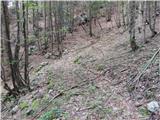 6
6 7
7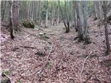 8
8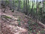 9
9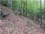 10
10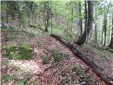 11
11 12
12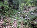 13
13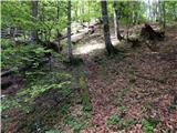 14
14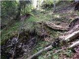 15
15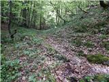 16
16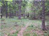 17
17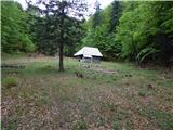 18
18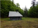 19
19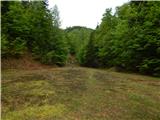 20
20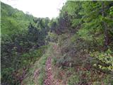 21
21 22
22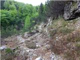 23
23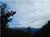 24
24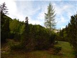 25
25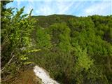 26
26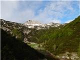 27
27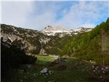 28
28 29
29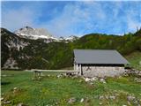 30
30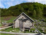 31
31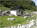 32
32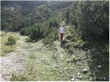 33
33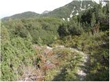 34
34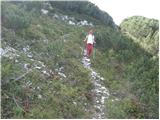 35
35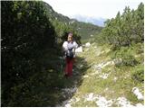 36
36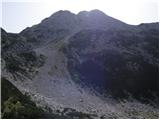 37
37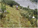 38
38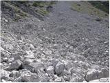 39
39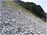 40
40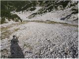 41
41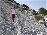 42
42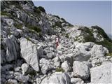 43
43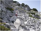 44
44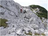 45
45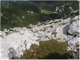 46
46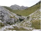 47
47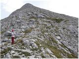 48
48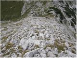 49
49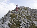 50
50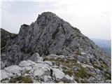 51
51 52
52
Discussion about the trail Vodel - Raskovec
|
| Jernej96813. 06. 2022 23:55:52 |
Podroben opis te poti me je opogumil, da se tod vzpnem na Raskovec. Za izhodišče sem iz čiste radovednosti izbral stezo, ki je na moji topografski karti vrisana na vzhodni strani Pezdenice,torej sem makadamsko cesto zapustil pred velikim polkrožnim ovinkom. Ostanki te steze so se višje izgubili, zato sem se usmeril proti zahodu in malo prek lovsko kočo dosegel stezo v opisu. Naprej sem se držal opisa. Najtežavnejši del poti je že omenjeno melišče, ki je dokaj strmo in nestabilno. Držati se je treba poraščenih delov ali samega desnega roba melišča, ki je bolj stabilen. Z vrha sem pot nadaljeval po tranzverzali do sedla Vratca, od koder sem se po brezpotju spustil do markirane steze, ki vodi nazaj proti izhodišču mimo planine Osredki. Pot priporočam vsem, ki bi se radi preizkusili v orientaciji v tehnično nezahtevnem gorskem svetu. V megli pot odsvetujem.
|
|
|