Starting point: Vrh Bače (1273 m)
| Lat/Lon: | 46,2381°N 13,9804°E |
| |
Time of walking: 45 min
Difficulty: easy marked way
Altitude difference: 225 m
Altitude difference po putu: 250 m
Map: TNP 1:50.000
Recommended equipment (summer):
Recommended equipment (winter): ice axe, crampons
Views: 12.268
 | 2 people like this post |
Access to the starting point:
a) First drive to Bohinjska Bistrica, then continue to Soriška planina and Tolmin. Before you reach the parking lot below the Soriška planina ski centre, i. e. about 400 m down, a dirt road turns off to the right and you follow it to its end.
b) From Železniki or Podbrdo, take the first exit to Soriška planina and from there start descending towards Bohinjska Bistrica. After about 400 m of descending, pay attention to the left fork of the macadam road, as this is the road you will continue on. Follow this road to its end, where you will park.
Path description:
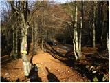
From the end of the road, continue right towards Črna prsti. The path initially leads us along cart track, which quickly turns into a footpath and leads us to the GRS hut after a mostly cross-country climb.
The way forward takes us out of the deciduous forest and into the coniferous forest, which is becoming increasingly scarce. Just a little further on, the path leads us to the Koble ridge, which opens up a beautiful view. There is a steep climb up the ridge, which is very steep on the south side and dangerous to slip in the wet. After a few minutes of climbing along the ridge, the path leads us to the pre-peak of Kobla. Here the ridge turns to the right and the path, which still follows the ridge, is followed for about 30 m to the highest point of the undistinguished peak of Kobla.
Pictures:
 1
1 2
2 3
3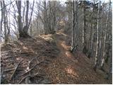 4
4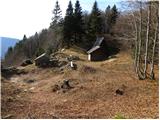 5
5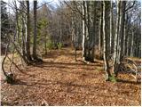 6
6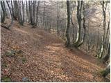 7
7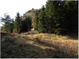 8
8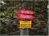 9
9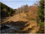 10
10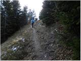 11
11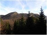 12
12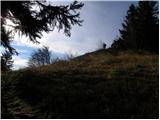 13
13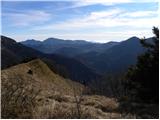 14
14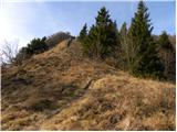 15
15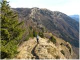 16
16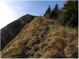 17
17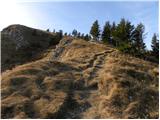 18
18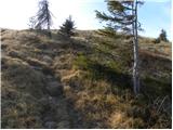 19
19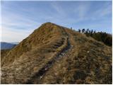 20
20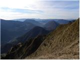 21
21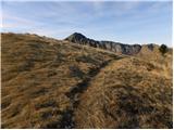 22
22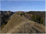 23
23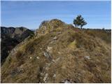 24
24 25
25 26
26
Discussion about the trail Vrh Bače - Kobla
|
| PUHIPUHI14. 02. 2017 |
Pozdravljeni!
Zanima me, če kdo ve v kakšnem stanju je makadamska cesta, ki vodi do izhodišča omenjene poti. Normalno prevozna za osebne avtomobile? Hvala, Lp
|
|
|
|
| luka2015. 02. 2017 |
zdravo.
To misliš zdaj v zimskih razmerah ali na splošno? Za zdaj ne vem, vem pa da je drugače v dokaj uredu stanju, za avtomobile normalno prevozna, lani sem tekel od vrha Bače proti Soriški po temu makadamu in bil v zelo uredu stanju in tudi nekaj avtov je bilo parkiranih pri Vrhu Bače-
lp,luka
|
|
|
|
| bumbi16. 02. 2017 |
V soboto, 11. februarja ceste skoraj ni bilo videti, ker je bilo precej snega.
|
|
|
|
| PUHIPUHI16. 02. 2017 |
Očitno bo treba počakati na pomlad. Najlepša hvala!
|
|
|