Vrhnika pri Ložu - Racna gora
Starting point: Vrhnika pri Ložu (584 m)
| Lat/Lon: | 45,7069°N 14,5076°E |
| |
Time of walking: 1 h 45 min
Difficulty: easy marked way
Altitude difference: 556 m
Altitude difference po putu: 556 m
Map: Snežnik 1:50.000
Recommended equipment (summer):
Recommended equipment (winter): ice axe, crampons
Views: 9.972
 | 4 people like this post |
Access to the starting point:
From the Ljubljana - Koper motorway, take the Unec exit and follow the road towards Cerknica. Continue through Cerknica, Martinjak and Grahovo to the village of Bloška polica, where at the crossroads turn right in the direction of the village of Lož (straight ahead Sodražica, access is also possible from this direction). Just after the village of Lož, you will reach Stari trg pri Ložu, where you turn left in the direction of the villages of Markovec and Vrhnika. Continue along a slightly narrower road, which leads past the village of Markovec to the beginning of the village of Vrhnika pri Ložu. Next, pay attention because when you see the mountain direction sign for "Castle Snežnik - straight ahead" on a tree, turn left onto the macadam road (the turn-off is not marked, but you will notice markings along the road). Follow this macadam road for 100m to the parking area by the road.
Path description:
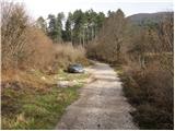
From the parking lot, continue along the macadam road, which soon leads to a right-hand bend in the middle of which you will see a signpost for Racno gora. Continue to the right and after a few minutes' walk the road leads to a turning point.
Next the road ends, and we continue straight on the marked cart track, which goes into the forest and leads us in a slight ascent to a crossroads. Continue along the right-hand cart track, which slopes slightly higher and after a while leads to a well-marked crossroads, where we leave cart track. Continue left on the partly grassy slope, where there is no trace of the mountain path.
Orientation ahead becomes more difficult, but if you continue straight up the slope you will soon see the markings which are more frequent higher up. The steep and barely visible path leads us higher up under the rocky cliffs, where it turns to the left and lays down a little. Then pass through a small "gate" after which the marked path turns right and joins cart track a little higher up, which we follow to the right. After walking for some 10 steps along cart track, the markings direct us to the left onto a footpath which quickly joins another cart track coming from the end of the forest road, which can be seen on our right (the road comes from the village of Dolenje Poljane).
Continue along the well-marked cart track, which after a few more minutes leads us to a large clearing in the middle of which we see a hunting observation post. The path then continues for some time along cart track, and we follow it to a place where a marked footpath directs us to the left on a less well-trodden path which is joined only slightly higher by a path from the hunting hut Urška. Continue right along a slightly steeper path which, after a short climb, leads us to the vegetated summit of Racna gora.

Pictures:
 1
1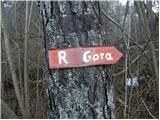 2
2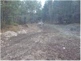 3
3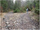 4
4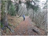 5
5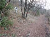 6
6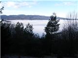 7
7 8
8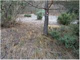 9
9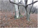 10
10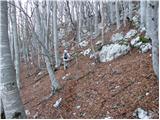 11
11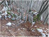 12
12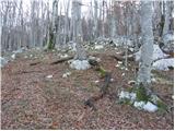 13
13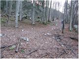 14
14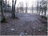 15
15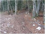 16
16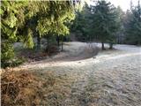 17
17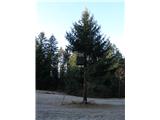 18
18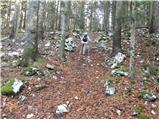 19
19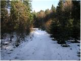 20
20 21
21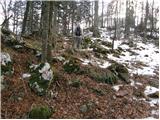 22
22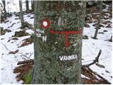 23
23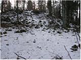 24
24 25
25
Discussion about the trail Vrhnika pri Ložu - Racna gora
|
| fpetel19. 12. 2008 |
Zanimive zgodnje zimske slike. Kako se pa najlepše pride po krožni poti od lovske koče nazaj do Vrhnike.
Pa lep pozdrav!
|
|
|
|
| Tadej9. 12. 2008 |
Midva sva od lovske koče sestopila po cesti v Kočevsko dolino in po njej nadaljevala do križišča za Knežjo njivo. Le malo naprej pa sva opazila kolovoz, ki se je odcepil levo navzdol. Po nekaj minutah spusta sva prišla v dolino. Sledil je le še sprehod skozi vas do izhodišča.
Od lovske koče do izhodišča cca 1,5h.
|
|
|
|
| navdušena15. 07. 2019 |
Včeraj bili na Racni gori po tej poti. Precej zaraščena (trava), zjutraj rosa, priporočam dobro obutev in dobre hlače. Sicer pa je pot dobro označena, malo moramo biti pozorni.
Sestopili smo v Dolenje Poljane in nadaljevali še do Gornjih Poljan. Lahko bi šli po krožni poti, a tokrat nismo. Ostaja za prihodnjič!
|
|
|