Vršič - Veliki Ozebnik (via Jalovška škrbina)
Starting point: Vršič (1611 m)
| Lat/Lon: | 46,4336°N 13,7435°E |
| |
Name of path: via Jalovška škrbina
Time of walking: 5 h 30 min
Difficulty: difficult pathless terrain
Altitude difference: 869 m
Altitude difference po putu: 1200 m
Map: TNP 1:50.000
Recommended equipment (summer): helmet, self belay set
Recommended equipment (winter): helmet, self belay set, ice axe, crampons
Views: 10.808
 | 3 people like this post |
Access to the starting point:
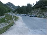
From Kranjska Gora drive towards Bovec or vice versa, but only as far as the Vršič pass, where you park.
Path description:
From the parking lot, walk to a small crossroads where a road closed to traffic turns left up past Tičarjev to the Postman's Home. Here you will see a small wooden log house on the right, selling souvenirs. Just a few metres behind the log cabin, you will see a marked footpath which, after a few steps, leads to the foot of the scree slope. Here the path turns slightly to the left and begins to descend gradually at the foot of the rocky cliffs. The path, which is still scenic at first, continues by crossing (slight ascents and descents) occasionally steeper slopes. On the two slightly more difficult passages, the fixed safety gear are helpful, especially when the path is wet. Next, the path begins to descend more and more and when we think that it will lead us into the valley we come to a crossroads where we continue right up in the direction of Jalovec (left down Zadnja Trenta, straight shelter under Špičkom). The path, which continues to climb relatively steeply, soon leads us out of the forest on increasingly more scenic slopes. The path, which mostly climbs on the slopes, then changes to a rockier world higher up, where we also arrive at a crossroads. Continue left (straight ahead Jalovška škrbina and Tamar) along the path which crosses the slopes below Jalovška škrbina towards the rocky slopes of Goličica. The relatively easy path is then stopped by the Goličica wall. Before entering the climbing part of the route, a sign informs us that we will continue the climb on a very difficult route. The route continues on a gentle ascent, crossing steep and exposed slopes, before turning right and starting to climb the wall almost straight up. During the ascent of the Goličica wall, we are only helped by a few measured fixed safety gear. Higher up, the steepness eases, and the path leads to a scree slope on and along which we then climb. The increasingly scenic route then leads us to a place where we have a view through the Jalovški ozebnik into the Tamar valley. Continue along a slightly less steep path over the slopes called Jezerca. There is a short descent and the path leads to a crossroads where you continue left towards the shelter under Špičko (Jalovec on the right). The path continues gently climbing on a partly grassy slope. After a few minutes of easy walking, the path leads to a place where you leave the marked path leading towards the shelter under Špičko (leave the marked path just a few metres before the jeklenico and the ravine, which is exposed to falling stones). Continue to the right and ascend the pathless world of the southern slopes of Veliki Ozebnik. Continue climbing on the right side of the ravine on very steep ground (high risk of rockfall). After 20 minutes of easy climbing, which does not exceed level 1, you reach the summit of Veliki Ozebnik.
Orientation in the last part is difficult and there is a high risk of falling rocks.

Pictures:
 1
1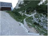 2
2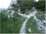 3
3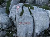 4
4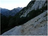 5
5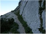 6
6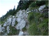 7
7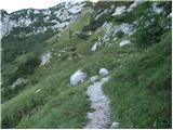 8
8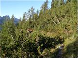 9
9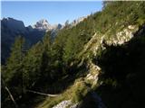 10
10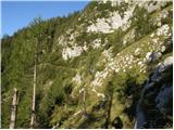 11
11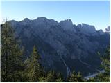 12
12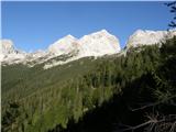 13
13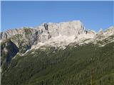 14
14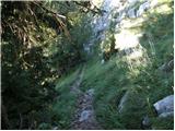 15
15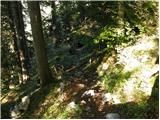 16
16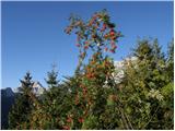 17
17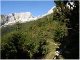 18
18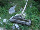 19
19 20
20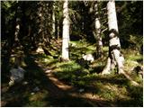 21
21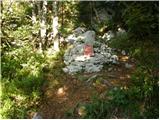 22
22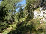 23
23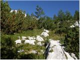 24
24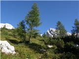 25
25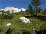 26
26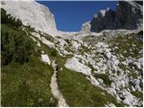 27
27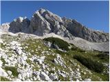 28
28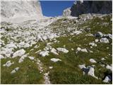 29
29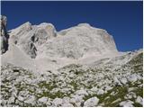 30
30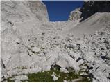 31
31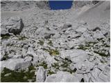 32
32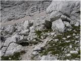 33
33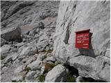 34
34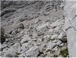 35
35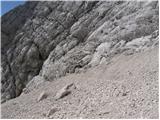 36
36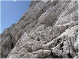 37
37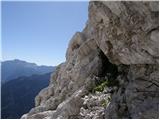 38
38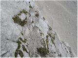 39
39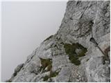 40
40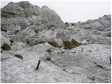 41
41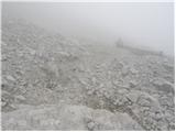 42
42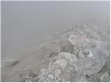 43
43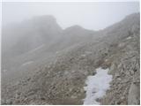 44
44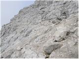 45
45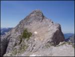 46
46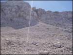 47
47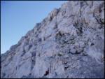 48
48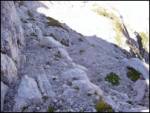 49
49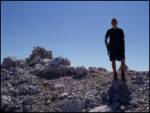 50
50
Discussion about the trail Vršič - Veliki Ozebnik (via Jalovška škrbina)