Zadnjica - Kanjavec (West peak) (via Prehodavci)
Starting point: Zadnjica (650 m)
| Lat/Lon: | 46,3824°N 13,7604°E |
| |
Name of path: via Prehodavci
Time of walking: 6 h 15 min
Difficulty: easy marked way, easy unmarked way
Altitude difference: 1919 m
Altitude difference po putu: 1960 m
Map: Triglav 1:25.000
Recommended equipment (summer):
Recommended equipment (winter): ice axe, crampons
Views: 10.074
 | 2 people like this post |
Access to the starting point:
From Kranjska Gora, drive over the Vršič pass towards Bovec or vice versa, but only as far as the 50th serpentine of the Vršiška or Ruska road (near the village of Trenta). Here you turn onto a side road, and then park for a few 100 metres in a roadside parking lot.
Path description:
From the parking lot, continue along the road, which takes you past a few houses (mainly on weekends) in about 15 minutes to a place where the road splits into two parts (there used to be a parking lot at the crossroads, but now parking is forbidden).
Continue along the lower right road (the upper road leads to the cargo cableway leading to Pogačnikov dom) in the direction of Doliča, Luknja and Prehodavci. Initially, follow the gently sloping road, which leads us across the meadows and higher up through the forest, almost to its end, or more precisely to a marked crossroads, where a marked footpath branches off to the right towards Prehodavci (it takes about 1 hour to get here).
From the crossroads in the area called Utro, continue to the right (straight ahead to Luknja, Triglav and Dolič), where you first cross partly vegetated gravel and a few torrents. After a few minutes of crossing, with some short ascents and descents, we reach the beginning of the Last Dol. Here the path starts to climb moderately on the right side of the valley. Higher up, the path curves slightly more to the right, where it takes us into the wods and then returns to a rockier world. The way forward leads us to a small well, next to which there is a small bench on which we can rest. The path continues to climb moderately to steeply for some time and gradually passes onto the scree below Zadnjiškim Ozebnikom. With a view of the nearby walls of the surrounding peaks, we then climb to the saddle Čez Dol, where the trail lays down and splits into two parts.
At this crossroads, continue left in the direction of Zasavska koča na Prehodavcih (straight ahead Trenta) and continue up the path, which continues over a rather steep and exposed slope. Follow this slightly narrower path to a nearby crossroads, where you join the mulatier from Trenta.
(If we find the short, slightly exposed part to dangerous, we can also take a slightly longer route to reach this crossroads. In this case, at the previous crossroads, continue straight on in the direction of Trenta and then a little further left in the direction of Prehodavci).
At this crossroads, continue straight ahead and continue climbing along a wide mulatier which crosses steep and precipitous slopes. As you climb over the precipitous slope, you will see a small "chapel" (statue of Mary and Jesus) on the left-hand side.
The slope becomes less steep and more scenic as the route continues. Higher up, a well-preserved mulatier leads us over the slightly less steep slope of Zelena Griva, and above it the slope becomes steeper again. There are a few short steep sections, and then the path and the slope fall away. A little above the unmarked break, you arrive at a marked crossroads, where you continue left (right Lepo or Veliko špičje - the path of Stank Kos, straight Koča pri Triglavskih jezerih) towards the nearby Zasavska hut on Prehodavci. The way forward leads us along a wide and scenic ridge, which leads us past the winter bivouac in a few minutes to the Zasavska hut. From Zasavska hut, descend a few 10 steps to the nearby winter bivouac, and from there continue left downhill (straight Zadnjica, Špičja ridge and Koča pri Triglavskih jezerih, the latter can also be reached if you continue left) towards the easier route to Koča na Doliču. In a few minutes, descend to Rjavo jezero, from where you continue straight up towards Hribarice (Zeleno jezero and Koča pri Triglavskih jezerih on the right). The trail, which continues under the Poprovec scree, then ascends crosswise to the right. A little higher up, the path from Zeleno jezero or the Hut at Triglav Lakes joins. Continue climbing for some time towards the Hribarice Pass, and before the path is laid to the right, the path from the Vrata Pass joins us. There are a few more minutes of ascent, and then the path lies on the Hribarice plateau (the Hribarice preval is located a little further on).
At the part where the path is laid, we arrive at a less visible crossroads, where we leave the path leading towards Dolič and further towards Triglav and continue the ascent to the left in the direction of Kanjavac. The way forward leads us into a small and relatively steep valley, which is located between the two peaks of Kanjavca. The increasingly scenic route, which continues along the aforementioned valley, then climbs higher and leads us to a saddle between the western and eastern summits of Kanjavac.
At the saddle between the two peaks, leave the marked path and turn left, and there is only a short climb to the western peak of Kanjavac.

Pictures:
 1
1 2
2 3
3 4
4 5
5 6
6 7
7 8
8 9
9 10
10 11
11 12
12 13
13 14
14 15
15 16
16 17
17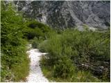 18
18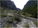 19
19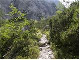 20
20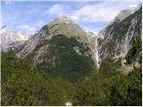 21
21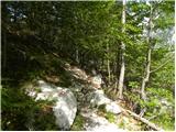 22
22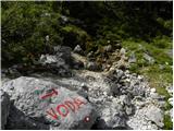 23
23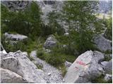 24
24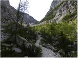 25
25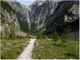 26
26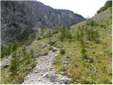 27
27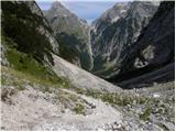 28
28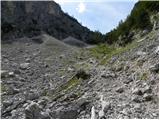 29
29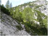 30
30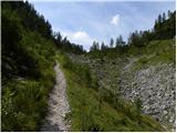 31
31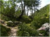 32
32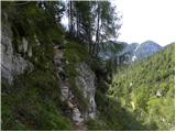 33
33 34
34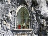 35
35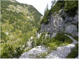 36
36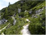 37
37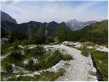 38
38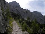 39
39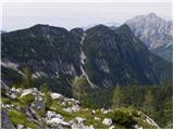 40
40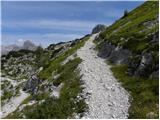 41
41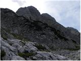 42
42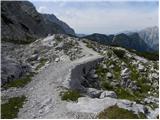 43
43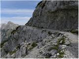 44
44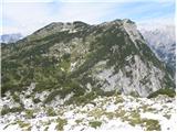 45
45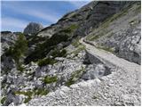 46
46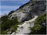 47
47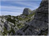 48
48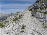 49
49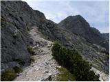 50
50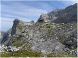 51
51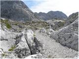 52
52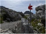 53
53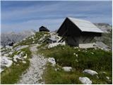 54
54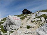 55
55 56
56 57
57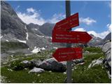 58
58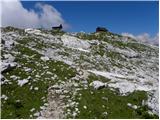 59
59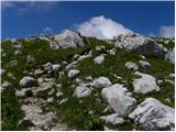 60
60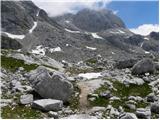 61
61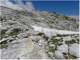 62
62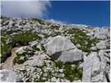 63
63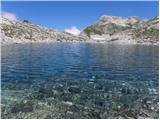 64
64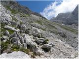 65
65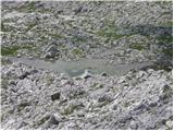 66
66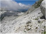 67
67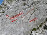 68
68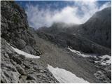 69
69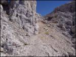 70
70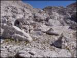 71
71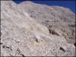 72
72 73
73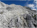 74
74 75
75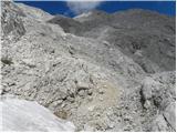 76
76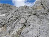 77
77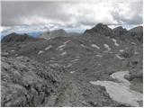 78
78 79
79 80
80 81
81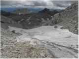 82
82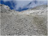 83
83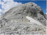 84
84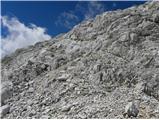 85
85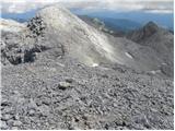 86
86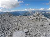 87
87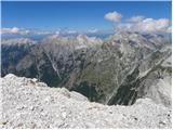 88
88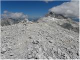 89
89
Discussion about the trail Zadnjica - Kanjavec (West peak) (via Prehodavci)