Zagora - Vodice (via Vodice)
Starting point: Zagora (100 m)
| Lat/Lon: | 46,0286°N 13,5979°E |
| |
Name of path: via Vodice
Time of walking: 2 h
Difficulty: easy marked way
Altitude difference: 551 m
Altitude difference po putu: 575 m
Map: Goriška 1:50.000
Recommended equipment (summer):
Recommended equipment (winter):
Views: 2.190
 | 2 people like this post |
Access to the starting point:
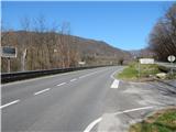
a) First drive to Nova Gorica, then continue to Tolmin and Bovec. Then drive past the Solkanski Bridge (the Solkanski Bridge, over which the railway line passes, is 220 metres long and has the longest stone arch in the world), and then drive for a few kilometres directly along the Soča River. Once the road moves away from the river, you reach a small crossroads, where the road branches off to the right towards Zagomila (house nos. 1-2) and Zagora (house nos. 1-7) and the Martin family's lodgings. Turn right here and park in a suitable roadside space after the first right turn. You can also park higher up the road.
b) From Tolmin and Most na Soči take the regional road towards Nova Gorica. After Plave, watch out for left turns. First, the road to a small hamlet or nearby house turns off to the left, and a little further on, the road to Zagomila (house Nos 1-2) and Zagora (house Nos 1-7) and the Martin family's lodgings turns off sharply to the left. Turn left here and park in a suitable roadside space after the first right turn. You can also park higher up the road.
Path description:
From where you parked, continue along the asphalt road, which climbs gently through the forest. At the very beginning, we get some views of the other side of the Soča River, where we see the church of St Ahacius above Prilesje, but then we don't get any special views apart from a view of a nearby pasture until a sharp right turn. From this bend, however, you can see the Soca, Prilesje, Plave and Korada. Around the bend, the forest gradually thins out and the path leads us to the village of Zagora, where the path leads us past a few houses. In the middle of the village, a short road branches off to the right towards Martinovi, and we continue to the left in the direction of Svete Gora. Just a little further on, we arrive above the village, and we continue our ascent along the asphalt road, which continues through the forest for some time. The road then climbs south to south-east and after a while leads us to Zagomila, a small hamlet above which we have a nice view towards Korada and the Sabotina ridge. The asphalt also ends behind the settlement, and the road leads to a marked crossroads where we continue left towards the hamlet Vodice (straight ahead Sveta Gora and the top of Vodice via the pass Preški vrh).
From the crossroads onwards, the road climbs in a few serpentines to the pass between Kuko (612 m) on the left and the lesser-known Košutnik (592 m) on the right. From the prevala, there is an easy descent and the path leads us past memorials and a small wooden cross to the next marked crossroads.
From the crossroads, the path to the aforementioned Kuk branches off to the left, the road continues slightly to the left, which leads to the settlement Paljevo, and we continue to the right, passing the memorial erected in June 1916 to Guido Novak von Arienti, commander of the 1st Mountain Brigade of the FML, which was erected in June 1916. After the monument, the road turns slightly left and after a few minutes leads to the hamlet Vodicee. After Vodice, leave the road and continue to the right in the direction of the monument (inscription on the signpost). The path turns slightly further to the right and leads us out of the woods onto a grassy hayfield, where it continues along the outer edge of a pasture fence. With beautiful views of the surrounding hills and Julian Alps, we are back in the forest in a few minutes. The trail continues through the forest and climbs gently for the most part, then it lays down further and leads to a forest road, which is reached near the information boards. At the information boards, the forest road continues to the left, leading to the Preški vrh pass, a little further on and then to the right leads the way to the nearby monument at the eagles, and the road continues along a worse road towards the Vodice peak and the mausoleum at the top. From the information boards it is only about a 2-minute walk to the top of the watercourses.
The whole route is marked at the crossroads, but not marked.

We can extend the trip to the following destinations: Sveta Gora
Pictures:
 1
1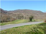 2
2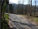 3
3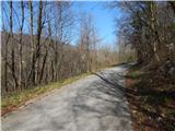 4
4 5
5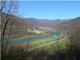 6
6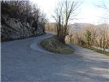 7
7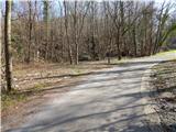 8
8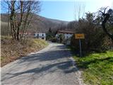 9
9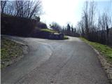 10
10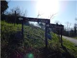 11
11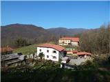 12
12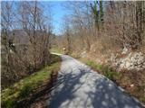 13
13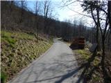 14
14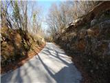 15
15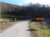 16
16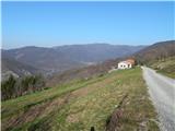 17
17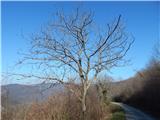 18
18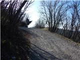 19
19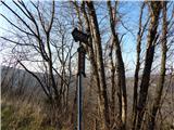 20
20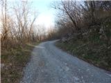 21
21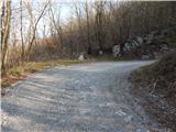 22
22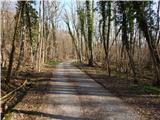 23
23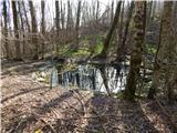 24
24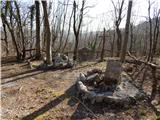 25
25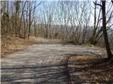 26
26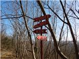 27
27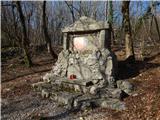 28
28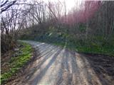 29
29 30
30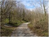 31
31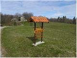 32
32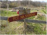 33
33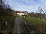 34
34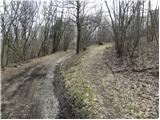 35
35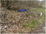 36
36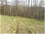 37
37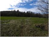 38
38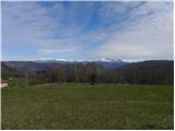 39
39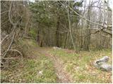 40
40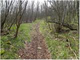 41
41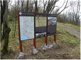 42
42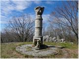 43
43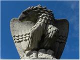 44
44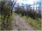 45
45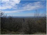 46
46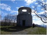 47
47 48
48
Discussion about the trail Zagora - Vodice (via Vodice)