Zagorje ob Savi - Vrh (Šticna) (Šmarjakova pot)
Starting point: Zagorje ob Savi (220 m)
| Lat/Lon: | 46,1317°N 14,9953°E |
| |
Name of path: Šmarjakova pot
Time of walking: 1 h
Difficulty: easy unmarked way
Altitude difference: 459 m
Altitude difference po putu: 459 m
Map:
Recommended equipment (summer):
Recommended equipment (winter):
Views: 6.948
 | 5 people like this post |
Access to the starting point:
a) From Trojan direction:
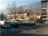
Follow the road signs in the direction of Zagorje ob Savi. Once in the town, take the roundabout towards the railway station. Follow the road until the traffic lights, where you turn right towards the blocks. Park in the large parking lot and head towards Pizzeria Ašič.
b) From Trbovlje or Litija:
Follow the road signs towards Zagorje ob Savi. Take the bridge over the Sava to Zagorje ob Savi. Follow the main road to the traffic lights, where you turn left towards the blocks. Park in the large parking lot and head towards Pizzeria Ašič.
Path description:
From the parking lot, head towards Pizzeria Ašič. A large sign on the house gives away the location of this pizzeria. At the crossroads, head straight up and follow the road past the houses. When you leave the houses behind, turn right at the crossroads and follow the road up towards the hamlet of Podstrana. When the asphalted road ends, take the tractor road, which will lead you in a few steps to the hamlet of Podstrana. Step back onto the tarmac road, but only for a short distance. Follow the road downhill and turn onto a dirt road that crosses a field. Follow this road until you reach a large rock on the left side of the road. Just after it, leave the road and head right up a forest track. Then follow the path, continuing straight ahead at all crossroads (there are not many). When you come close to a clearing where a power line runs, bear left at a crossroads. In a few further steps the path leads to a clearing, which we cross and turn left on a path that begins to climb (straight ahead leads the path towards Podkraje pri Zagorju). The forest path begins to climb steeply in the keys. The path is from here on very well traceable, without crossroads so there is practically no chance of getting lost. The path climbs, but when you get to the remains of the construction (probably a bunker from the 2nd World War) the path turns upwards. Follow the beaten track, which climbs steeply, straight up to the summit, which is only a few minutes away. The forest path runs right next to the forest border with the meadow and in a few further steps you reach the summit.

Pictures:
 1
1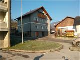 2
2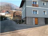 3
3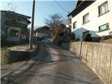 4
4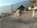 5
5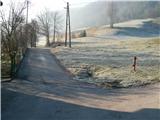 6
6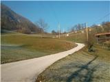 7
7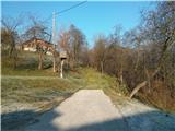 8
8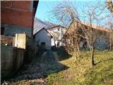 9
9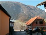 10
10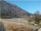 11
11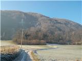 12
12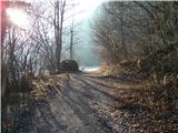 13
13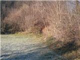 14
14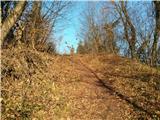 15
15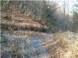 16
16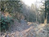 17
17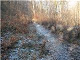 18
18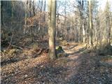 19
19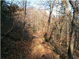 20
20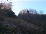 21
21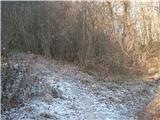 22
22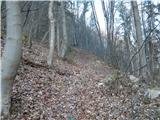 23
23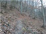 24
24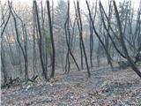 25
25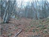 26
26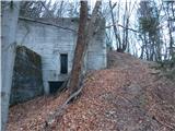 27
27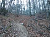 28
28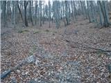 29
29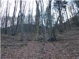 30
30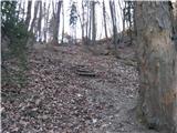 31
31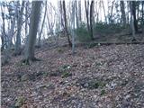 32
32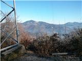 33
33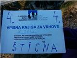 34
34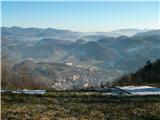 35
35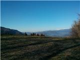 36
36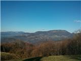 37
37
Discussion about the trail Zagorje ob Savi - Vrh (Šticna) (Šmarjakova pot)
|
| hribuc8524. 12. 2013 |
Zelo lep in relativno hitro dostopen razgledni vrh na Zagorjem. Omenjena pot je nekoliko težje prehodna v mokrih razmerah zaradi strmega in neporaslega dela.
|
|
|
|
| Bandzo25. 12. 2013 |
Danes na Šticni, razgledi so bili glede na vreme dobri, pot je bila pa razmočena in je bila zato na tistem zadnjem vzponu proti vrhu kar težavna.
|
|
|
|
| michael6627. 12. 2013 |
Ha,ha,ta vrh je glih nad mano,pa še nism bil gor 
|
|
|
|
| docepe226. 02. 2015 |
Mi lahko eden razloži, ko v vpisno knjigo vpisujete poti semering in golavc, katere so to.
Poznam še pot, ki si kmalu za veliko skalo ob kolovozu odcepi desno mimo nekdanjega rudnika, tam kjer je bil podor skal in proti Riglu.
|
|
|
|
| hribuc8527. 02. 2015 |
Docepe2, pozdravljen.
Golavc je nad vasjo Vrh nad Čolniščami. Torej če prideš po cesti od Čolnišč, greš v vasi desno in potem slediš kolovozu v hrib mimo novogradnje (vsaj mislim da nekdo tam gradi hišo), prideš na travnato jaso ki jo ob robu gozda prehodiš (držiš se bolj levo) in potem je v gozdu omenjeni vrh. Ni razgleden, ima pa vpisno knjigo in verjetno še kaj (tam sem bil samo enkrat). Če štartaš z vrha Šticne (daljnovod z vpisno knjigo), greš po poti v gozd in nato desno po kolovozu v vas. Za pot Semering tudi sam prvič slišim. Če poznate gosopda Jurjec Štefana iz Dolenje vasi 4 (nad Okrogarjevo kolonijo), vprašajte njega ker po mojem on bolj pozna te kraje. Sicer pa tudi sam zahajam v tiste konce in jih še raziskujem. Šticna je tak relativno hitro dostopen in razgleden vrh. Lahko da se kdaj srečava (če se slučajno že nisva).
Srečno!
|
|
|
|
| hribuc8528. 02. 2015 |
Da dopolnim prejšnji članek:
danes sem obiskal ta kraj in po pogovoru s planincem izvedel naslednje: pot Semering je pot mimo zapuščenih betonskih konstrukcij (včasih je tu potekala tovorna žičnica). Ko prispeš do vrha (daljnovod z vpisno knjigo), greš po poti naprej v gozd in se potem držiš smeri levo po gozdu proti poseki (še en daljnovod). No, to je pa t.i. Rigel. Upamm da sem bil dovolj jasen.
Srečno!
|
|
|