Zauchen - Hochobir (Ojstrc) (via Kunetov graben)
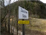
Starting point: Zauchen (509 m)
| Lat/Lon: | 46,5199°N 14,5756°E |
| |
Name of path: via Kunetov graben
Time of walking: 5 h 5 min
Difficulty: easy marked way
Altitude difference: 1630 m
Altitude difference po putu: 1650 m
Map: Karavanke - osrednji del 1:50.000
Recommended equipment (summer):
Recommended equipment (winter): ice axe, crampons
Views: 4.906
 | 2 people like this post |
Access to the starting point:
a) From the motorway Ljubljana - Jesenice take the exit Kranj - East and follow the road towards Jezersko. From Zgornje Jezersko, continue driving over the Jezerski vrh alpine pass to Železna Kaple / Bad Eisenkappel and continue along the Bela valley to Suha / Zauchen. Here, at the junction after the bus station, turn left onto a narrow local road, parking alongside it a few 10 m higher up.
b) From Styria, first drive to Mozirje, then continue to the Logar valley and later to Pavlice saddle. From Pavliče sedlo, descend to Belo / Bad Vellach, then continue to Železna Kapla / Bad Eisenkappel and continue along the valley of the Bela to Suha / Zauchen. Here, at the junction after the bus station, turn left onto a narrow local road, where you will park a few 10 m higher up the road.
Path description:
From the starting point, continue along the road along which you parked, but it loses its asphalt coating after the hamlet. We continue along the relatively wide road for a while, then in the middle of the right serpentine we see the signs for "Hochobir", which direct us left onto a worse abandoned macadam road. Continue along the above-mentioned road, which climbs moderately along the valley of the Kunetovje graben. The path is exposed to falling rocks in several places and to avalanches in winter. Higher up, the road moves slightly away from the stream bed, and if we pay attention, we will see the walled "entrance" to the mine on the left side of the road (the real entrance is on the other side of the hill). A little further on from the mine, the path returns to the stream bed, and then the road widens and leads to a marked crossroads, where we continue to the left (to the right Grabštajnska mountain pasture). We continue along the road, which gives us our first view of Hochobir, and only a little higher up leads us to the next crossroads, where we see a hunting observation post. Here we continue to the right and follow the road for only a few steps, then the signs direct us left into the forest on a marked footpath which begins to climb moderately through the forest. Higher up, the path leads through a clearing, returns into the forest above it and then joins a lesser forest road, which you follow to the right. Walk along the above-mentioned road for only a few metres and then turn left onto a footpath which begins to climb, first moderately and then steeply, through the forest. Higher up, the path lies down and leads out of the forest to mountain pasture Zgornja Šefnarca. Walk across the mountain pasture and the path leads to a road where the path through Santa's Graben joins from the left.
Continue along the marked cart track in the direction of the 'Eisenkappler Hütte', which, after a few minutes' further walking, leads to the Počula lookout saddle, at the edge of which stands a chapel.
To the right of the chapel, the path enters the forest and begins a moderate to steep ascent. After a few minutes, the steepness eases and the path leads to the mountain pasture grazing area on the lakes. Here we continue slightly to the right, and then, when the view opens up towards Košuta, the path starts to descend moderately on the wide cart track. After a few minutes of descending, we reach Eisenkappler Hutte / Eisenkappler Hütte. From the hut, continue along the marked trail towards the Hochobir / Hochobir peak. The trail goes shortly above the hut into the forest, through which it then climbs for some time. Higher up, the path, along which you can see a large number of natural history teaching signs, is laid out and leads out of the forest into the lane of dwarf pines. A few minutes of easy walking follows and the path leads us to a bench at the top of the Kraguljša lookout.
From Kraguljše, which offers a fine view of Hochobir, the path first descends slightly and then passes a small watering place for animals, leading us to an expansive ridge. Once on the ridge, the wide, marked path turns left and then ascends crosswise to the left. After a short climb, you reach the "Kalte Quelle" pass, and the trail continues to climb crosswise to the left for some time. Higher up, the path turns right and climbs along the edge of a small valley to the ruins of a former hut at 2040 m (Rainer Schutzhaus). The path continues up to a small saddle in the main ridge of the Obirje, where the path from the Šajda / Zell-Schaida saddle joins us on the left, and we continue to the right and climb up and along an increasingly exposed ridge, which is particularly dangerous for slipping, especially in the snow, to the summit at 2139 m. Continue along the path to the right and along the ridge, where the path from the Šajda / Zell-Schaida saddle joins us on the left.

Pictures:
 1
1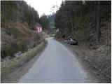 2
2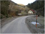 3
3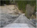 4
4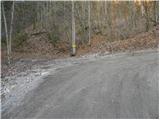 5
5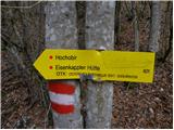 6
6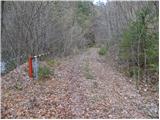 7
7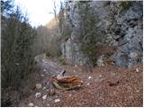 8
8 9
9 10
10 11
11 12
12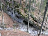 13
13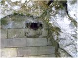 14
14 15
15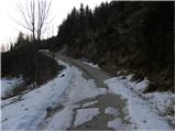 16
16 17
17 18
18 19
19 20
20 21
21 22
22 23
23 24
24 25
25 26
26 27
27 28
28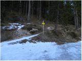 29
29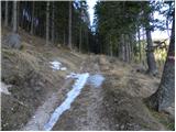 30
30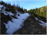 31
31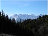 32
32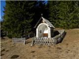 33
33 34
34 35
35 36
36 37
37 38
38 39
39 40
40 41
41 42
42 43
43 44
44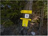 45
45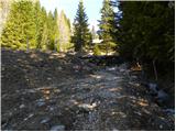 46
46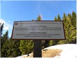 47
47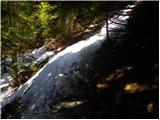 48
48 49
49 50
50 51
51 52
52 53
53 54
54 55
55 56
56 57
57 58
58 59
59 60
60 61
61 62
62 63
63 64
64 65
65 66
66 67
67 68
68 69
69 70
70 71
71 72
72 73
73 74
74 75
75 76
76 77
77 78
78 79
79 80
80 81
81 82
82 83
83 84
84 85
85 86
86 87
87
Discussion about the trail Zauchen - Hochobir (Ojstrc) (via Kunetov graben)