Zgornji Gabernik - Boč (over Galke in Balunjača - circular path)
Starting point: Zgornji Gabernik (301 m)
Name of path: over Galke in Balunjača - circular path
Time of walking: 3 h 30 min
Difficulty: easy marked way
Altitude difference: 677 m
Altitude difference po putu: 699 m
Map: Posavsko hribovje Boč - Bohor 1:50.000
Recommended equipment (summer):
Recommended equipment (winter):
Views: 19.891
 | 5 people like this post |
Access to the starting point:
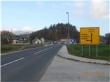
a) From the Ljubljana - Maribor motorway: take the Dramlje exit and leave the motorway. Continue to the right in the direction of Šentjur. In Šentjur, follow the signs for Rogaška Slatina and Podčetrtek (turn left at the 3rd and 4th traffic lights). The route then leads straight ahead through the settlements of Grobelno, Šentvid, Šmarje pri Jelšah, Belo, Mestinje (watch the radar). In Mestinje, drive straight ahead in the direction of Rogaška Slatina until you reach Podplat. In Podplat turn left at the traffic lights for the direction Poljčane and drive straight along the main road until you see the Strašek car service and technical inspections on the left. Drive past the garage over the bridge and immediately turn right towards Gabernik (Vinska cesta). Follow the local road straight ahead until you see the foot of Boč and a 5-legged ("strange") crossroads, where you drive straight towards a grassy football field. There is a mountain signpost and a picture of Boč next to it. We have arrived at the trailhead.
b) From the direction of Poljčany: head in the direction of Rogaška Slatina, cross Pečica and descend towards Podplat. Before the Strašek car service and technical inspections, turn left towards Gabernik and follow the above description.
Path description:
From the parking lot, continue straight along the asphalt road and follow the signs for the mountain lodge at Boč. The mountain signs lead us to the Ogrizek Tourist Farm, where the path turns right and takes us along the asphalt road uphill into the forest. The asphalt ends and the macadam road leads us out of the forest to the Jagodič quarry. Pass the sand piles, through a right-hand bend, where a marker directs you left onto the dirt road. Continue uphill on the dirt road (with the Galka stove on your right) to the weekend. Follow the dirt road past the cottage and then immediately turn right steeply uphill along the path by the vineyard. Ascend to the highest vikend, cross the access road and continue up the steep slope into the forest. Follow the marked mountain path and after 5 minutes you will see the Chapel of Our Lady in the cliff on the right. Continue to the viewpoint where you can see our starting point. The path continues to climb straight up to a beautiful viewpoint "skalce", where there is a nice view over the whole Gabernik valley and a good point for taking photos. We continue uphill and after about 15 minutes we arrive at the top of the Galka mountain. The trail from Pečice joins us. A third of the way is behind us.
Continue straight ahead in a gentle slope along the forest ridge, which leads us after approx. 200 metres to a crossroads where we turn right onto a straight path (the straight path leads to the top of a small hill). Continue along the beautifully routed crossing, where you will find a bench with a nice view. After a short stop, we continue along the beautifully laid path and after about 20 minutes the path widens and leads us out of the forest by the hunting lodge at Boč. Along the way there are several forest trail signs. Continue in the direction of the mountain lodge at Boč past the Velikonočnica protected area. After about 15 minutes, you will arrive at the Boč mountain lodge.
From the Boč Mountain House, continue straight along the meadow through the avenue to the Partisan Monument above the house. At the monument, turn left towards the spruce forest, where a beautiful path leads to a small wooden hut. Above the wooden hut, the path forks straight ahead and to the left. We continue straight on and after a few metres of steep ascent we reach a macadam road where we turn left. Follow the road, where the path from Poljčany joins from the left. The road soon ends and the last third of the way to the summit begins.
After the first steep part of the winding path, you reach a signpost where you have two options to continue. The left path is called the Balunjača path and the right path is called the steep path (the two paths merge at a higher level). The Balunjača path then crosses the slopes of Boč in a moderate ascent to the rocky cliffs that we can see in front of us. The path then crosses the foot of these cliffs using the fixed safety gear. The passage under the cliffs is not difficult, but is somewhat exposed to falling rocks. At the foot of the cliffs, however, you can observe some small caves, which brighten up the day, especially for younger mountaineers. Next, the path climbs steeply and leads us in a few minutes to a place where our path and the steep path merge again. The steepness of the path then gradually eases and the path leads us to cart track, which climbs gently alongside the military area below the transmitter. After leaving the vicinity of the military area, there is only a five-minute walk along the top of the still wooded slope. At the top, however, the climb does not end. Ahead of us we see a 20 m high lookout tower, which we climb up steep steps. The climb to the top of the tower rewards you with a beautiful view.
We will return along a circular, flatter path. From the tower, continue along the vegetated slope in the opposite direction to that in which you came up, or in the direction of Mount Donacca. After 5 minutes of walking along the ridge, the path branches off to the right and you descend along a winding path to the mountain lodge at Boč. From the Boč mountain lodge, head back towards the Velikonočnica plantation, where you turn left onto the macadam road or towards the Velikonočnica mountain hut. Keep on the road, where at two forks turn right downhill until you reach a water reservoir. Continue along the dirt road and after a few minutes you will reach the Velikonočnica mountain hut. From Velikonočnica, continue 100 metres straight along the road and at the first left turn, turn right into the forest on man-made steps. Continue downhill along the path, which leads past a half-demolished building to a chapel where you can ring the bell and sit on a bench. The bench gives us a beautiful view of the Galka mountains and the surrounding hills and valleys. Continue down along the edge of the meadow to a fork and continue straight on to the cottages. From the cottages, follow the road down to a crossroads, where you can continue straight ahead or to the left. Both roads lead to the same place, the straight road is shorter. We continue straight on past the vineyards and down the access road. Continue downhill to the asphalted road, which you follow until you reach the starting point where you parked your vehicle.

Pictures:
 1
1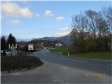 2
2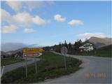 3
3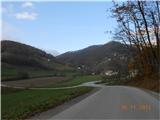 4
4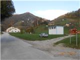 5
5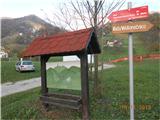 6
6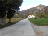 7
7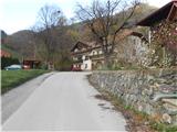 8
8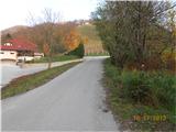 9
9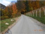 10
10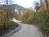 11
11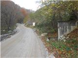 12
12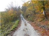 13
13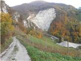 14
14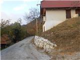 15
15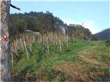 16
16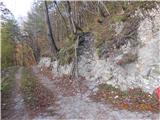 17
17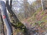 18
18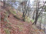 19
19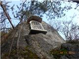 20
20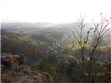 21
21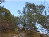 22
22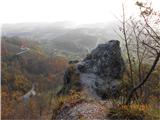 23
23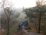 24
24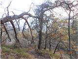 25
25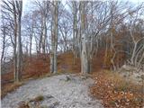 26
26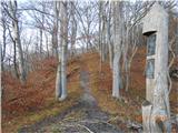 27
27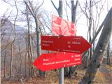 28
28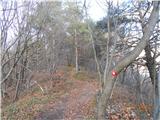 29
29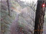 30
30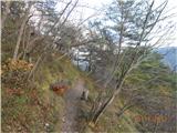 31
31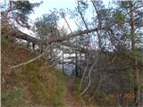 32
32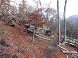 33
33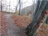 34
34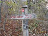 35
35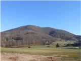 36
36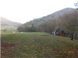 37
37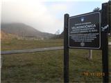 38
38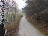 39
39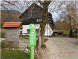 40
40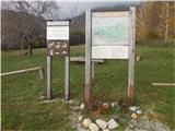 41
41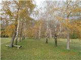 42
42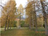 43
43 44
44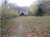 45
45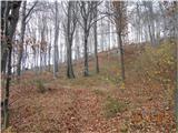 46
46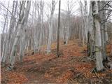 47
47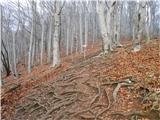 48
48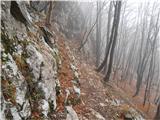 49
49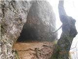 50
50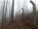 51
51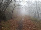 52
52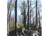 53
53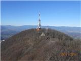 54
54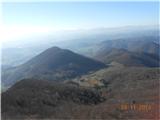 55
55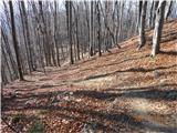 56
56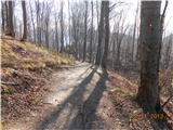 57
57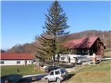 58
58 59
59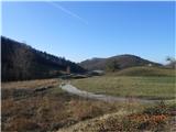 60
60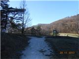 61
61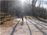 62
62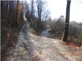 63
63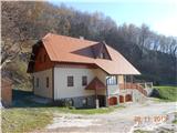 64
64 65
65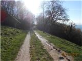 66
66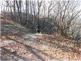 67
67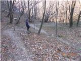 68
68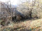 69
69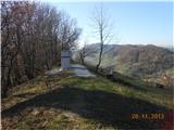 70
70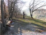 71
71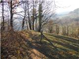 72
72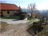 73
73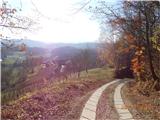 74
74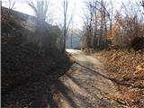 75
75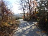 76
76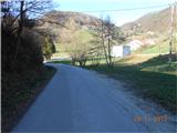 77
77
Discussion about the trail Zgornji Gabernik - Boč (over Galke in Balunjača - circular path)
|
| bruny18. 01. 2014 |
Lep in širok opis poti...všečen je tudi prikaz, nekaj prvih fotk poti neposredno na izhodišče - vsekakor zanimivo. Je pa tudi nekaj drobnih nepravilnosti, ki pa na samo pot nimajo vpliva. Ob prihodu iz smeri Poljčane je pod Pečico takoj možno v križišču zaviti levo, to je pred podružnično cerkvijo Sv. Rozalije in preko Spodnjega v Zgornji Gabernik. Galke, vrh je višji, visok 658 metrov po podatkih na Geopediji. Višina 610 metrov je nekje pravilna za zaključek ožjega območja pečevja. Ob izhodu iz gozda, neposredno pred rastiščem velikonočnice seveda ni lovski dom ampak nekakšen bivak, brunarica lovcev – odličen kraj za  piknike predvsem. To je območje lovske družine Boč in imajo lovski dom v Zgornjem Gaberniku, ob planinski poti, katere začetek je nekoliko pod prevalom Pečica. Med fotkami 42 do 46 tudi, če se ne motim ni označena planinska pot ampak bližnjica. Uradna pot vodi za planinskim domom, nad letnim točilnim pultom -žarom...Vodni objekt nad kočo Velikonočnico ni zajetje ampak vodohran, ki omogoča uporabnikom stabilno vodno oskrbo/pritisk in uporabo hidrantov. Hvala za zanimiv opis, široko videnje opisanega področja Boča ob poti in pričakujem-o nove opise poti. Lp
|
|
|
|
| jprim21. 01. 2014 |
Lepo, zanimivo, kar vlečejo macesni, ta pot načrt v prihodnosti, sva kar pogosto na Boču, sicer izhodišče v začetku gozda, pa po grebenu ... vedno narediva krožno.
Kaj pa izhodišče v Studenicah?
LP!
|
|
|
|
| stipi6922. 03. 2014 |
Zelo lepa, predvsem vzpon tja mimo vikenda in preko pečevja, potka, ki jo bom sigurno še večkrat prehodil. Pri turistični kmetiji Ogrizek se tudi da parkirati, če pri čudnem križišču ni prostora... In pazite na tovornjake proti kamnolomu, cesta ni kaj prida široka 
|
|
|
|
| Stamp30. 10. 2014 |
Odlično dokumenturano..
Pitanje samo - da li se u Planinskem domu Boč može dobiti grah (ili sl) ? Radi preko cijele godine ?
Hvala
|
|
|
|
| firbec22. 02. 2015 |
Živjo, mene vleče, de bi šou gor v naslednjem vikendu, pa me zanima kako je v snežnih al pa precej razmočenih razmerah in pa seveda, če je dom odprt. Hvala za vsako informacijo in srečno  !
|
|
|
|
| Luciano6717. 02. 2019 |
Pozdravljeni,
a bi mi kdo lahko opisal pot iz Boča, od planinskega doma, do Donačke gore?
Zelo rad bi prehodil omenjeno pot, pa nisem ravno siguren, če jo bom zadel.
Hvala vsem, ki mi boste pomagali.
|
|
|
|
| Luciano6717. 02. 2019 |
Drugače pa, vzpon čez Galke mi je nekako najljubša smer na Boč. Hvala avtorju za slike in opis poti.
|
|
|
|
| edelweiss9618. 02. 2019 |
Pot Boč-Donačka je zelo popularna in odlično markirana, tako da ni strahu, da bi se izgubil Od planinskega doma na Boču nadaljuješ gor po cesti do vrha prelaza, kjer te table usmerijo proti Donački gori (cca. 5ur v eno smer). Nato samo slediš markacijam po široki makadamski cesti. Pomembnejše točke ob poti (za orientacijo): Lovski dom Gavez (LD Rogaška Slatina, Plešivec (822m), planota Ravnocerje, cerkev Sv. Marije na Ložnem, preval nad Stopercami, Rudijev dom na Donački gori Več info: klik
|
|
|
|
| firbec26. 06. 2019 |
Živjo, prosim ali mi lahko kdo pove zakaj se mi na zemljevidu ne izrišejo poti posameznih tur, vrhov, variant vspona …?! Hvala in LP!
|
|
|
|
| edelweiss9627. 06. 2019 |
Meni se poti izrišejo z rdečo črto, samo traja par sekund. Drugače pa ni nobene potrebe po zemljevidu. Pot je dobro označena, pa tudi avtor te poti jo je odlično opisal. S pomočjo fotografij se je nemogoče izgubiti.
|
|
|
|
| frajer12. 07. 2019 |
Pot je trenutno od Planinskega doma do vrha ovirana zaradi polomljenega drevja. Senčna pot oz. pot od planinskega doma po desni strani je popolnoma neprehodna.
|
|
|