Žiri - Planinska koča Mrzl'k
Starting point: Žiri (487 m)
| Lat/Lon: | 46,0426°N 14,1047°E |
| |
Time of walking: 2 h
Difficulty: easy marked way
Altitude difference: 484 m
Altitude difference po putu: 545 m
Map: Škofjeloško in Cerkljansko hribovje 1:50.000
Recommended equipment (summer):
Recommended equipment (winter):
Views: 3.810
 | 1 person likes this post |
Access to the starting point:
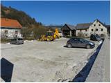
a) From Železniki, Kranj or Medvode, drive to Škofja Loka, and from there continue in the direction of Gorenje vasi in the Poljanska valley and Žire. From Žiri, continue towards Logatec, then before the end of the town you will reach the Lenger Inn and a few 10 m further on to a crossroads where the main road towards Logatec turns left and the road continues straight on towards Idrija. Park in a suitable place at the crossroads. There is a large parking lot next to the Lenger Restaurant, but it is a courtesy to ask the staff if you are allowed to park in this parking lot beforehand.
b) From Horjul or Polhov Gradec, drive to Šentjošt nad Horjul, and from there continue to Smreč. When you reach the main road Podlipa - Žiri, follow it to the right, and we drive along it to Žiri. When in Žire, reach the main road Škofja Loka - Logatec, follow it to the left, and we follow it past the parish church and the Lenger Inn and Pizzeria, to the junction where the main road to Logatec turns left, and in a straight direction the road continues towards Idrija. Park in a suitable place at the junction. There is a large parking lot next to the Lenger Inn, but it is a courtesy to ask employees in advance if we are allowed to park in this parking lot.
c) From the motorway Ljubljana - Koper take the exit Vrhnika, then when you reach the old road Ljubljana - Logatec, continue in the direction of Logatec, but only for a short time, as at the next junction you will turn right in the direction of Horjul. The road continues for a short distance through Vrhnika, then through the outskirts of Stara Vrhnika, and then soon we leave the road towards Horjul and continue slightly left in the direction of Smrečje. After Smrečje the road starts to descend towards Račeva and Žire. Once in Žire, we reach the main road Škofja Loka - Logatec, follow it to the left, and we follow it past the parish church and the Lenger Inn and Pizzeria, to the crossroads where the main road to Logatec turns left, and the road to Idrija continues in a straight direction. Park in a suitable place at the junction. There is a large parking lot next to the Lenger Inn, but it is a courtesy to ask employees in advance if we are allowed to park in this parking lot. d) From the motorway Koper - Ljubljana take the exit Logatec, and when you reach the old road Logatec - Vrhnika follow it to the right (first exit from the roundabout), and follow it for only a short distance, as the signs for Rovte and Žiri then direct you to the left. After Rovte, the road starts to descend towards Žire, and when you reach the above-mentioned place, the road to Idrija branches off to the left. Park in a suitable place at the junction. There is a large parking lot next to the Lenger Restaurant (the restaurant is located some 10 m further from the crossroads in the direction of the centre of Žiri), but it is polite to ask the employees beforehand if you are allowed to park in this parking lot.
e) From the road Idrija - Spodnja Idrija, just after the end of Idrija, turn right (if coming from Spodnja Idrija, turn left before Idrija) over the bridge over the Idrijca river towards the Eurospin shop. On the other side of the bridge you will reach the village of Mokraška vas, and we stick to the main road leading to Ledinsko Razpotje and Žire. Higher up, the road leads us through some serpentines, and then we arrive at the Ledine crossroads, where the road gradually becomes a dirt track. After the neighbouring settlement Govejk, the road starts to descend towards Žire, and after a few kilometres of descent we arrive in Žiri and a little further on to a crossroads where we reach the main road Žiri - Logatec. Park at a suitable place at the crossroads. There is a large parking lot next to the Lenger Restaurant (the restaurant is located some 10 m further from the crossroads in the direction of the centre of Žiri), but it is a courtesy to ask the employees beforehand if you are allowed to park in this parking lot.
Path description:
From Žiri, continue along the main road towards Idrija and Logatec, and follow it to the chapel at the crossroads. Here we turn right onto a side road, and after a few metres we see signs for Breznica and Mrzli vrh on the electricity pylon, which direct us left to cart track, which climbs steeply between the houses. Higher up, we cross the road, which gives us a fine view of Žiri, and we continue along cart track. Cart track quickly leads to a small hamlet, after which we continue to the right on a marked footpath, which we follow up to a small saddle. From the small saddle, next to which there is a sign and a bench, continue to the left and after a few steps you will reach a macadam road, which you can only cross. The path continues into the woods, through which it climbs steeply for a short time, and then lays down and leads us to a grassy slope with a view. There is a climb of a few minutes on the cart track and the path leads us to Breznica pri Žireh, where we also get on the asphalt road. Through the village, follow the markings and the road leads past the village church of St. Kancijan, in a slight downhill to a crossroads from which we continue right in the direction of Mrzlega Vrha. Here the road ascends slightly and then begins to descend to the next crossroads, where you turn right again (left Korita). From the junction onwards, the road loses its asphalt coating and we follow the macadam road across a larger meadow.
When the road returns to the forest, the signs for Mrzli Vrh direct us left onto a marked footpath which climbs moderately through the forest. Continue climbing through the forest for a while, and then the path leads to a grassy ridge, which offers a beautiful view of Blegoš and the surrounding peaks. Here we walk along the road for a short time, and then the signs for Mrzli Vrh direct us slightly to the right onto an ascending path, which lies higher and gradually passes to the right side of the ridge. A short crossing follows and the scenic route leads to a signpost marking Mrzli vrh (the signpost is located just below the summit).
Continue along the marked path, which begins to descend gently towards the nearby road. Once on the road, join the path leading from the village of Ledinica, and we continue left along the road, which initially only crosses the slopes, then begins to descend. After a short descent, we arrive at a marked crossroads where we continue straight on towards Bevkov vrh (Ledine and Sivka on the left). The path descends gently, including past the Vodičar farm, and then we arrive at a marked crossroads where the marked path to Bevkov vrh branches off slightly to the left. Continue along the road, which is joined on the left by the trail from Sovodnja, and then, after the information board on the trail at the Rapallo border, you will reach a small crossroads, where a relatively steep macadam road branches off to the right, along which you will climb to the Mrzl'k Mountain Hut within a minute's further walk.

Pictures:
 1
1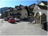 2
2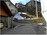 3
3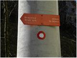 4
4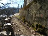 5
5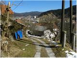 6
6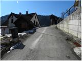 7
7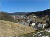 8
8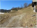 9
9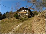 10
10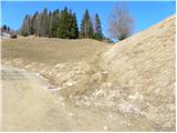 11
11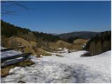 12
12 13
13 14
14 15
15 16
16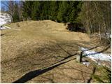 17
17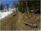 18
18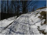 19
19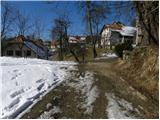 20
20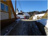 21
21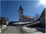 22
22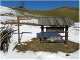 23
23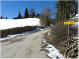 24
24 25
25 26
26 27
27 28
28 29
29 30
30 31
31 32
32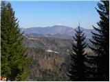 33
33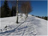 34
34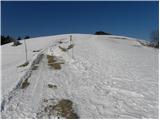 35
35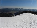 36
36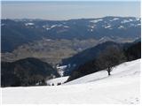 37
37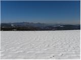 38
38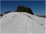 39
39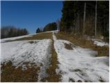 40
40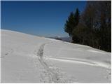 41
41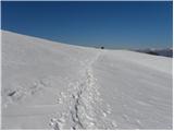 42
42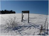 43
43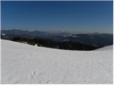 44
44 45
45 46
46 47
47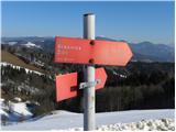 48
48 49
49 50
50 51
51 52
52 53
53 54
54 55
55 56
56 57
57 58
58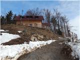 59
59 60
60
Discussion about the trail Žiri - Planinska koča Mrzl'k