Belopeška jezera - Capanna Ponza
Starting point: Belopeška jezera (929 m)
| Lat/Lon: | 46,4733°N 13,6713°E |
| |
Time of walking: 2 h
Difficulty: easy marked way
Altitude difference: 728 m
Altitude difference po putu: 728 m
Map: Julijske Alpe - zahodni del 1:50.000
Recommended equipment (summer):
Recommended equipment (winter): ice axe, crampons
Views: 18.949
 | 2 people like this post |
Access to the starting point:
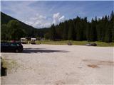
From Kranjska Gora, drive to Trbiž / Tarvisio via the Rateče border crossing. Shortly after the border crossing, the road to the left turns off in the direction of the Belopeški jezera / Laghi di Fusine, which is then followed in a moderate ascent to the large parking lot at the Upper Mangart (Belopeci) Lake.
Path description:
From the parking lot, continue along the left-hand side of the guest house towards the Zacchi hut. The path initially follows a forest road, which you leave after a few minutes, as the signs direct you to the left on a wide cart track. The cart track we are walking on turns into an ascending footpath a little higher up. The relatively wide and well-marked path then leads us on a moderate ascent through the forest to the Zacchi mountain hut (which can also be reached by forest road) within a good hour's walk from the starting point.
From the hut, continue along the left path, which goes into the forest after a few steps of ascent. The path continues, first in a gentle and then in a moderate ascent, crossing the slopes to the north, crossing a large number of ravines in the process. Some of the ravines are crossed by bridges, others by a well-maintained path. The forest trail leads us higher up to a viewpoint from which we can look out over the Belopeška Lakes and the surrounding hills. The path then goes into the forest again and after a few more minutes of easy walking leads us to a less well-marked crossroads where a short path to the shelter branches off to the right. Here you turn right and after a minute's climb you reach the shelter under Ponca.
Starting point - Zacchi hut 1:15, Zacchi hut - shelter under Ponco 45 minutes

Pictures:
 1
1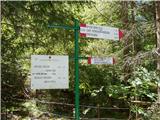 2
2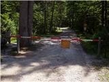 3
3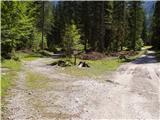 4
4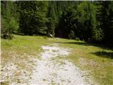 5
5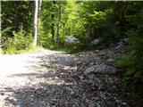 6
6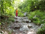 7
7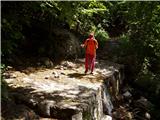 8
8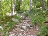 9
9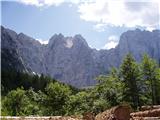 10
10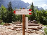 11
11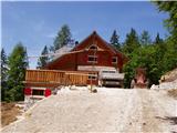 12
12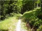 13
13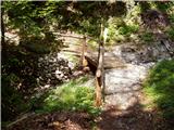 14
14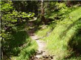 15
15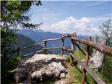 16
16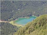 17
17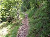 18
18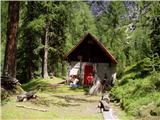 19
19
Discussion about the trail Belopeška jezera - Capanna Ponza
|
| slavko11. 07. 2012 |
Malo pred bivakom je razgledna točka. Sijajen razgled na Belopeško jezero in gore naokoli.
|
|
|
|
| panda12. 07. 2012 |
Predvidevam da zgornje jezero. 
|
|
|
|
| Jg11. 10. 2021 20:20:50 |
Včeraj sem šel mimo tega zavetišča. Začel sem direktno iz malega parkirišča pri spodnjem jezeru. Na kažipotu nekoliko zavajujoče piše "Rif. Zacchi". V bistvu se pa pot najprej povzpne gor do tega zavetišča, potem pa spusti k koči Zacchi in od tam na veliko parkirišče pri zgornjem jezeru (ta zadnji del je tudi napisan na hribi.net). Priporočam za ljubitelje razgledov in krožnih poti 
|
|
|