Podbrdo - Matajurski vrh (via Črna prst)
Starting point: Podbrdo (508 m)
| Lat/Lon: | 46,2132°N 13,9717°E |
| |
Name of path: via Črna prst
Time of walking: 4 h 55 min
Difficulty: partly demanding marked way, easy pathless terrain
Altitude difference: 1428 m
Altitude difference po putu: 1640 m
Map: Škofjeloško in Cerkljansko hribovje 1:50.000
Recommended equipment (summer):
Recommended equipment (winter): ice axe, crampons
Views: 1.210
 | 1 person likes this post |
Access to the starting point:
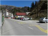
a) First drive to Škofja Loka, then continue to Železniki, Podbrdo and Tolmin. When you arrive in Podbrdo, park in a suitable place in the centre of the town.
b) From the road Idrija - Most na Soči, turn right at Bača pri Modreju, or left if you are coming from the route of Posočje, and continue to Podbrdo. When you arrive in Podbrdo, park in a suitable place in the centre of the town.
Path description:
From the Podbrdo centre, continue along the main road towards Tolmin. The road first leads under the railway, then leads to a crossroads where the road to the village Porezen branches off to the left, and the road to the right leads to Bača pri Podbrdu. From here, continue along the main road for only a few more 10 m, and then the signs for the villages Trtnik and Črna prst direct you to a narrower and ascending road. Follow the slightly narrower road ascending west of Podbrdo until you reach the village of Trtnik, which is reached after about 20 minutes' walk.
At Trtnik, the signs for Črna prst direct you straight up a marked footpath, which first leads you up the steps of a nearby dwelling house, then onto a grassy slope where it climbs steeply alongside an orchard. The path goes higher into the woods and gradually flattens out. The path continues through the forest and soon joins the partly stone cart track, which is followed to the right. The cart track continues ascending cross-country to the right, occasionally leading over steeper slopes. As the path is wide enough, the steepness of the slope does not cause us any major problems, but we have to be careful especially in one place where it is usually full of leaves and the path is consequently quite slippery. Higher up, we cross a slightly larger ravine, and then cart track leads us to a forest road, which we climb in a few minutes to the nearby Sedlo, where there is a marked crossroads.
From Sedlo, from where the path from the village of Kal and the path from Kocenpohar join, continue straight on the cart track, which is followed for only a short time, as the signs then direct us to the left onto a footpath which begins to climb steeply through the forest. Higher up, the path transitively lays down a little, and then leads to a lookout with a bench. A little beyond the bench, the path splits into two (the right-hand path is the more beaten track), and then after about 15 minutes they join again. Just above the merging of the two paths, you reach the next bench, which offers a beautiful view towards Kobla and the peaks above Soriška mountain pasture.
From the bench, continue through the forest for a short distance, and then the trail switches to the grassy slopes, which are becoming more and more scenic. Once out of the forest, the path slowly starts to turn slightly to the right, then turns left and climbs cross-country to the Čez Suho saddle, where it joins the path from the Bohinj side. Continue left here and, with views of Baška grapa, Bohinj and the highest peaks of Julian Alps, climb in a few minutes to the Doma na Črna prst, located just a few metres below the summit.
Go around the Zorko Jelinčič House on the left and climb the short steep slope to the summit in a few steps.
From Črna prst, continue west towards Rodica, which is about a three-hour walk. The way forward initially leads along a broad grassy ridge, which quickly narrows and the path begins to descend more steeply. After a few minutes of descent, the path from mountain pasture Osredki joins us from the right, and we continue along the left (coastal) side of the ridge in the direction of Vogel.
After the crossroads, the path becomes more difficult as it crosses quite steep grassy slopes with the help of steel cables, but mostly without them, which are dangerous to slip on, especially in wet conditions. The path then bends slightly and leads to the saddle of Vrata (1721 m). After this, the ridge retreats to the left again and climbs crosswise over the next steep slope. A commemorative plaque warns that the route is not entirely easy. The steepness of the slopes then gradually eases and the path again approaches the main ridge.
(Here you can climb to Četrt in 15 minutes - easy potholes).
Continue westwards along the scenic, mostly grassy ridge, which climbs gently towards Konjski vrh, which the trail passes on the left. After this, the path descends gently and leads to an inconspicuous saddle between Konjski and Poljane vrh. The latter, which again begins to climb gently, is also bypassed on the left and leads us to the foot of Matajurski vrh, which will be seen on the left. At the point where the path approaches Matajurski vrh, we will notice a less well-trodden path on the left, which climbs gently southwards at first. The path, which is getting worse, turns slightly to the right and after a short steep climb leads to a side ridge. Once on the ridge, continue slightly to the left along a faintly visible path, along which you can see some old faded markings. Follow this increasingly scenic "path" to the summit, which is reached after a further 10 steps. As most of the trail is on a ridge, you should only set off in good weather due to the possibility of lightning.
Podbrdo - Čez Suho 3:00, Čez Suho - Črna prst 15 minutes, Črna prst - Matajurski vrh 1:40.

Pictures:
 1
1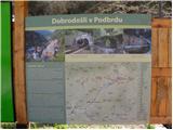 2
2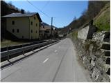 3
3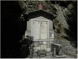 4
4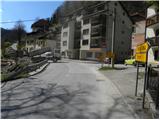 5
5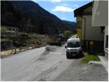 6
6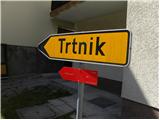 7
7 8
8 9
9 10
10 11
11 12
12 13
13 14
14 15
15 16
16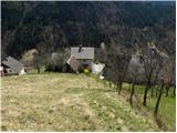 17
17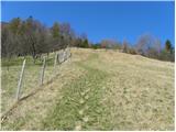 18
18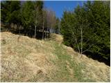 19
19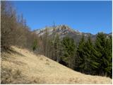 20
20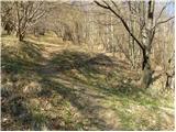 21
21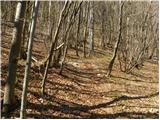 22
22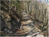 23
23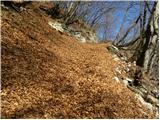 24
24 25
25 26
26 27
27 28
28 29
29 30
30 31
31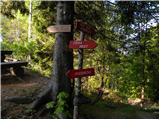 32
32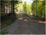 33
33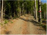 34
34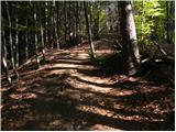 35
35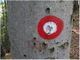 36
36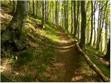 37
37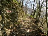 38
38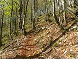 39
39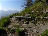 40
40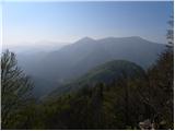 41
41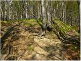 42
42 43
43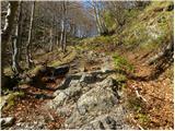 44
44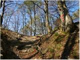 45
45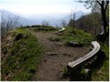 46
46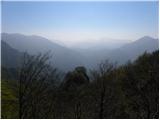 47
47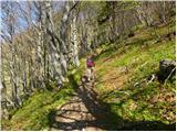 48
48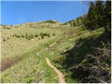 49
49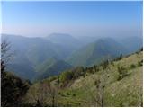 50
50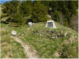 51
51 52
52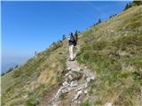 53
53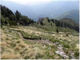 54
54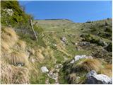 55
55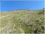 56
56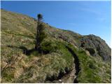 57
57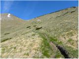 58
58 59
59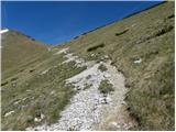 60
60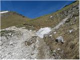 61
61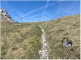 62
62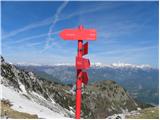 63
63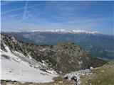 64
64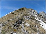 65
65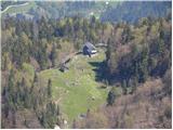 66
66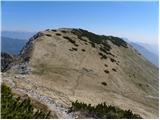 67
67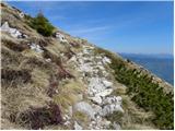 68
68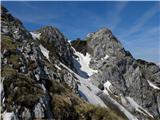 69
69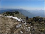 70
70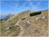 71
71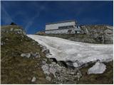 72
72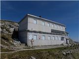 73
73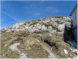 74
74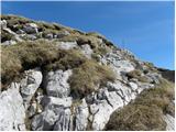 75
75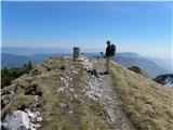 76
76 77
77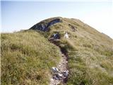 78
78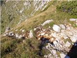 79
79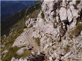 80
80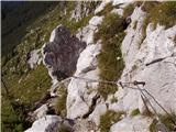 81
81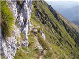 82
82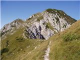 83
83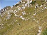 84
84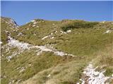 85
85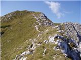 86
86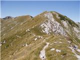 87
87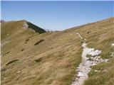 88
88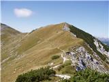 89
89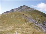 90
90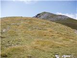 91
91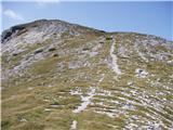 92
92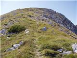 93
93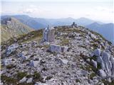 94
94
Discussion about the trail Podbrdo - Matajurski vrh (via Črna prst)
|
| ljubitelj gora28. 03. 2022 12:56:59 |
Včeraj 27.3.na Matajurski vrh iz smeri Stržišča. Pred vasjo sem zavil levo, na naslednjem odcepu naravnost (rahlo desno) in pri naslednjem se lahko parkira, kjer so tri stranske ceste. Naravnost gre zelo dolga cesta do mal pod lovsko kočo (priporočljivo gorsko kolo). Pod lovsko je kratek del lovske poti. Pri lovski desno čez manjši travnik in nato levo na nov kolovoz (desni gre proti Črni prsti), ki preide v lovsko pot. Lovski sledil do razcepa v desno, rušje posekano. Višje so nepreveč strme trave in brezpotni pristop do nezahtevnega grebena. Po označeni na Matajurski vrh. Še se kdaj vrnem saj mira je na pretek.
|
|
|