Rutarski gozd - Suha Rodica (Novi vrh)
Starting point: Rutarski gozd (1030 m)
| Lat/Lon: | 46,2156°N 13,8895°E |
| |
Time of walking: 3 h 15 min
Difficulty: easy pathless terrain
Altitude difference: 914 m
Altitude difference po putu: 955 m
Map: TNP 1:50.000
Recommended equipment (summer):
Recommended equipment (winter): ice axe, crampons
Views: 945
 | 1 person likes this post |
Access to the starting point:
From Podbrdo drive to Tolmin or vice versa, but only as far as the village of Koritnica. At Koritnica you will see a sign for the village Rut, which directs you to the right (from Tolmin take a sharp left). Follow the mostly ascending road to the above-mentioned village, where there is also a small crossroads. Continue straight ahead (Grunt village on the left) along the road, which soon loses its asphalt surface. The wide macadam road quickly climbs above the village and turns right. Three serpentines follow, at the third or second left we are joined on the right by the marked path from Stržišče, and from here on we become alert to possible parking on the roadside, as driving is prohibited from the next junction onwards.
Path description:
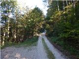
From the parking lot, continue along the dirt road, then quickly reach an unmarked junction, where you continue along the upper right-hand road, with a ramp and a road sign prohibiting further traffic.
After the ramp, the road climbs steeply, and then at the next junction, where a narrower road branches off to the right, continue straight ahead, walking along it to where the road narrows or splits into two cart track.
Continue along the wider cart track above, with signs for Rodica. Continue for some time cross-climbing on the lesser road or cart track, which leads us past a hunting observation post and occasional views of the mountains on the other side of the Baška Grape. Higher up, the marked path from the village of Grant joins us from the left, and a few 10 metres further on we continue right with cart track in the direction of Rodica (straight ahead Koča na planini Razor - the path over Hudo stopno).
After the crossroads called Mladinska koča, we start climbing up a well-preserved mulatier, which after a few minutes turns sharply to the left, and then climbs for some time crosswise to the left, first still through the forest, and then through dwarf pines. During the cross-climb, the path also leads over a few ravines, but the crossings are not difficult as the path is wide throughout. With beautiful views of the Idrija and Cerkljansko hills, we approach the Jehlc peak at the right-hand serpentine, which we can see in front of us the whole time we are crossing it. At this serpentine, the pathless approach to the summit continues straight ahead (the last part before the ridge is difficult), and we continue along the marked path, which continues on the mule track. Two serpentines higher, an easier approach to the above-mentioned summit branches off to the left, and we continue to climb through dwarf pines. A little higher we reach a ridge that stretches from Jehliec to the main ridge of the Lower Bohinj Mountains, but the path retreats several times, once to the left and again to the right. The higher dwarf pines are replaced by grass and stones, and with every step, the views get better. There are a few more serpentines, where we climb up a steeper slope, then the slope flattens out and the path leads us to a marked crossroads, where we join the path from the Bohinj side. Continue right here (Šija, Ski hotel Vogel and Ribčev Laz on the left) and climb the moderately steep ridge to the 1966-metre summit of Rodica in just over 10 minutes of further walking.
From the top of Rodica, continue along the ridge in the direction of Črna prsti. The trail first starts descending along the ridge and then moves to the southern slopes, where it crosses sometimes quite steep slopes just a few metres below the ridge. The very scenic path, at the foot of the Dry Rodica, passes onto the slopes of the summit, where it crosses the slopes of the aforementioned peak (snowfield, which is retained until the beginning of summer). In this part, where the path runs along the north side, you will notice some mountain signs on the rock (forward Črna prst, back Rodica). Just a few steps further from this sign, leave the marked path and turn right into the steep pathless world. After 10 minutes of steep climbing on rocky terrain, you reach the top of Suha Rodica.
Starting point - Rodica 2:30, Rodica - Novi vrh 45 minutes.

Pictures:
 1
1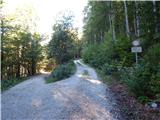 2
2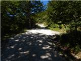 3
3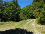 4
4 5
5 6
6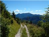 7
7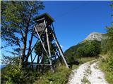 8
8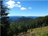 9
9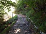 10
10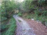 11
11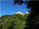 12
12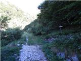 13
13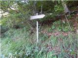 14
14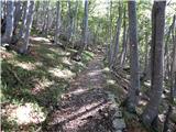 15
15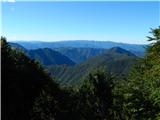 16
16 17
17 18
18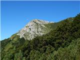 19
19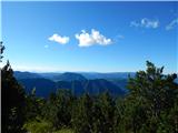 20
20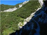 21
21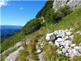 22
22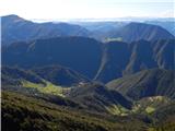 23
23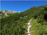 24
24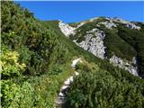 25
25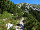 26
26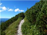 27
27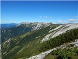 28
28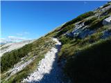 29
29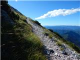 30
30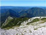 31
31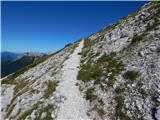 32
32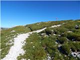 33
33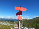 34
34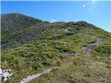 35
35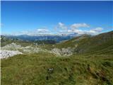 36
36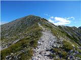 37
37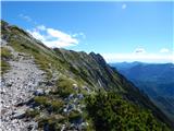 38
38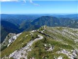 39
39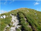 40
40 41
41 42
42 43
43 44
44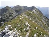 45
45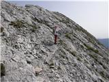 46
46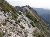 47
47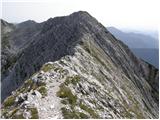 48
48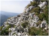 49
49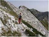 50
50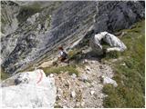 51
51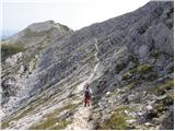 52
52 53
53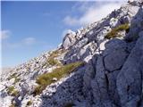 54
54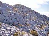 55
55 56
56
Discussion about the trail Rutarski gozd - Suha Rodica (Novi vrh)