Starting point: Rudno polje (1347 m)
| Lat/Lon: | 46,3458°N 13,9236°E |
| |
Time of walking: 2 h 55 min
Difficulty: easy marked way
Altitude difference: 618 m
Altitude difference po putu: 665 m
Map: TNP 1:50.000
Recommended equipment (summer):
Recommended equipment (winter): ice axe, crampons
Views: 4.620
 | 2 people like this post |
Access to the starting point:
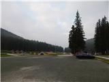
a) From Bled or Jesenice take the Zatrnik, then continue to Pokljuka. Once on Pokljuka, stick to the main road the whole way, and we will follow it to the large, well maintained parking lot at Rudne Polje.
b) From Železniki or Podbrdo, drive to Bohinjska Bistrica, then continue towards Bled. Shortly after the Petrol station, which is located just after Bohinjska Bistrica, turn left in the direction of Pokljuka and Jereka. The road climbs steeply at first, then gradually flattens out behind Koriti, leading to a junction by the bus station, where you continue right in the direction of Pokljuka, Koprivnik and Jereka (straight ahead Srednja vas). Just after the crossroads we arrive at Jereka, and from the crossroads in front of the church we continue straight towards Pokljuka (left Podjelje). After Jereka the road starts to climb steeply again, and higher up it levels off and continues along the Mrzle potok, where the road to Koprivnik v Bohinju branches off to the left, and we continue straight towards Pokljuka and Gorjuši. After Gorjuše the road turns into a forest and we follow it to a crossroads where we join the road from Bled. Turn left here, and then follow the main road to the large parking lot at Rudno Polje.
Path description:
From the parking lot, first cross the road carefully and then continue on the dirt road in the direction of Triglav, Viševnik and Blejska koča on Lipanca. Walk along the rather slippery road for about 10 minutes and then reach the ski slope Viševnik, where you leave the road and continue to the right in the direction of Viševnik and Srenjski preval (continue along the road Triglav, Vodnikov dom and Studor preval). The way forward leads to the left of the ski slope, along a track that runs through the edge of the forest. After a short climb, we return to the dirt road, only to reach a point where the marked trail to Viševnik continues straight up, and we follow the road to the right, crossing the ski slope. The road leads quickly into the forest and to a crossroads where we continue along the road on the bottom right, and at the next crossroads we turn right again, both times in the direction of Lipance. After the second crossroads we reach the Rudno polje sandpit, and just ahead, after a short descent, the signs for mountain pasture Lipanca and Blejska koča direct us left into the forest. Follow the markings through the forest at a couple of crossroads, then cross a dirt road a little higher up. After crossing the road, the path becomes a little steeper and climbs mainly across to the right. Higher up, the forest starts to thin out and we see an animal watering place on the left (often without water). From here it is a few minutes' climb before reaching a crossroads where we continue downhill to the right (Viševnik and Mrežce on the left) and within a minute or two of further walking we descend to Blejska koča on Lipanca.
From Blejska koča continue right, descend a few steps, then continue in the direction of Debela peč. There is a slight climb over the mountain pasture viewpoint of Lipanec, and then the path splits at the edge of the forest. Continue left along the marked path (hunting lodge on the right at mountain pasture Brda), which crosses the slopes to the left and then splits after a short climb.
Continue on the more prominent right-hand path (slightly left Lipanski vrh and Krma), which climbs gently for a few minutes, then turns right and climbs cross-country over a short steep section. When the path takes us above the steep part we are at the next crossroads, and this time we continue in the direction of Debela peč (left Brda and Krma). The way ahead climbs gently for a while and passes through a sparse, mostly larch forest. Higher up, there are fewer and fewer trees, and the path is again a little steeper, but when it lays down, it opens up to a beautiful view of the mountains on the other side of the Krma valley.
There is also a marked but slightly less visible crossroads, where you go right in the direction of Debela peč (on the left the eastern path to Brda).
A few 10 steps further on, leave the well-trodden path towards Debela peč and continue ascending right towards the summit of Okroglež. The ascent follows a less distinct path, which takes us through the lane of dwarf pines to the scenic summit of Okroglež, where there is a stamp on a metal pole, in less than 5 minutes of further walking.
Rudno polje - Blejska koča 1:45, Blejska koča - Okroglež 1:10.
Description and pictures refer to the situation in 2017 (June).

Pictures:
 1
1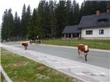 2
2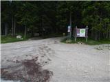 3
3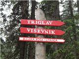 4
4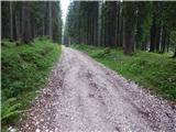 5
5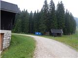 6
6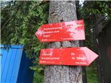 7
7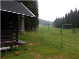 8
8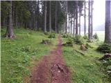 9
9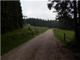 10
10 11
11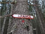 12
12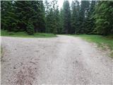 13
13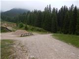 14
14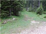 15
15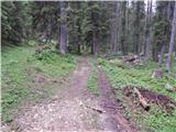 16
16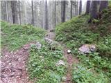 17
17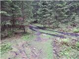 18
18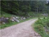 19
19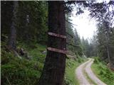 20
20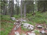 21
21 22
22 23
23 24
24 25
25 26
26 27
27 28
28 29
29 30
30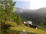 31
31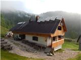 32
32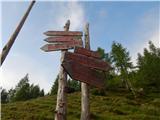 33
33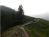 34
34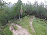 35
35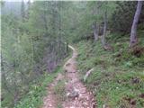 36
36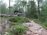 37
37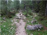 38
38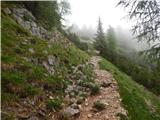 39
39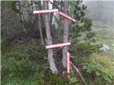 40
40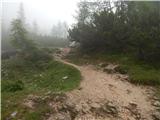 41
41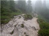 42
42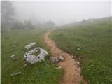 43
43 44
44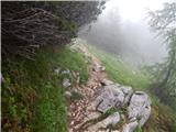 45
45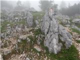 46
46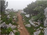 47
47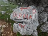 48
48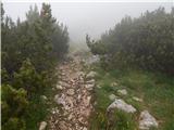 49
49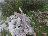 50
50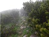 51
51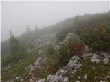 52
52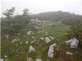 53
53 54
54
Discussion about the trail Rudno polje - Okroglež