Planina Polog - Planina Črča
Starting point: Planina Polog (457 m)
| Lat/Lon: | 46,2373°N 13,7223°E |
| |
Time of walking: 1 h
Difficulty: easy marked way
Altitude difference: 343 m
Altitude difference po putu: 343 m
Map: Julijske Alpe - zahodni del 1:50.000
Recommended equipment (summer):
Recommended equipment (winter):
Views: 4.407
 | 1 person likes this post |
Access to the starting point:
First, go to Tolmin, and from there follow the road in the direction of Zatolmin (leave the main road at the traffic lights). In Zatolmin, you will see the mountain signs for Javorca, which will direct you to the ascending road towards Javorca. After about 8 km of driving, the sometimes quite narrow and sometimes precipitous road leads us to a small crossroads where the road to Javorca branches off to the left upwards. Turn left here and follow the road for another 100 m to a marked parking area.
Path description:
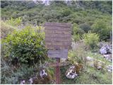
From the parking lot, continue along the paved road, which quickly enters the forest and starts to climb steeply. After about 15 minutes of walking, the forest thins out and the road turns sharp right. After a few minutes of walking along the edge of the pasture, the road leads to the Church of the Holy Spirit in Javorca.
Go around the church on the left and continue along the wide and at first winding cart track, which quickly turns into a forest. Here, the roar of the waterfall of the Peščak stream can be heard below us on the left, and we continue along the marked path (kolovoz), which crosses the aforementioned stream higher up via a bridge. We continue up a moderately steep track, which continues partly through the forest and partly through dense bushes and brambles. Higher up, we cross another of the numerous grazing fences and the path leads us to mountain pasture Črč, on which there are a few old huts.
Pictures:
 1
1 2
2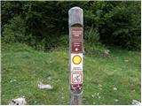 3
3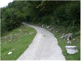 4
4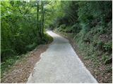 5
5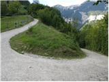 6
6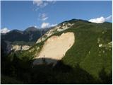 7
7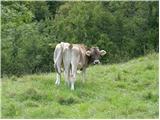 8
8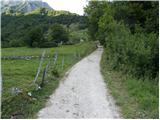 9
9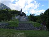 10
10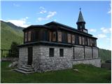 11
11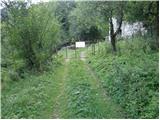 12
12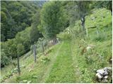 13
13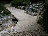 14
14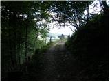 15
15 16
16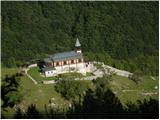 17
17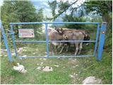 18
18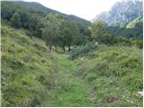 19
19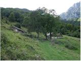 20
20
Discussion about the trail Planina Polog - Planina Črča
|
| vlastat18. 07. 2013 |
Zanimiv izlet! Opozorim le na malenkost povezano s poimenovanji lokacij. Domačini imenujejo planino Črče in ne Črča ter Mederje in ne Medrja. Obakrat končnici e in ne a. Zdi se mi prav, da bi v zapisih to upoštevali. 
|
|
|
|
| winni27. 06. 2020 |
Cesta Zatolmin -> Javorca je zaprta za ves promet.
|
|
|