Stara Fužina - Planina Spodnja Grintovica
Starting point: Stara Fužina (600 m)
| Lat/Lon: | 46,2903°N 13,8868°E |
| |
Time of walking: 2 h 45 min
Difficulty: easy marked way
Altitude difference: 575 m
Altitude difference po putu: 600 m
Map: Triglav 1:25.000
Recommended equipment (summer):
Recommended equipment (winter):
Views: 6.801
 | 3 people like this post |
Access to the starting point:
From the Ljubljana - Jesenice motorway, take the Lesce exit and follow the road towards Bled and on to Bohinjska Bistrica. Continue towards Bohinjsko jezero (Ribčev laz), at which you will come to a crossroads where you will turn right towards Stara Fužina. At Stara Fužina, at the crossroads by the chapel, turn sharp left onto the ascending road towards mountain pasture Blato, mountain pasture Vogar and the Voja valley. The road leads on to a place where tolls are collected, and we park here in a pay and display parking lot.
Path description:
From the parking lot, continue right towards the Mostnice riverbeds along a wide path, which will take you to the Devil's Bridge in a few minutes, from which you can get your first view of the riverbeds. At the bridge, turn left onto a minor road, which you follow for a short distance, as the signs for the troughs then direct you to the right onto a well-maintained tourist trail. The path ahead soon leads us to the central trough, along which we then climb steeply. During the ascent along the troughs, we come across the "Elephant" markers (a rock hollowed out by water in the shape of an elephant - worth a look). The way forward continues to climb for some time along Mostnica, then turns slightly to the left, where after a few minutes of further walking it leads us to a forest road leading towards the valley of the Voja valley. Follow the road to the right, and it will quickly lead us to the mountain hut at Voja (we can also get here by car, which shortens the journey by about 45 minutes).
From the hut, continue along the gently sloping macadam road, which leads us further along the edge of the vast pastures of the Voja valley. A little further on, the road splits into two parts, and we can continue either on the left (direction Velo polje) or on the right road, which is a few minutes longer and leads us to the Mostnice waterfall along the valley headland.
If you have seen the waterfall, go back a few metres, then cross the little bridge to join the slightly shorter "left" path. The path continues into the dense forest, where it first climbs above the waterfall, then gradually turns quite left, where it climbs up relatively steep slopes. After a climb of about one hour through the forest, the path turns right and then, after a few minutes of cross-climbing, leads us out of the forest to mountain pasture Spodnja Grintovica, where there is a trough of water (because of the possibility of frost, the tap can only be opened in the summer months).

Pictures:
 1
1 2
2 3
3 4
4 5
5 6
6 7
7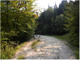 8
8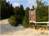 9
9 10
10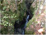 11
11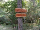 12
12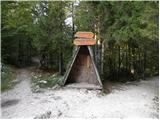 13
13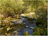 14
14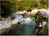 15
15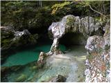 16
16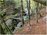 17
17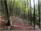 18
18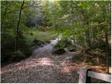 19
19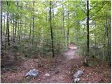 20
20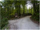 21
21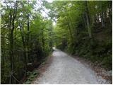 22
22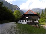 23
23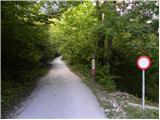 24
24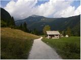 25
25 26
26 27
27 28
28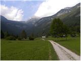 29
29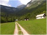 30
30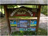 31
31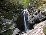 32
32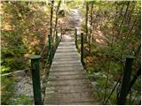 33
33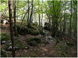 34
34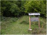 35
35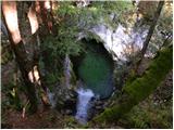 36
36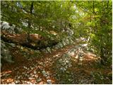 37
37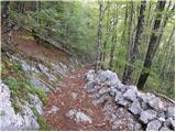 38
38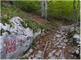 39
39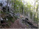 40
40 41
41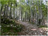 42
42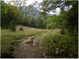 43
43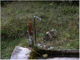 44
44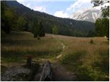 45
45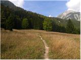 46
46
Discussion about the trail Stara Fužina - Planina Spodnja Grintovica
|
| darh22. 08. 2012 |
Po tu opisani poti smo se v petek vračali s planine Vrtača, na katero smo zašli nekoliko po naključju. Klanec takoj nad slapom je res strm, celo bolj od neoznačene poti, po kateri smo se vzpenjali. Slike in podrobnejši opis naše poti pa najdete tule.
|
|
|