Poljane (Spodnje Gorje) - Boršt (by road)
Starting point: Poljane (Spodnje Gorje) (620 m)
| Lat/Lon: | 46,3997°N 14,0735°E |
| |
Name of path: by road
Time of walking: 1 h
Difficulty: easy unmarked way
Altitude difference: 311 m
Altitude difference po putu: 311 m
Map: TNP 1:50.000
Recommended equipment (summer):
Recommended equipment (winter): ice axe, crampons
Views: 2.725
 | 4 people like this post |
Access to the starting point:
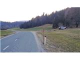
From the motorway Ljubljana - Jesenice take the exit Lipce (Jesenice East), where you turn left in the route "Blejska Dobrava and Spodnje Gorje". Soon after entering the railway underpass, we are at the next crossroads, where we turn right - Bled, Gorje. The road, serpentine at first, climbs straight westwards and soon reaches the summit or the settlement of Kočna in a left turn. After passing it, follow the road for another 2 km. A few 100 m before the next (still barely visible) settlement, which belongs to Spodnje Gorje, on a slight left turn, you will notice a space (a cart track) on the right side of the road where you can park. Alternatively, the space at the beginning of the above-mentioned settlement, on the left-hand side of the road, could also be a starting point.
Path description:
From the starting point, continue along the road to a small settlement with a restaurant on the left and an asphalted side road to follow. After a short walk, you will reach a crossroads: straight ahead, the forest road closure to Boršt, on the right a hamlet with a few buildings. Continue straight ahead, past the roadblock on the road uphill, which first turns left. Soon, when the road turns sharp right, it leads uphill to the east for some time. Here we gradually get some views towards the Bled corner, Lesce and Radovljica. After passing through a double bend, the road leads us uphill to the north. Then, when we see a larger clearing on the right, the forest road ends in an open area at the edge of the forest. Continue in the same direction cart track, which leads uphill through the forest. Soon after logging trail joins from the left, the path turns right. From here you can follow it all the way to the top of the hill, which is no longer far away, but you can choose to follow it a little differently for the sake of a better view. Leave the path at the right-hand bend and continue straight through the forest, following the saddle between Boršt and the small hill on the left, to the edge of the steep and rocky north-western slope of the hill. Here we come to a narrow pier (the continuation to the edge of the pier is not for the giddy!), with fine views on many sides, and a road winding deep below us. From here, we continue to the right towards the summit, following the edge of the rocky slope (the track on our right), where we climb up the roots towards the grass-covered part. (If we have noticed a track before this climb, which keeps slightly to the left on the steep slope, we will of course miss it). As we climb towards the summit, we now have a fine view of the village of Kočna, Jelenkamen and Kahlkogel, Javorniški rovt, and back towards the Julian Mountains and Mežakla with the mountain pasture part of Obranec. Continue along the edge of the slope on partly rocky terrain to the top of the hill, which is reached in a short time. On the eastern slope of Boršt, a few metres below the summit, you can enjoy a beautiful view stretching from Pustý rovt on the left, through Karawanks and part of the Kamnik Alps, and the vast Ljubljana basin, to the slope of Jelovice on the right.

Pictures:
 1
1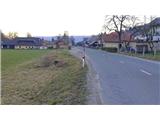 2
2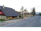 3
3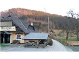 4
4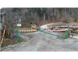 5
5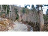 6
6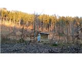 7
7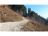 8
8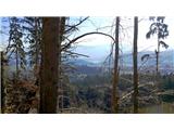 9
9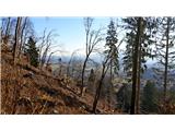 10
10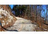 11
11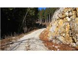 12
12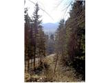 13
13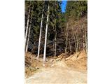 14
14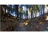 15
15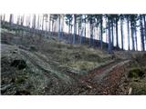 16
16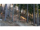 17
17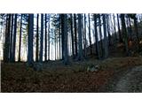 18
18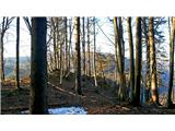 19
19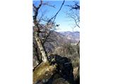 20
20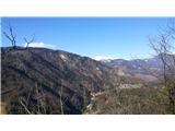 21
21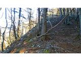 22
22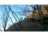 23
23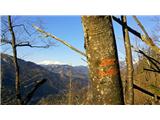 24
24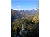 25
25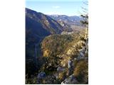 26
26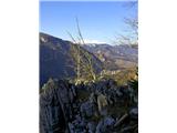 27
27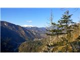 28
28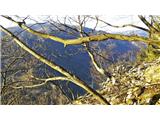 29
29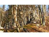 30
30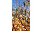 31
31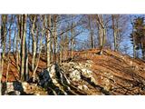 32
32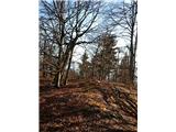 33
33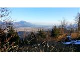 34
34 35
35
Discussion about the trail Poljane (Spodnje Gorje) - Boršt (by road)
|
| Jusk4. 01. 2020 |
Danes iz Blejske dobrave na Boršt,sestop pa po tej poti..med slikama 7 in 8 je odcep poti v levo,ki vodi proti gorjanski strani Vintgarja. Tako se da izlet podaljšat še na Hom,Sv.Katarino ali pa nazaj na Bl.dobravo
|
|
|