Starting point: Planina Blato (1147 m)
| Lat/Lon: | 46,3112°N 13,8501°E |
| |
Time of walking: 2 h 30 min
Difficulty: easy marked way
Altitude difference: 614 m
Altitude difference po putu: 614 m
Map: Triglav 1:25.000, PZS
Recommended equipment (summer):
Recommended equipment (winter): ice axe, crampons
Views: 13.882
 | 2 people like this post |
Access to the starting point:
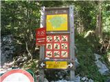
From the Ljubljana - Jesenice motorway, take the Lesce exit and follow the road towards Bled and on to Bohinjska Bistrica. Continue towards Bohinjsko jezero (Ribčev laz), at which you will come to a crossroads, where you turn right over a bridge towards Stara Fužina. At Stara Fužina, at the crossroads near the chapel, turn sharp left onto the ascending road towards mountain pasture Blato, mountain pasture Vogar and the Voja valley (marked with signs). The road leads to a parking area where tolls or parking fees are collected (depending on whether you drive on or park). The toll in 2009 is € 10. We drive along a narrow, winding, partly asphalted, partly dirt road, which climbs moderately, past the turn-off for Voje and then for quite some time along a mainly asphalted road to the next junction, where you turn sharp right off the asphalt onto a dirt road in the direction of mountain pasture Blato (the asphalted part of the road leads straight on to mountain pasture Vogar). Follow the dirt road for a short distance to the parking lot above mountain pasture Blato, which is at the end of the road, some 10 m after the information board and signs for mountain pasture by the lake and Laz, which can be seen as you drive along on your left hand side.
Path description:
From the parking lot at mountain pasture Blato, follow the road a little way back to the signs at the steep, wide cart track, which is closed to traffic by a metal gate. Cart track, which climbs steeply at first and then moderately, leads after a ten-minute walk to a crossroads, where you turn left (straight mountain pasture in Laz). Cart track is then followed through the forest to the hut at mountain pasture at Jezero. Here you will have a view of the surrounding hills.
At the hut, turn left slightly downhill to the signposts, where they direct you left, steeply up the grassy slope past some tents (direction mountain pasture Viševnik and Pršivec). The trail is barely visible at the beginning, but only a little higher above the tents it becomes more traceable, and then it is clearly visible and well marked all the time. The trail then goes into the forest and the steepness soon eases. Then you walk along a mostly rocky path, which climbs a little steeper in places, but the steepness is moderate in the main. After about 40 minutes of walking from Mountain pasture by the lake, you come out of the forest again. Here we can see mountain pasture Viševnik in front of us, on which stands Bregar's shelter, which is open during the summer season. Here you can refresh yourself with a variety of drinks, and you can also stay overnight.
From mountain pasture, continue left towards Pršivec along the path which ascends crosswise towards the western part of mountain pasture. The path then turns slightly more to the left and starts to climb steeply, again on a mainly rocky track, past some small potholes. The path then descends slightly and before it starts climbing steeply again towards the top of Pršivec we reach the May Cave (a chasm explored to a depth of 592m), the entrance to which is visible on our right under blackened rocks. After a steep ascent, we reach the top after about 20 minutes of further walking on an increasingly scenic slope. The view from the top is beautiful on all sides, with Lake Bohinj visible below us.

Pictures:
 1
1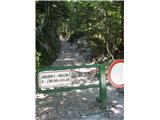 2
2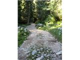 3
3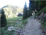 4
4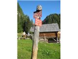 5
5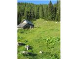 6
6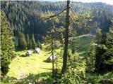 7
7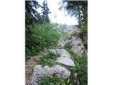 8
8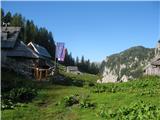 9
9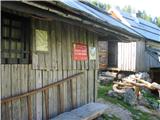 10
10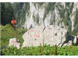 11
11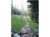 12
12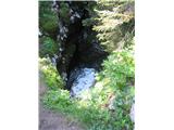 13
13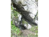 14
14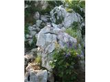 15
15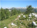 16
16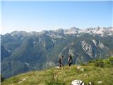 17
17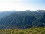 18
18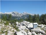 19
19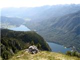 20
20 21
21
Discussion about the trail Planina Blato - Pršivec