Starting point: Grant (725 m)
| Lat/Lon: | 46,2073°N 13,879°E |
| |
Time of walking: 3 h 30 min
Difficulty: easy marked way
Altitude difference: 1241 m
Altitude difference po putu: 1241 m
Map: TNP 1:50.000
Recommended equipment (summer):
Recommended equipment (winter): ice axe, crampons
Views: 9.930
 | 1 person likes this post |
Access to the starting point:
From Podbrdo drive to Tolmin or vice versa, but only as far as the village of Koritnica. At Koritnica you will see a sign for the village Rut, which points to the right (from Tolmin, take a sharp left). Follow the mostly ascending road to the village, where there is also a small crossroads. Continue left towards the village Grant, which is reached after about 1 km of further driving. There are no parking spaces in the village, so park in a suitable place nearby.
Path description:
At the end of the village Grant find the continuation of the marked path, which continues along a worse road or cart track. There are a few forks, where we follow the few signposts, and we quickly climb above the village. Higher up, we leave the nearby pasture and then climb to a wider macadam road, which we cross and continue our ascent through the forest. A fairly steep path, with more frequent signposting later on, crosses another forest road higher up. Above the road, the path turns slightly to the left and then starts to climb quite steeply. The steepness eases a little higher up, and then you join a wider dirt track, which you follow to the left, quickly reaching a marked crossroads, where you continue right in the direction of Rodica (straight ahead Koča na planini Razor and the Geological Trail).
After the crossroads marked Mladinska koča, you start climbing up a well-preserved dirt track, which after a few minutes turns sharp left, then climbs for some time cross-country to the left, first through the forest, then through dwarf pines. During the cross-climb, the path also leads over a few ravines, but the crossings are not difficult as the path is wide throughout. With beautiful views of the Idrija and Cerkljansko hills, we approach the Jehlc peak at the right-hand serpentine, which we can see in front of us the whole time we are crossing it. At this serpentine, the pathless approach to the summit continues straight ahead (the last part before the ridge is difficult), and we continue along the marked path, which continues on the mule track. Two serpentines higher, an easier approach to the above-mentioned summit branches off to the left, and we continue to climb through dwarf pines. A little higher we reach a ridge that stretches from Jehliec to the main ridge of the Lower Bohinj Mountains, but the path retreats several times, once to the left and again to the right. The higher dwarf pines are replaced by grass and stones, and with every step, the views get better. There are a few more serpentines, where we climb up a steeper slope, then the slope flattens out and the path leads us to a marked crossroads, where we join the path from the Bohinj side. Continue to the right (left Šija, Ski hotel Vogel and Ribčev Laz) and climb the moderately steep ridge to the 1966 metre high summit of Rodice in just over 10 minutes of further walking.

Pictures:
 1
1 2
2 3
3 4
4 5
5 6
6 7
7 8
8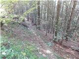 9
9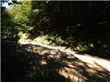 10
10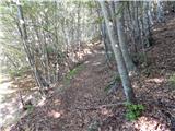 11
11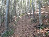 12
12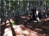 13
13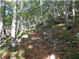 14
14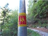 15
15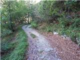 16
16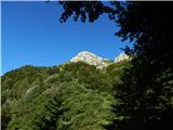 17
17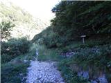 18
18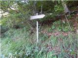 19
19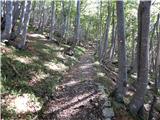 20
20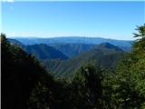 21
21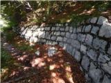 22
22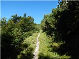 23
23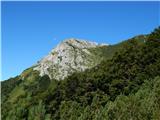 24
24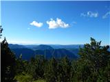 25
25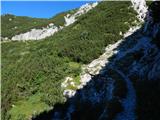 26
26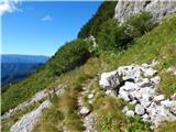 27
27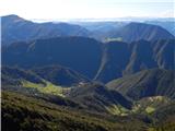 28
28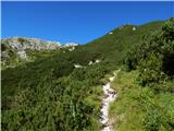 29
29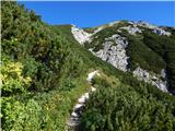 30
30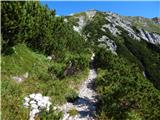 31
31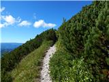 32
32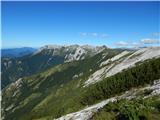 33
33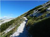 34
34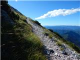 35
35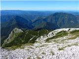 36
36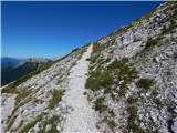 37
37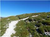 38
38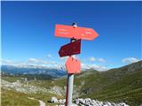 39
39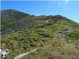 40
40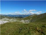 41
41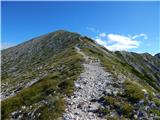 42
42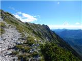 43
43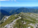 44
44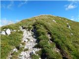 45
45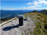 46
46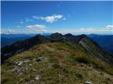 47
47 48
48
Discussion about the trail Grant - Rodica
|
| PUHIPUHI20. 07. 2019 |
Danes sva prehodila to pot. Menim, da je oznaka OZNAČENA pot neprimerna. Iz vasi v smeri Rodice ni nobenih markacij; povsem nemogoče je vedeti katera pot je prava. Na opisano pot sva po veliko napačnih poskusih prišla pri sliki 15. Nazaj grede sva tukaj zavila na pravo pot. Markacije na tem delu so zelo redke in res zelo zbledele; skoraj nevidne. Cesto se prečka cca 6x. Na eni točki pa je pot naprej znova nemogoče najti. Del poti med slikama 7 in 10 nama še vedno ostaja neznanka.
|
|
|
|
| gasperv15. 08. 2022 10:31:35 |
V teh dneh smo prehodili to pot in moj komentar bi bil podoben prejšnjemu. V sami vasi je težko najti primerno izhodišče.
Na markacije smo naleteli precej visoko - na razpotju Tregile kjer se pridruži pot iz vasi Rut.
Imam precej star zemljevid - 2006 in na njem je pot iz vasi Grant vrisana. Na aplikaciji maPZS pa je vrisana pot iz vasi Rut.
|
|
|
|
| darinka429. 12. 2023 11:04:21 |
Se kr strinjam s predhodnikoma. Midva sva vozilo pustila na koncu vasi. Pri spomeniku padlim. Ker sva šla od tu prvič nama je zelo prišla prav GPS sled od Jerneja , ki je od tu šel nekaj časa nazaj. Nekajkrat sva prečkala cesto. Le na enem drevesu je pisalo z rdečimi črkami Rodica. Drugače poti so še vidne. A v slabem stanju. Naprej ko se pot priključi tisti z Rutarskega gozda pa vse poznano.
|
|
|