Ahlete / Aclete - The lake Zgornje Mangartsko jezero
Starting point: Ahlete / Aclete (850 m)
| Lat/Lon: | 46,4908°N 13,6419°E |
| |
Time of walking: 1 h 5 min
Difficulty: easy marked way
Altitude difference: 79 m
Altitude difference po putu: 130 m
Map: Julijske Alpe - zahodni del 1:50.000
Recommended equipment (summer):
Recommended equipment (winter):
Views: 731
 | 1 person likes this post |
Access to the starting point:
a) First drive to Kranjska Gora, then continue to Rateče and on to Itali. Continue towards Trbiž / Tarvisio, and a little after the road to Lake Belopezi / Lago di Fusine, the road to the village of Ahlete / Aclete turns off to the left. Continue on the above-mentioned road, which leads past a few more houses and then climbs up to the village of Ahlete, where the above-mentioned route begins. There are no parking spaces in the village.
b) Via Border crossing Predel, drive into Itali, then continue to Trbiž / Tarvisio and on to Rateci. At Bela Ofen / Villa Bassa, the road turns off to the right towards Ahlete / Aclete. Continue on the above-mentioned road, which leads past a few more houses and then climbs up to the village of Ahlete, where the route described above begins. There are no parking spaces in the village.
Path description:
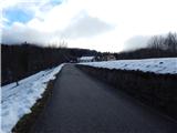
Continue through the village, then follow the signs for the lake at the crossroads. The road becomes gravel higher up and turns into a forest, where it becomes a lay-by. There are a few more crossroads, and we are still following the signs for the lake, but the signs are mostly in three languages, Italian, German and Slovenian, with only a few in Italian here and there. The road we are on generally heads east, but as it turns more to the north, it also starts to visibly descend. A little further on, leave the road and continue left in the route Spodnje Mangartsko jezero (this sign has English instead of Slovenian). There is a short descent, and then the forest path continues without any major changes in elevation. Continue past Malo jezero / Lago Piccolo and Majceno jezero / Lago Piccolissimo, then descend to Lower Mangart Lake.
When you reach the shore of the lake, it is better to continue to the left for a better view of the surrounding mountains, although the right path is slightly shorter. Walk along the lake shore for a few minutes and then cross the Jezerski potok (Jezerski brook) over a bridge, just below the dam. When you get on the road, go right, then after a few steps off the road, slightly further right, onto the footpath that leads around the lake. The path continues past the Edelweiss restaurant, and then you reach the south side of the lake, where there is a crossroads of several paths.
Continue in the route Zgornje Mangartsko jezero, first climbing up to the right, then the path flattens out and turns slightly to the left at the climbing area. After a short flat section, there is some more downhill to reach Zgornje Mangartsko jezero, which offers a fine view of the mountains rising steeply above the Mangart valley.
Ahlete - Lower Mangart Lake 0:50, Lower Mangart Lake - Upper Mangart Lake 0:15.
Description and images refer to the situation in 2018 (November).

Pictures:
 1
1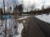 2
2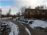 3
3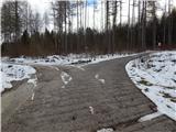 4
4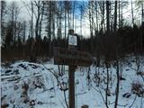 5
5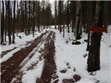 6
6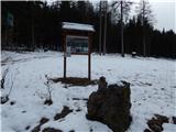 7
7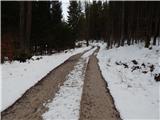 8
8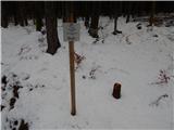 9
9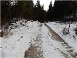 10
10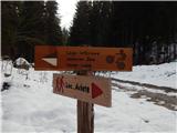 11
11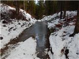 12
12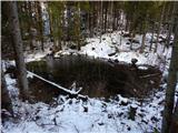 13
13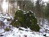 14
14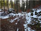 15
15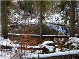 16
16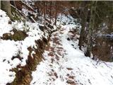 17
17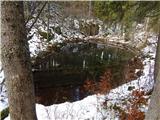 18
18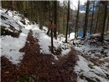 19
19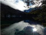 20
20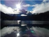 21
21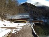 22
22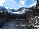 23
23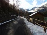 24
24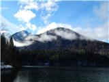 25
25 26
26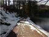 27
27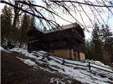 28
28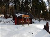 29
29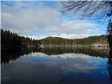 30
30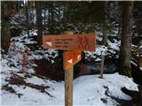 31
31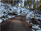 32
32 33
33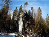 34
34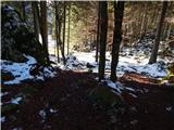 35
35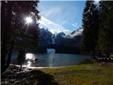 36
36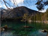 37
37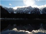 38
38
Discussion about the trail Ahlete / Aclete - The lake Zgornje Mangartsko jezero