Ukanc - Vogel (via Globoko)
Starting point: Ukanc (570 m)
| Lat/Lon: | 46,2758°N 13,8358°E |
| |
Name of path: via Globoko
Time of walking: 4 h 15 min
Difficulty: easy marked way
Altitude difference: 1352 m
Altitude difference po putu: 1375 m
Map: TNP 1:50.000
Recommended equipment (summer): helmet
Recommended equipment (winter): helmet, ice axe, crampons
Views: 4.769
 | 2 people like this post |
Access to the starting point:
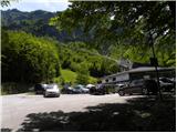
a) From the motorway Ljubljana - Jesenica take the exit Lesce and follow the road towards Bled, Bohinjska Bistrica, Ribčev Laz and the Vogel ski resort. The route starts at the large parking lot at the bottom station of the lift to Vogel.
b) From Primorska, first drive to Bohinjska Bistrica, then follow the signs for Bohinjsko jezero and Vogel. The route starts at the parking lot at the bottom station of the funicular to Vogel.
Path description:
Below the lower cable car station at Vogel, a forest road (ski slope in winter) is seen, which starts to climb moderately westwards. The path continues for some time climbing gently to moderately, then leads us out of the forest to a scenic slope from where we have a beautiful view of Komarčo, Pršivec and Lake Bohinj.
After this, the road starts to turn more and more to the left and becomes steeper and steeper. Higher up, we continue along a relatively steep ski slope, which is constantly being guided by a poorer and rough transport and rescue road. After a while, the road or ski slope is laid, then turns right and continues along the lower part of the Žagarjev graben valley. At the part where the road or ski slope descends slightly and leads us into the valley, we leave it and a few steps to the right in the forest we see an old mulatier along which we continue parallel to the ski slope.
The way forward leads us along the mule track, along which we notice quite frequent older markings, at a small crossroads we go right in the direction of Globoke. The path soon turns back to the left and we gradually start to climb steeply across the steep slopes, where the mulatier is damaged in several places, but there are no difficult places. When the slope flattens out a bit, the markers for Globoko and Vogel from the mulatier direct us to the left, where we quickly arrive in a valley where the track begins to disappear amongst the lush vegetation. Here it is at first a little more difficult to follow the old markings and the track, which can be seen under the overgrowth. The route of the further ascent is quite similar and is mainly along or slightly to the left of the valley of Žagar's graben. Higher up, the terrain becomes slightly less overgrown and the markings and track are easier to follow. After the little man on the rock, join the well-maintained and better-trodden path leading from the Ski Hotel on the Vogel to the Dom na Komni.
Follow the trail to the right, and in the direction of Komna, walk only as far as the nearby marked crossroads, from which turn left onto the less well-trodden but well-marked trail in the direction of the Globoko and Koča na planini Razor passes (straight ahead to Konjsko sedlo and Komna).
The way forward continues along the grass-covered mule track, which the marked path also crosses a few times. Higher up we climb with increasingly beautiful views, and we follow the mule track, which makes a few longer turns, to a crossroads where we join the other trail leading from the Vogel ski resort towards Komna. Continue right towards the Globoko pass and in a few minutes, past the ruins, climb to the crossroads below the Globoko pass.
Bear left towards Vogel and Črna prst (right up the Globoko pass and the Hut at mountain pasture Razor, right Konjsko sedlo and Komna), where you first descend crosswise and then, with fine views, begin to climb crosswise, quickly reaching a crossroads on the slopes of Vrch Krnic.
Continue right towards Vogel, and at the next crossroads turn right again towards Vogel, and we quickly climb to the ridge of the Bohinj-Tolmin mountains, which we reach at a saddle between Vogel on the left and Vrh Krnic on the right.
Continue towards Vogel, the summit of which is reached in a few minutes' walk along a scenic ridge.
The description refers to the situation in July 2020 and the pictures are from different periods.

Pictures:
 1
1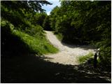 2
2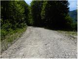 3
3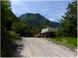 4
4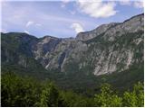 5
5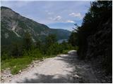 6
6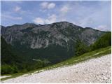 7
7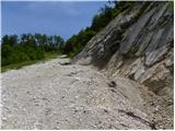 8
8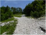 9
9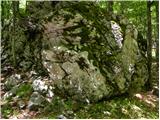 10
10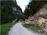 11
11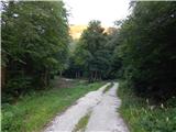 12
12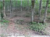 13
13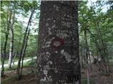 14
14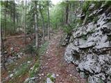 15
15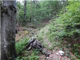 16
16 17
17 18
18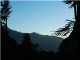 19
19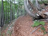 20
20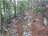 21
21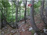 22
22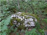 23
23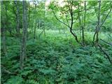 24
24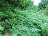 25
25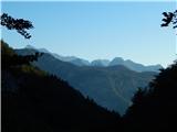 26
26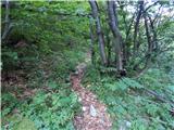 27
27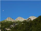 28
28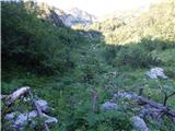 29
29 30
30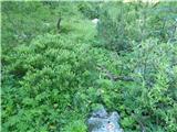 31
31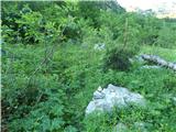 32
32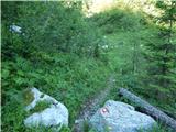 33
33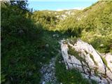 34
34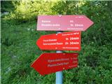 35
35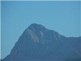 36
36 37
37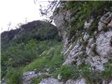 38
38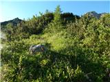 39
39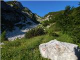 40
40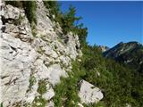 41
41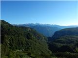 42
42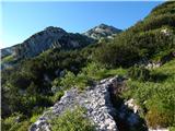 43
43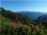 44
44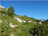 45
45 46
46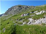 47
47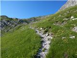 48
48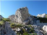 49
49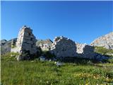 50
50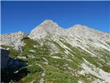 51
51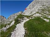 52
52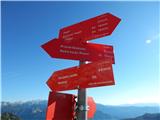 53
53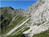 54
54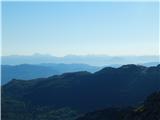 55
55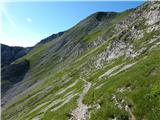 56
56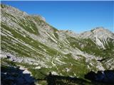 57
57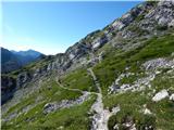 58
58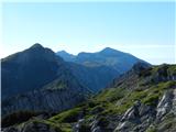 59
59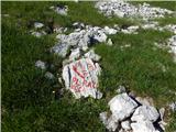 60
60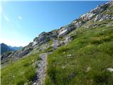 61
61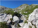 62
62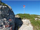 63
63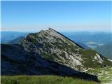 64
64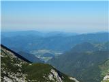 65
65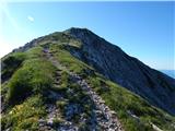 66
66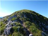 67
67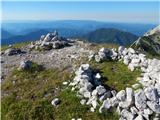 68
68 69
69
Discussion about the trail Ukanc - Vogel (via Globoko)
|
| cjendaw22. 08. 2020 |
Hja, če na križišču s slike 21 ne zaviješ levo, uletiš v skoraj neprehodne odseke poti. Ni table za smer levo. Sledi zaraščena pot, podrto drevje, zasuta pot, in to kakšno uro. Z vztrajanjem sicer prideš na isto markirano pot, kot v opisu, sem pa razmišljal tudi o povratku. Je škoda teh poti, ki bodo izginile v zgodovino.
|
|
|
|
| cjendaw22. 08. 2020 |
Oz. sem morda spregledal tablo, ki je na sliki 21 malce s poti.
|
|
|
|
| IgorV13. 08. 2021 16:42:37 |
V tem tednu sem probal osvojiti vrh Vogla po tej poti, pa to žal ni bilo možno. Po nekaj 100 metrih hoje po mulatjeri le-ta postane tako zaraščena, da nadaljevanje poti ni več možno. Mogoče bi se dalo, vsekekor pa to nebi bil užitek. Mislim da bi bilo lažje nadaljevati gor po smučišcu in se potem višje gor držati desne in se priključiti nadaljevanju te poti.
Lp
|
|
|