Rifugio Pelizzo - Monte Mataiur/Matajur (via Ledina)
Starting point: Rifugio Pelizzo (1300 m)
| Lat/Lon: | 46,203°N 13,5391°E |
| |
Name of path: via Ledina
Time of walking: 2 h
Difficulty: easy marked way
Altitude difference: 342 m
Altitude difference po putu: 550 m
Map: Julijske Alpe - zahodni del 1:50.000
Recommended equipment (summer):
Recommended equipment (winter): ice axe, crampons
Views: 5.590
 | 4 people like this post |
Access to the starting point:
a) On the Slovenian side:
From the Tolmin - Kobarid road, a steep dual carriageway turns left at Idrsko (right from Kobarid) towards the village of Livek (approx. 5 km). From here, continue along the narrower and narrower road into Itali. On the other side of the border, the road starts to descend slightly, and at the village of Polava it widens again, and climbs slightly towards the village of Cepletischis. From here it descends towards a crossroads (0. 5 km), where it continues to the right, towards the villages of Monte Mataiur / Montemaggiore and Rifugio Pelizzo. Straight on to Sauodnia / Savogna. From Liveco to Monte Mataiur is about 10 km and to Rifugio Pelizzo 13 km.
b) On the Italian side:
From Goriško direction take the regional road towards Udine, to the turn-off for Krmin / Cormons. At the roundabout before Cormons turn right towards Cormons and Cividale. Go under the underpass and then immediately turn left. At the large and awkward junction in Cormnos, turn towards Chedad / Cividale del Friuli. We continue driving through several towns on the carefully cultivated Friulian plain. In good visibility we will see our destination Monte Mataiur in the company of Krno, first on our right, and from Chedad straight ahead. In Chedad we arrive at a semaphorised junction next to a building which houses first a pharmacy (farmacia) and then a bank. Take a sharp right at the junction (straight ahead is the entrance to the old part of the town and a large free parking lot). The famous Devil's Bridge (in Friulian: Puint dal diaul) is just a few minutes' walk away.
Continue to a small roundabout, in front of which there are several direction signs, including a brown sign for Kolovrat. From here, follow the signs for Kolovrat. Follow the river Nadija towards Speter Slovenov / San Pietro al Natisone. Approximately 1 km before Speter, you reach the crossroads at Muost/Puint/Ponte San Quirino. Turn right here (straight Speter), and left over the bridge to take the road from Chedad on the other bank of the river Nadija, which leads to the route you can find on Google Maps. Continue following the signs for Kolovrat, but only for about 1. 5 km, where the road for Kolovrat and the former border crossing and the Solarji / Solarie saddle fork off to the right. We continue straight on to the larger town of Sauodnja / Savogna, also the centre of the municipality of the same name. Here we turn right over a bridge and continue along the main road. You could also go left up after the bridge, but the road is very steep and narrow. On the bridge you can also see the red signs for Rifugio Pelizzo. The path soon starts to climb serpentinely (approx. 3 km and 6 sharp bends). At the top, you reach the next turn-off where you turn left towards the village Monte Mataiur/Montemaggiore and Rifugio Pelizzo. Straight ahead is the village of Cepletischis and about 6 km more to Livko. From the crossroads, the village of Monte Mataiur is about 5. 5 km away on a moderately ascending dual carriageway. Above the village Monte Mataiur the road narrows slightly and after 3,5 km, a gentle climb leads to Rufugio Pelizzo.
Path description:
The trail is very suitable for all hikers who are not fans of steep climbs and like to walk on (in terrestrial conditions) easy trails. The trailhead is not marked, but orientation is easy. After 20-30 minutes, as we keep moving away from our destination and starting point, we join the trail leading from the village of Mašera/Masseris. The route from the village of Mašera is comparable in altitude and length to the one from Avsa. For those who find the above two routes too demanding, this is a good shortcut, cutting about 1 hour off the steepest climb, and enjoying only the most beautiful part of the route to Monte Mataiur.
In winter, the path is usually unpaved, so snowshoes are almost compulsory, or if it is icy, crampons.
We park in the larger parking lot to our left, just below Rifugio Pelizzo. The word rifugio literally means shelter, but in Italian it also means mountain hut or home. Pelizzo is more of the latter in terms of size. From the parking lot, follow the road down towards the arrival to a large bend (about 300 m).
In snow conditions there is a roadblock above the village Monte Mataiur. The shortest way to the bend below Rifugio Pelizzo, where our route starts, is along a gently ascending road (about 40 minutes' walk), which can be shortened a few times by taking steep shortcuts.
At the bend, through a gap in the guard rail, descend the embankment below the road and follow the path to the nearby grove. Shortly after entering the forest, you will see the first markings. The trail continues descending towards the bed of the Skrila torrent. If there is a lot of snow, this part of the trail can be quite challenging, as the steepness increases and the snow likes to freeze here.
After crossing the torrent bed, the path begins to climb moderately to the left on the slopes below Ledina. After a short climb, the path almost lays down and crosses steep grassy slopes. In snowy conditions, this short section of the trail can be dangerous to cross. On the southern grassy slopes below Ledina, the snow softens quickly and can slip. If there is more than 0. 5 m of snow, especially a few days after a snowfall, we prefer to choose another route.
After a short crossing of the grassy slopes below Ledina, the path starts to climb again towards the forest. We keep moving away from the starting point and our destination. In the forest, the trail starts to climb steeply. After a short climb, we come out of the forest and join the path leading from the village of Mašera/Masseris. At this point we are the furthest away from our destination (about 30 minutes from the starting point). From here on, our route will again head towards the Monte Mataiur summit. We continue ascending to the left, down to the right to the village of Mašera.
After a short climb on grassy terrain, we re-enter the forest, where the trail winds along a corridor between the rocks. You need to be particularly careful on this part of the trail, as leaves can obliterate the path. At the end of the corridor, turn right (if you are not careful and go straight ahead, you are not going right).
The path turns out of the forest and then crosses sparsely vegetated slopes. From here, you can look out towards Mrzli vrh above Idrska planina and Krn. A gentle to moderate ascent leads to cart track - the Old Livko Trail.
Continue walking along cart track to the left, Avsa and Livek to the right. In a barely perceptible ascent we cross the slopes of Ledina, from where we can see our goal Monte Mataiur and the path ahead, as well as the path we have walked from the starting point below Rif. Pelizzo. In snowy conditions, there can be a lot of snow on this part of the trail, which can be very penetrating. Snowshoes come in handy here, too, although skiers have made a ski before. Also, if on the southern slopes below the Rif. Pelizzo is gone, snow can remain for a long time on this part of the trail. If it is icy, at least a pair of small ice skates will come in handy.
After about 15 minutes of relaxing walking, Cart track leads to a clearing where a stone house stands. It is about 1 hour's walk from the starting point. Continue for a few minutes on the cart track, then a path branches off to the right, which only shortens the detour and leads us in a few steps to a saddle. Here the path from the Rif joins. Pelizzo past the source of Skril. Ahead of us we can clearly see our goal, the Monte Mataiur peak, and behind us rises the mighty Krn with its neighbours. The route sign says it is 20 minutes to the summit, but feel free to add another 10 minutes and enjoy the ever more beautiful views. The path continues for a few steps along cart track to a bend where signs direct you to a path leading straight uphill. Cart track crosses the south-eastern slopes of Monte Mataiur in a gentle ascent towards the Lodge on Monte Mataiure. If the snow is close to 1m, you will not see cart track. If the snow is not transformed or if it is very southerly, crossing the slopes towards Dom na Matajure is not recommended. Instead of a wide cart track, only steeply descending slopes where an avalanche can be triggered, or triggered from the slopes above.
From the bend, our route continues along a path that climbs quite steeply to a small saddle where the path from Avsa joins from the right. From here, the views ahead of us widen to the Kanin Mountains and Rombon, Mangart, Jalovec, and Razor. There is a short climb to the eastern ridge, from which the view extends from Dolomites to the Lower Bohinj Mountains. After crossing the ridge, the path climbs moderately for a few more minutes towards the summit, which can be seen in front of you all the time.
From the top of Monte Mataiur we can go to Rifugio Pelizzo and the starting point:
- straight down the former ski slope (where the trail from the Dom to Monte Mataiur joins, the trail can be extended in the direction of Livka and on past the source of Skrilla)
- along the western ridge to Dom na Monte Mataiur and from there to Rif. Pelizzo straight ahead or extend past the Skril spring
- along the northern ridge to the small lake at Marsinska mountain pasture (descent along the ridge is not recommended in snowy conditions) and from here:
a) continue to the end of mountain pasture and continue to Rif. Pelizzo
b) from the lake, ascend to the Doma na Monte Mataiur and from there to Rif. Pelizzo.
If our starting point was above the village of Monte Mataiur, we can continue from the Dom na Monte Mataiur or from the mountain pasture route to the village of Matajur.
If the weather conditions are favourable, it is a real pity not to hike this beautiful mountain in several directions, as the climb itself is not difficult. Walking up this mountain, the father mountain of the Venetian Slovenians, offers plenty of enjoyment and beautiful views for lovers of easy terrain.

Pictures:
 1
1 2
2 3
3 4
4 5
5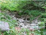 6
6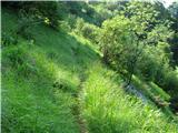 7
7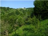 8
8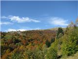 9
9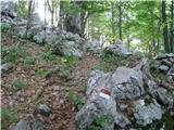 10
10 11
11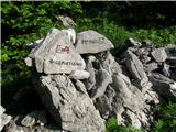 12
12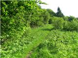 13
13 14
14 15
15 16
16 17
17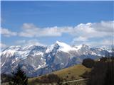 18
18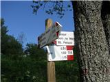 19
19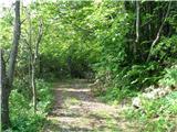 20
20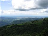 21
21 22
22 23
23 24
24 25
25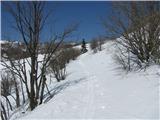 26
26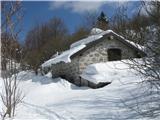 27
27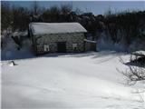 28
28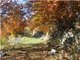 29
29 30
30 31
31 32
32 33
33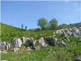 34
34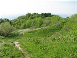 35
35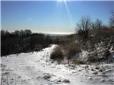 36
36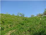 37
37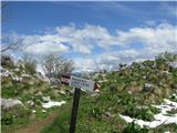 38
38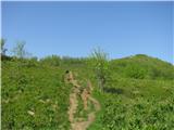 39
39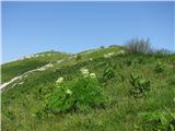 40
40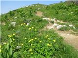 41
41 42
42 43
43 44
44 45
45 46
46 47
47 48
48 49
49 50
50 51
51 52
52 53
53 54
54 55
55 56
56 57
57 58
58
Discussion about the trail Rifugio Pelizzo - Monte Mataiur/Matajur (via Ledina)