Srednja vas - Tosc (Za Ribnico and via Planina Spodnji Tosc)
Starting point: Srednja vas (583 m)
| Lat/Lon: | 46,2975°N 13,9231°E |
| |
Name of path: Za Ribnico and via Planina Spodnji Tosc
Time of walking: 5 h 45 min
Difficulty: difficult marked way, easy unmarked way
Altitude difference: 1692 m
Altitude difference po putu: 1850 m
Map: TNP 1:50.000
Recommended equipment (summer):
Recommended equipment (winter): ice axe, crampons
Views: 2.420
 | 1 person likes this post |
Access to the starting point:
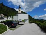
From the motorway Ljubljana - Jesenica take the exit Lesce and follow the road towards Bled and on to Bohinjska Bistrica. Just before Bohinjska Bistrica, at Bitnje, take a sharp right in the direction of Pokljuka. After a short climb, the road flattens out and quickly leads into the Upper Bohinj Valley. Here, at the crossroads, continue left (Pokljuka on the right) and follow the road to Srednja vas. Here, in the second part of the village, you will see signs for St Martin's Church, which direct you to the right onto a narrower and rather steep road, which then quickly leads to the church and the primary school. Park in a suitable place next to the school or church.
Path description:
From the church parking lot, walk a few steps down to the primary school, and from there continue towards the viewpoint on Kresu. The way forward leads us along a narrower asphalt road, which quickly leads to a larger water reservoir, where we see signs for Uskovnica. Continue along cart track, which turns into a forest, and at the right-hand bend, step out of the forest and a beautiful view of Rudnica and part of the Upper Bohinj valley opens up. Continue along cart track, which leads through a slightly narrower passage, then in a cross-climb to a place where you reach the road leading to Uskovnica. The road reaches the beautifully landscaped lookout point at Kres, from which a view opens up towards Srednji vas, the Upper Bohinj valley and the Lower Bohinj mountains in the background. Continue along the road for a short distance, and then at the end of a gentle left-hand bend, signs for Uskovnica direct you right to cart track, which leads you through the woods, lane bushes, and higher up through the woods again. A few minutes higher, we reach the dirt road again, but this time we leave it immediately as we continue in the direction of the footpath to Uskovnica. Cart track soon forks, and we continue along the left one, where we see a marker on a power pole. Continue along the power line for a while and follow the markings. Soon a path branches off to the left, leading to Uskovnica via Lom, and we continue on the path, which turns slightly right and passes onto the steep slopes of the area called Za Ribnico (Ribnica is a stream deep below us). Higher up, we reach the newer cart track or logging trail, and follow it to the right. The newer logging trail ends after a few minutes and continues to cross the slopes to the right. A little further on, at a small crossroads, continue along the upper left path, along which there are signs for Uskovnica and which is visibly more beaten. Further on, climb a little steeper along the path, from which an unmarked path branches off a little higher up towards Lom (the sign says "cheese, cottage cheese, milk and more").
Continue again in the direction of Uskovnica, then in a few minutes reach a macadam road (reach the part of the road where it is already closed to public traffic), which you follow to the right. Once on the road, join the trail from Stara Fužina, the trail from Srednja vas via Lom and the trail from the starting point or Lom parking lot. The winding macadam road leads quickly to the cottages on Uskovnica, and then, just past the water trough, leave it and continue left on cart track towards the Cottage on Uskovnica. After about 50 metres of ascent on cart track you will reach the Hut on Uskovnica. From the parking lot, continue in the direction Koča na Uskovnici, following the road which leads quickly out of the forest, where you will see signs for cheese, milk and homemade products. A short path branches off the road to the left and leads to the nearby cheese cottage pr Ulčnek, where you can buy the aforementioned products during the grazing season, otherwise continue straight ahead until you reach a marked crossroads a few steps away, where you continue to the right in the direction of Koča na Uskovnice. The way forward leads us first past the sign (cross) and then on between the pastures. When the pastures end on the right, the marked path from Srednja vas (the "Za Ribnico" path) joins us from the right.
Continue straight on, then pass the cottages to reach a water trough and a few steps further on to a place where the signs for the familiar cottage direct you left to cart track. There is a short climb up the cart track and the path leads to the Cottage on Uskovnica.
From the hut continue in the direction of Tosc, Draškega vrh, Viševnik, Vodnikov dom, Rudni polje and Praprotnice along the path which first crosses the grazing fence and then quickly joins the macadam road, which is followed to the right. The road then leads between bumpy meadows, and after crossing the next fence you quickly reach a crossroads at the Chapel of Our Lady Queen of Peace at Uskovnica.
After the chapel, continue left (straight mountain pasture Konjščica, right Rudno polje) along a sloping road which leads across the extensive meadows of Uskovnica, and then leads to the edge of the forest, where it begins to turn into the initially wide cart track. The cart track, which then begins to climb moderately, has a few forks, and we follow it in the direction of Vodnikov dom and Triglav. Higher up, the cart track, most of which runs through the forest, turns into a footpath, which quickly leads us to a pleasant small spring. At the well, continue straight ahead (hunting lodge on the right) and continue the ascent along the gently sloping path, which leads us slightly further up the steep slopes. Soon after we have reached the steep slopes, the fixed safety gear are helpful in crossing the steep ravine. The route continues along relatively steep and, especially in wet conditions, slippery slopes. While crossing the steep slopes, the path climbs steeply for a short time and then descends again. In the last part of the crossing, some very steep ravines are crossed, over which the path is in places completely destroyed (high risk of slipping). The crossing ends at a large torrent (usually a small spring), after which you enter a softer world of grasses. A few minutes of easy walking follows and the path leads to the abandoned mountain pasture Lower Tosc. The way forward begins to climb moderately and soon leads us to a small crossroads where we continue sharp right (straight old, partly abandoned path) along a nice traceable path. The way forward starts to climb steeper and steeper and quickly leads us out of the belt of sparse forest between dwarf pines, where it starts to turn more and more to the left. The path soon becomes straight and from dwarf pines it leads to grassy slopes over which, within a few minutes' further walking, we climb up to the Pokljuka - Triglav route.
Follow the above-mentioned path to the right, and after a few steps it will lead you to the place where the path to Tosc branches off to the left. Continue in the direction of Tosc (the branch is marked) along the unmarked but well-traced path, which begins to climb steeply over the grassy slopes of Tosc. The increasingly steep path slowly turns slightly to the right, then turns sharply to the left and almost completely flattens out. A short steep slope is crossed, and then the path leads to less steep slopes, where it gradually begins to disappear. The less visible path then turns slightly to the right and starts to climb slightly steeper. After a few minutes of climbing, you will reach the unmarked Mali Tosc, which opens up a view of Tosc. A short descent follows and the path leads us past a large sinkhole, which we bypass on the right-hand side, to the summit base of Tosc. The way forward climbs moderately over a pleasant grassy slope and after a few minutes of further walking leads us to the top of Tosc.
In the fog, orientation is difficult in the last part.
Srednja vas - Koča na Uskovnici 1:40, Koča na Uskovnici - Tosc 4:05.

Pictures:
 1
1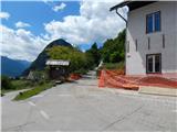 2
2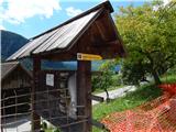 3
3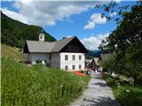 4
4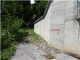 5
5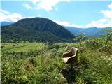 6
6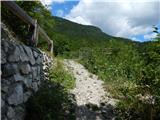 7
7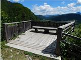 8
8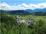 9
9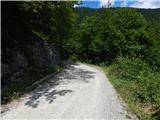 10
10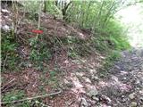 11
11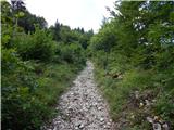 12
12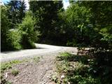 13
13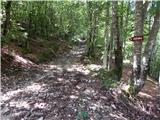 14
14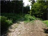 15
15 16
16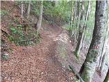 17
17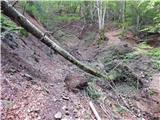 18
18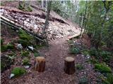 19
19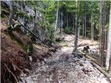 20
20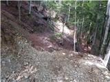 21
21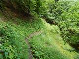 22
22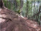 23
23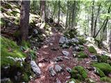 24
24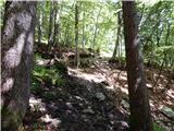 25
25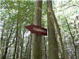 26
26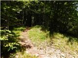 27
27 28
28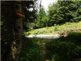 29
29 30
30 31
31 32
32 33
33 34
34 35
35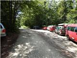 36
36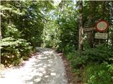 37
37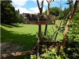 38
38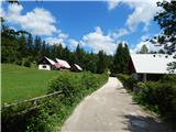 39
39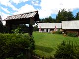 40
40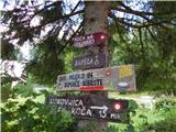 41
41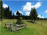 42
42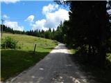 43
43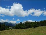 44
44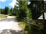 45
4546
47
48
49
50
51
 52
52 53
53 54
54 55
55 56
56 57
57 58
58 59
59 60
60 61
61 62
62 63
63 64
64 65
65 66
66 67
67 68
68 69
69 70
70 71
71 72
72 73
73 74
74 75
75 76
76 77
77 78
78 79
79 80
80 81
81 82
82 83
83 84
84 85
85 86
86 87
87 88
88 89
89 90
90 91
91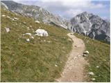 92
92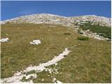 93
93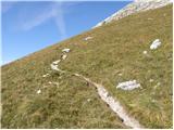 94
94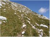 95
95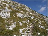 96
96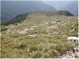 97
97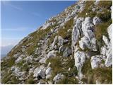 98
98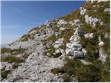 99
99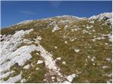 100
100 101
101 102
102 103
103 104
104 105
105 106
106 107
107 108
108 109
109 110
110 111
111 112
112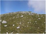 113
113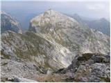 114
114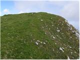 115
115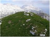 116
116
Discussion about the trail Srednja vas - Tosc (Za Ribnico and via Planina Spodnji Tosc)