Prelaz Vrhe - Source of Sotla
Starting point: Prelaz Vrhe (426 m)
| Lat/Lon: | 46,2583°N 15,7586°E |
| |
Time of walking: 1 h 30 min
Difficulty: easy marked way
Altitude difference: 214 m
Altitude difference po putu: 315 m
Map:
Recommended equipment (summer):
Recommended equipment (winter):
Views: 8.914
 | 2 people like this post |
Access to the starting point:
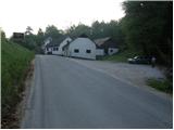
From the Ljubljana - Maribor motorway, take the Dramlje exit and follow the road towards Šentjurje, Rogaška Slatina and Rogatec. In Rogatec, the signs for Donačka gora direct you to the left onto a slightly narrower road, which you then follow towards the village of Žetale. At a small pass, just at the point where the municipality Rogatec ends, you will see a slightly larger parking lot on your right, where you park.
Path description:
From the parking lot, first walk to the pass, then continue along the main road towards the source of the Sotla River. After a few steps down the road, at the very beginning of the village Čermožiše, the signs for the Sotla spring direct you to the right onto a macadam road, which you follow for only a few 10 metres. Here you will see the sign cart track, which turns right off the dirt road and starts to climb moderately through the forest. Continue the ascent along the well-marked cart track, which leads us higher up to the forest road, which we follow to the left, and which quickly leads us to the hunting lodge (Koserjeva koča).
Immediately after the cottage, leave the macadam road, as the markings direct us left on a footpath which begins to climb steeply through the dense forest. The path soon leads to the broad ridge of Maclja, where it lays down and then continues with a few short ascents and descents. When a fine view of Donačka gora opens up, leave the ridge and continue slightly to the right, following cart track, which starts to descend. After a few minutes of descending, you reach the next crossroads, where you continue sharp left (slightly right Trlično and Lipovec). Continue ascending gently on the grassy cart track, and then the signs for the source of the Sotla River direct you to the right to a path which leads you down to the source within a minute of further walking.

Pictures:
 1
1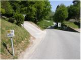 2
2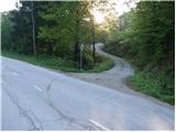 3
3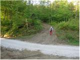 4
4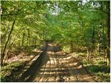 5
5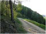 6
6 7
7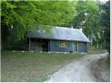 8
8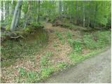 9
9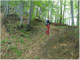 10
10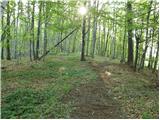 11
11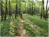 12
12 13
13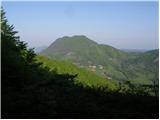 14
14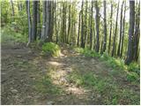 15
15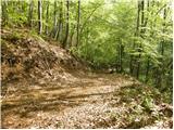 16
16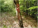 17
17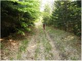 18
18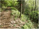 19
19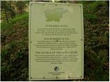 20
20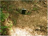 21
21
Discussion about the trail Prelaz Vrhe - Source of Sotla
|
| capin21. 06. 2011 |
Po dolgem času na izvir Sotle iz prelaza Vrhe .Pot do lovske koče strma in blatna, dalje po grebenu Maclja pa pravi užitek. Koliko gob se mi je znašlo na poti pa ne povem ker se mi vsaj zdi da tam okoli klantra šerpa (če slučajno ni na Donački)L.p.
|
|
|
|
| Marx23. 07. 2011 |
Zelo natančen opis. Zanimlivo , ko sem z Hrvaškeg ampak na Izvir vedno grem iz prevoja Vrhe , nikoli sam ni šel z mesta Macelj.
Ampak , kako priti na najvišji vrh Maceljske gore (In kateri je natačno najvišji , Belinovec ali nekateri drugi?) ?
|
|
|