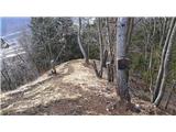
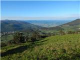
 | Vidrga - Zasavska Sveta gora (on forest footpath)
Zasavska Sveta gora is a popular excursion point located between Litija and Izlaki. From the top, where the parish church of the Nativity of the ...
1 h 30 min |
| Vidrga - Zasavska Sveta gora (on a cart track)
Zasavska Sveta gora is a popular excursion point located between Litija and Izlaki. From the top, where the parish church of the Nativity of the ...
1 h 30 min |
 | Mala voda - Kožljek
Kožljek is a 788 m high peak located to the west of Koreno, specifically above the village of Samotorica. From the top, where there are a few ben...
1 h 15 min |
 | Brezje pri Tržiču - Vaško (eastern path)
Vaško is a little-known mountain in the south-eastern ridge of Dobrča. From the top there is a beautiful view towards Jelovica and the Julian Alp...
1 h 5 min |
| Water storage Žegnani studenec - Vaško
Vaško is a little-known mountain in the south-eastern ridge of Dobrča. From the top there is a beautiful view towards Jelovica and the Julian Alp...
1 h 5 min |
 | Podgorje - Kojnik (via hunting cottage)
Kojnik is a partially vegetated peak located in the southern part of the Podgorje Karst near the Slovenian-Croatian border. From the top of the s...
1 h 30 min |
 | Planina - Petričev hrib
Petričev hrib is the peak north of Postojna and west of Mountain pasture. From the summit, which has a registration box, there is a beautiful vie...
1 h 30 min |
| Planina (Dolnja Planina) - Petričev hrib (via Zavrtniki)
Petričev hrib is the peak north of Postojna and west of Mountain pasture. From the summit, which has a registration box, there is a beautiful vie...
1 h 35 min |
| Planina (Dolnja Planina) - Petričev hrib (via Sv. Duh)
Petričev hrib is the peak north of Postojna and west of Mountain pasture. From the summit, which has a registration box, there is a beautiful vie...
1 h 35 min |
 | Tržič - Kamnek (Milanova pot)
Kamnek (Kamnik on maps, but also Kamnjek) is a scenic peak above Tržič....
1 h 5 min |
 | Tržič (Slap) - Kamnek (via Dobrivc)
Kamnek (Kamnik on maps, but also Kamnjek) is a scenic peak above Tržič....
1 h |
 | Podpeč - Grmada on Mala gora
Grmada (also Grmada nad Ortnek) is an 887 m high peak located above the village of Vrh pri Poljanah in the Mala Gora mountain range. Just a few m...
1 h 35 min |
 | Prelesje - Sivka
Sivka is a grassy peak located in the westernmost part of the Polhograje Hills. In good weather, the peak offers a magnificent view from Snežnik ...
1 h |
| Novi Lazi - Livoldski vrh
Livoldski vrh is a forested peak located in the south-eastern part of Stojna. The summit has a registration box and a stamp....
1 h 10 min |
 | Planina - Grmada (Planinska gora)
Grmada is an 873m high peak rising west of Planinsko Polje. The summit is overgrown, but from the lookout point just below the summit we have a b...
1 h |
 | Planina (Dolnja Planina) - Grmada (Planinska gora) (via Zavrtniki)
Grmada is an 873m high peak rising west of Planinsko Polje. The summit is overgrown, but from the lookout point just below the summit we have a b...
1 h 5 min |
| Planina (Dolnja Planina) - Grmada (Planinska gora) (via Sv. Duh)
Grmada is an 873m high peak rising west of Planinsko Polje. The summit is overgrown, but from the lookout point just below the summit we have a b...
1 h 5 min |
 | Jesenice (Ukova) - Jelenkamen (via Dole)
Jelenkamen is a peak belonging to the northern Caravan Mountains above Jesenice, interesting especially for local hikers in the mountain pasture,...
1 h 20 min |
 | Poljana - Smolnik
Smolnik is a steep 1075 m high peak - a solitary peak below Valvasor's house, rising above the Zavrh (Završnica) valley, with a view of Hochstuhl...
1 h 15 min |
 | Poljana - Smolnik (steep path)
Smolnik is a steep 1075 m high peak - a solitary peak below Valvasor's house, rising above the Zavrh (Završnica) valley, with a view of Hochstuhl...
1 h |
 | Oblakov Vrh - Hudournik
Hudournik is a 1148 m high peak located on the northern edge of the Vojskar plateau, a plateau situated between the valleys of the Idrijca, Kanom...
1 h 30 min |
 | Smrečje - Goli vrh
Goli vrh, also known as Golni vrh on maps, is a nondescript forested peak located above the scattered settlement of Goli Vrh. There is no view fr...
1 h 30 min |
 | Bohinjska Češnjica - Rudnica
Rudnica is a scenic mountain located between the Lower and Upper Bohinj Valley. From the top, where there is a registration box with a stamp and ...
1 h 30 min |
| Srednja vas (Senožeta) - Rudnica
Rudnica is a scenic mountain located between the Lower and Upper Bohinj Valley. From the top, where there is a registration box with a stamp and ...
1 h 30 min |
 | Ledinsko Razpotje - Gradišče (above Spodnja Idrija) (steep path)
Gradišče is a 998-metre-high peak that separates the Ledine plateau in the north-western part of the Rovtarski hills from the Idrijca valley. A t...
1 h |
 | Ledinsko Razpotje - Gradišče (above Spodnja Idrija) (gentle path)
Gradišče is a 998-metre-high peak that separates the Ledine plateau in the north-western part of the Rovtarski hills from the Idrijca valley. A t...
1 h 15 min |
 | Nemilje - Sveti Mohor (Zabrekve)
The Church of St. Mohor is situated on a 952 m high hill, between Zgornja Besnica and Selce. From the church, or its immediate surroundings, we h...
1 h 20 min |
 | Nemilje - Sveti Mohor (Zabrekve) (via Prevoje)
The Church of St. Mohor is situated on a 952 m high hill, between Zgornja Besnica and Selce. From the church, or its immediate surroundings, we h...
1 h 35 min |
 | Njivica - Sveti Primož in Felicijan (Jamnik)
The Church of St. Primož and Felicijan on Jamnik, is situated on a scenic grassy ridge rising between Kropa and Podblica. From the church or its ...
1 h 10 min |
 | Brezovica - Sveti Primož in Felicijan (Jamnik)
The Church of St. Primož and Felicijan on Jamnik, is situated on a scenic grassy ridge rising between Kropa and Podblica. From the church or its ...
1 h 20 min |
| Češnjica pri Kropi - Sveti Primož in Felicijan (Jamnik) (via Berigla)
The Church of St. Primož and Felicijan on Jamnik, is situated on a scenic grassy ridge rising between Kropa and Podblica. From the church or its ...
1 h 20 min |
 | Rodik - Sveti Socerb (Artviže)
The Church of St. Socerbo is situated on a hill overloking the village of Artviže, which is the highest peak in Brkina with its 817 m. The church...
1 h 20 min |
 | Gorenji Novaki (Mrovlje) - Škofje
Škofje is a 973 m high peak located above the villages of Čeplez, Planina pri Cerknem and Podpleče. The peak itself, on which stands a small conc...
1 h |
 | Ribenski most - Tolsti vrh (Talež)
Tolsti vrh is an 883 m high hill located south of Bled, above the Talež Hunting Lodge. The summit, which descends steeply towards the Sava Bohinj...
1 h 15 min |
 | Selski most - Tolsti vrh (Talež)
Tolsti vrh is an 883 m high hill located south of Bled, above the Talež Hunting Lodge. The summit, which descends steeply towards the Sava Bohinj...
1 h 15 min |
 | Trojane - Lipovec
Lipovec is an 848 m high peak located above the pastures of Lipovec. In good weather, the summit offers a view of Posavsko hribovje, Kum, Menino ...
1 h 30 min |
 | Jasen - Ahac
Ahac or St. Ahac is a 799 m high peak located east of Ilirska Bistrica. The summit, which is home to a registration box, a cross and the ruins of...
1 h |
| Vrbovo - Ahac
Ahac or St. Ahac is a 799 m high peak located east of Ilirska Bistrica. The summit, which is home to a registration box, a cross and the ruins of...
1 h |
 | Brezje nad Kamnikom - Vovar (western way)
An obscure hill in front of the Kamnik mountains. Recently covered by storms, it has been covered with wood harvesting tracks.There is also a sma...
1 h |
| Brezje nad Kamnikom - Vovar (northern way)
An obscure hill in front of the Kamnik mountains. Recently covered by storms, it has been covered with wood harvesting tracks.There is also a sma...
1 h |
 | Žiri - Javorč
Javorč is a 901-metre-high peak located to the north-east of Žiri. The summit, where the registration box with the registration book is located, ...
1 h 15 min |
 | Babni Vrt - Gradišče (Pustinjak) (through forest and past Sveti Lovrenc)
Gradišče or Pustinjak (also Gradišče above Bašlje) is an 871-metre-high peak located above the Belica stream, which in turn is below the 2132-met...
1 h 15 min |
 | Col - Špiček (Špečk) (via Križna gora)
Špiček (locals call it Špečk) is a peak located north to north-east of Cola. On the summit is a cross in honour of St Hubert and commemorating th...
1 h 10 min |
 | Col - Križna gora above Col (via Špiček)
Križna gora is a 957 m high peak located north of Cola. The summit, which is forested on the north side, offers a beautiful view to the east, sou...
1 h 10 min |
 | Blejska Dobrava (cemetery) - Hom pri Bledu (via Katarina)
Hom is an 834 m high hill that rises north above the villages Zasip and Podhom near Bled, or south of the village Blejska Dobrava near Jesenice. ...
1 h 25 min |
 | Blejska Dobrava (cemetery) - Hom pri Bledu (on east slope)
Hom is an 834 m high hill that rises north above the villages Zasip and Podhom near Bled, or south of the village Blejska Dobrava near Jesenice. ...
1 h 5 min |
 | Poljane (Spodnje Gorje) - Boršt (by road)
Boršt is a 931 m high vegetated peak located 4 km north-west of Bled, or east of the Mežakla plateau. Between it and the neighbouring peak of Hom...
1 h |
 | Kočna - Boršt (via Vrše)
Boršt is a 931 m high vegetated peak located 4 km north-west of Bled, or east of the Mežakla plateau. Between it and the neighbouring peak of Hom...
1 h 20 min |
 | Trate (Blejska Dobrava) - Boršt
Boršt is a 931 m high vegetated peak located 4 km north-west of Bled, or east of the Mežakla plateau. Between it and the neighbouring peak of Hom...
1 h |
 | Ukova (Jesenice) - Mirca (via Pekova plan'ca)
Mirca (dialect Merca) is one of the peaks of the southern Karavanke mountain range with an altitude of 1025 m. It rises north above the centre of...
1 h 20 min |
 | Murova - Mirca
Mirca (dialect Merca) is one of the peaks of the southern Karavanke mountain range with an altitude of 1025 m. It rises north above the centre of...
1 h 10 min |
 | Jeršiče - Baba (at Javorniki)
Baba is a 1085 m high peak located between the Javorniki Ridge and Sveta Trojica. From the grassy summit, we have a beautiful view of the Javorni...
1 h 30 min |
 | Možjanca - Kopa (Partizanski vrh)
Kopa, also Partizanski vrh, is a 1024-metre high mountain located west of the Davovec saddle, which is west to south-west of Krvavec. There is a ...
1 h 30 min |
 | Možjanca - Skutman
Skutman is a lesser-known peak located above the left bank of the Kokra River and north of Štefanje Gora. The summit is marked by a metal sign wi...
1 h 25 min |
 | Kokra (resting place Kokra-sotočje) - Skutman
Skutman is a lesser-known peak located above the left bank of the Kokra River and north of Štefanje Gora. The summit is marked by a metal sign wi...
1 h 10 min |
 | Bele Vode (Kovač) - Sveti Križ above Bele Vode (on south ridge)
Sveti Križ is a scenic mountain located above Beli Voda. From the top, which is home to a number of church buildings and a conversion tower, we h...
1 h 10 min |
 | Poljšica pri Gorjah (Zatrata) - Hotunjski vrh (on footpath)
Hotunjski vrh is a 1107-metre-high lookout peak located above the Zatrnik ski resort. From the top, where there is a registration box and a bench...
1 h 30 min |
 | Mežica - Andrejev vrh (by cart track)
Andrejev vrh is a forested peak located between Mežica and Lesa. There is a bench on the top and a registration box with a registration book....
1 h 15 min |
| Mežica - Andrejev vrh (past the chapel)
Andrejev vrh is a forested peak located between Mežica and Lesa. There is a bench on the top and a registration box with a registration book....
1 h 20 min |
| Leše - Andrejev vrh (via Leše churches and via chapel)
Andrejev vrh is a forested peak located between Mežica and Lesa. There is a bench on the top and a registration box with a registration book....
1 h 35 min |
| Leše - Andrejev vrh (past Leše churches and on cart track)
Andrejev vrh is a forested peak located between Mežica and Lesa. There is a bench on the top and a registration box with a registration book....
1 h 30 min |
 | Selca - Sleme (Površnica)
Sleme is a scenic peak located between Rudni, Dražgoše and Lajša. The summit, where the transmitters are located, offers a beautiful view of the ...
1 h 35 min |
| Železniki - Sleme (Površnica) (via Štalca)
Sleme is a scenic peak located between Rudni, Dražgoše and Lajša. The summit, where the transmitters are located, offers a beautiful view of the ...
1 h 35 min |
 | Selca - Sveti Križ above Selca
The Sveti Križ above Selca church is situated on a lookout point, which offers a beautiful view over part of the Škofjeloško hribovje....
1 h 15 min |
| Železniki - Sveti Križ above Selca (via Štalca)
The Sveti Križ above Selca church is situated on a lookout point, which offers a beautiful view over part of the Škofjeloško hribovje....
1 h 15 min |
 | Podblica - Bela peč (Podbliška gora)
Bela peč is located on the edge of Jelovica above the village of Podblica. From the top of the cliff we have a beautiful view of the village, the...
1 h 30 min |
 | Senično - Planica (Paragliding site Gozd) (gentle path)
Planica is a 926-metre-high peak located above the village of Gozd. From the top, where the JPK Kriška gora hut is located, we have a beautiful v...
1 h 15 min |
| Senično - Planica (Paragliding site Gozd) (steep path)
Planica is a 926-metre-high peak located above the village of Gozd. From the top, where the JPK Kriška gora hut is located, we have a beautiful v...
1 h 10 min |
| Pristava - Planica (Paragliding site Gozd)
Planica is a 926-metre-high peak located above the village of Gozd. From the top, where the JPK Kriška gora hut is located, we have a beautiful v...
1 h 20 min |
 | Šenturška Gora - Prgozdnik (Martinova pot)
Prgozdnik is a 1013-metre-high peak located on the ridge of the same name, between the settlements of Ambrož pod Krvavcem, Šenturška Gora, Apno a...
1 h 5 min |
 | Apno - Prgozdnik (Martinova pot)
Prgozdnik is a 1013-metre-high peak located on the ridge of the same name, between the settlements of Ambrož pod Krvavcem, Šenturška Gora, Apno a...
1 h 10 min |
 | Bukovo - Črvov vrh
Črvov vrh, also known as Črvov grič, is the highest peak of the Šentviška plateau, rising above the right bank of the Idrijca and the left bank o...
1 h 30 min |
| Šentviška Gora - Črvov vrh
Črvov vrh, also known as Črvov grič, is the highest peak of the Šentviška plateau, rising above the right bank of the Idrijca and the left bank o...
1 h 10 min |
 | Bukovo - Bukovski vrh
Bukovo vrh (918 m) is located above the settlement Bukovo Vrh, more precisely above the homestead at Pircu.From the grassy summit we have a beaut...
1 h 20 min |
| Šentviška Gora - Bukovski vrh
Bukovo vrh (918 m) is located above the settlement Bukovo Vrh, more precisely above the homestead at Pircu.From the grassy summit we have a beaut...
1 h 30 min |
| Grahovo ob Bači (Brelih) - Bukovski vrh (via Žrelo)
Bukovo vrh (918 m) is located above the settlement Bukovo Vrh, more precisely above the homestead at Pircu.From the grassy summit we have a beaut...
1 h 40 min |
 | Hotavlje - Vrh Slajke
Vrh Slajke is a 790-metre-high hill located above Hotavlje, on the right bank of the Kopačnice River. From the top, where the antenna tower stand...
1 h 15 min |
| Hotavlje - Vrh Slajke (via Bela)
Vrh Slajke is a 790-metre-high hill located above Hotavlje, on the right bank of the Kopačnice River. From the top, where the antenna tower stand...
1 h 30 min |
| Podgora - Vrh Slajke
Vrh Slajke is a 790-metre-high hill located above Hotavlje, on the right bank of the Kopačnice River. From the top, where the antenna tower stand...
1 h 25 min |
 | Ledinica - Krog (Ledinski grič)
Krog is a 940 m high peak located on the western part of the Ledinski grič ridge, which is situated between the Jerešča and Ledinščica watercours...
1 h 15 min |
 | Jazne (Lanišar) - Krog (Ledinski grič)
Krog is a 940 m high peak located on the western part of the Ledinski grič ridge, which is situated between the Jerešča and Ledinščica watercours...
1 h 35 min |
| Ledinsko Razpotje - Krog (Ledinski grič)
Krog is a 940 m high peak located on the western part of the Ledinski grič ridge, which is situated between the Jerešča and Ledinščica watercours...
1 h 30 min |
 | Selca - Lepo brdo
Lepo brdo is a 778-metre-high hill located above the settlements of Selca and Studeno....
1 h |
 | Veliki Boč (Zgornji Kovač) - Možičev vrh (via Žavcarjev vrh)
Možičev vrh is a 926 m high peak located to the west of the better known, but slightly lower, Žavcar Peak. There is a track leading to the summit...
1 h 40 min |
 | Veliko Tinje - Repnikov vrh
Repnikov vrh is a 988 m high peak on Pohorje, located between Mountain pasture below Šumik and Urh. The peak is located in the middle of the fore...
1 h 25 min |
 | Übelbach - Schankkogel
...
1 h 30 min |
 | Übelbach - Schankkogel (strma pot)
...
1 h 30 min |
 | Deutschfeistritz - Parmaseggkogel (čez Kugelberg)
...
1 h 15 min |