Lovnik - Sveti Mihael on Pečica (Lovnik - Sv. Mihael na Pečici - Sladka gora)
Starting point: Lovnik (348 m)
Name of path: Lovnik - Sv. Mihael na Pečici - Sladka gora
Time of walking: 1 h
Difficulty: easy marked way
Altitude difference: 152 m
Altitude difference po putu: 152 m
Map: Posavsko hribovje Boč - Bohor 1:50.000
Recommended equipment (summer):
Recommended equipment (winter):
Views: 2.328
 | 2 people like this post |
Access to the starting point:
a) From Ljubljana, leave the motorway at Slovenske Konjice and drive to Poljčane via Žič, Loč and Zbelové. At the crossroads, turn right in the route Zgornje Poljčane - Rogaška Slatina and after four kilometres along the valley of the Bela stream, you will reach the village of Lovnik, where you will park on the roadside.
b) From the route of Maribor, leave the motorway at Slovenski Bistrica, continue towards Poljčane and through the centre of Poljčane, where you will follow the above description. . .
c) From the route of Rogaška Slatina, Šmarje pri Jelšah, Brežice. . . in the village of Podplat, at a large semaphorised junction, continue in the direction of Poljčane - Maribor, reach the famous Pečica Pass and shortly thereafter, downhill, the village of Lovnik, where you park on the side of the road.
Path description:
In the village of Lovnik, at the signposts by the Zorin vineyard farm, follow the municipal road and the signs for the pilgrimage route of the Virgin Mary and cross the stream for the first time. At the second stream crossing, turn left onto the forest road and follow it all the way to the asphalt road exit via Pečice. Continue to the right and after some 200 metres reach the intermediate destination of the Church of St Michael on Pečica.
After the tour, return to the crossroads and follow the signs to Sladko Gora. After a good hundred metres, take a sharp right downhill (straight ahead is the route to Boč) and now the route is also the Štajerska - Zagorje Brotherhood Trail. To the left of the trail is a small resting place with a water spring and a little further downhill to the right along the trail/road is the interesting studio of the painter Jerič (partly open air). Continue and in the final downhill with farmhouses along the trail you soon reach the village of Sladka gora 327 metres above sea level with a church in the centre of the village. The trail is also very suitable for mountain or trekking bikes.
The total length of the trail from Lovnik is about 4500 metres, 152 positive vertical metres and 173 negative vertical metres.

Pictures:
 1
1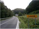 2
2 3
3 4
4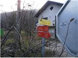 5
5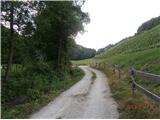 6
6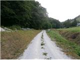 7
7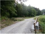 8
8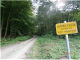 9
9 10
10 11
11 12
12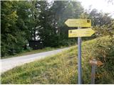 13
13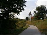 14
14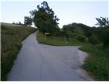 15
15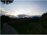 16
16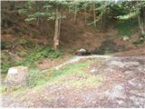 17
17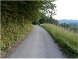 18
18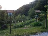 19
19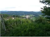 20
20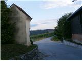 21
21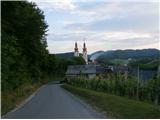 22
22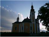 23
23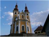 24
24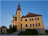 25
25
Discussion about the trail Lovnik - Sveti Mihael on Pečica (Lovnik - Sv. Mihael na Pečici - Sladka gora)
|
| bruny11. 12. 2014 |
V večerni pohodniški aktivnosti, ki je ,,padla,, za dobro uro v nočno tudi po opisani poti v nasprotni smeri opisa. Tudi v nasprotno smer opisa je pot izredno prijetna. Ja zvezd polno je bilo nebo...
|
|
|