Dolga gora - Sveti Mihael on Pečica (Dolga Gora - Sv. Mihael na Pečici - Sladka Gora)
Starting point: Dolga gora (297 m)
| Lat/Lon: | 46,2773°N 15,4981°E |
| |
Name of path: Dolga Gora - Sv. Mihael na Pečici - Sladka Gora
Time of walking: 1 h 45 min
Difficulty: easy marked way
Altitude difference: 203 m
Altitude difference po putu: 260 m
Map: Posavsko hribovje Boč - Bohor 1:50.000
Recommended equipment (summer):
Recommended equipment (winter):
Views: 3.025
 | 2 people like this post |
Access to the starting point:
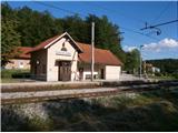
a) Access by train is optimal. . . the railway stop between Celje and Maribor, directly next to the railway station is the start of the mountain trail.
b) By car. . . highway exit Slovenske Konjice, continue in the direction of Draža vas, Žič and Loč. Immediately after the village of Loče, turn right in the direction of Ponikva and follow the signs Dolga gora and Dolga gora/ railway station. After about 4 kilometres from Loče, you will reach the starting point, where you will park at the station.
Path description:
At the railway station, a direction sign points in the direction of Boč. Follow the asphalt connection (there are also mountain markings along the way) to the first crossroads, where you continue to the left. The asphalt road turns to macadam and follow the road to the right in an easy ascent alongside a larger homestead to the junction with the Dolga Gora - Sladka Gora road, where you continue left for a good hundred metres. Continue right uphill (perfectly marked) and a direction sign with the inscription Sveti Mihael is also helpful. Follow the fairly rough asphalt road higher up and then a little further up - down between farmhouses and cottages along the way. With pleasant views, we soon reach the intermediate destination - Sveti Mihael na Pečicica. . .
After the sightseeing, we continue with the help of direction signs to Sladko Gora. After a good hundred metres, take a sharp right downhill (straight ahead is the direction to Boč) and now the route is also the Štajerska - Zagorje Brotherhood Route. To the left of the trail is a small resting place with a water spring and a little further downhill to the right along the trail/road is the interesting studio of the painter Jerič (partly open air). Continue and in the final downhill with farmhouses along the trail you soon reach the village of Sladka gora 327 metres above sea level with a church in the centre of the village. The trail is also very suitable for mountain or trekking bikes.
The total length of the trail from Dolga Gora is about 6500 metres, 260 positive vertical metres and 230 negative vertical metres.

Pictures:
 1
1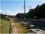 2
2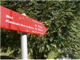 3
3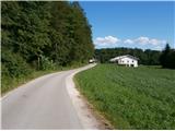 4
4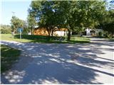 5
5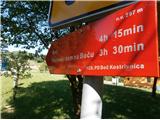 6
6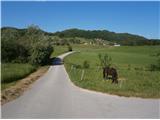 7
7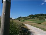 8
8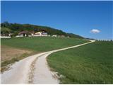 9
9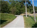 10
10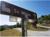 11
11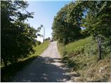 12
12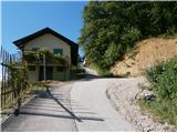 13
13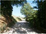 14
14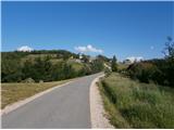 15
15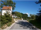 16
16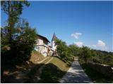 17
17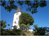 18
18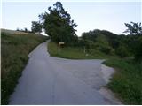 19
19 20
20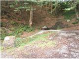 21
21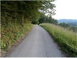 22
22 23
23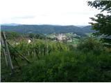 24
24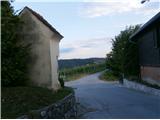 25
25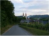 26
26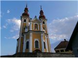 27
27
Discussion about the trail Dolga gora - Sveti Mihael on Pečica (Dolga Gora - Sv. Mihael na Pečici - Sladka Gora)