Zgornje Poljčane - Studenice castle
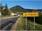
Starting point: Zgornje Poljčane (270 m)
Time of walking: 55 min
Difficulty: easy marked way
Altitude difference: 45 m
Altitude difference po putu: 130 m
Map: Posavsko hribovje Boč - Bohor 1:50.000
Recommended equipment (summer):
Recommended equipment (winter):
Views: 2.289
 | 2 people like this post |
Access to the starting point:
a) From Ljubljana, leave the motorway at Slovenske Konjice and drive to Poljčane via Žič, Loč and Zbelové. At the crossroads, turn right in the direction of Zgornje Poljčane for a few hundred metres and park in the centre of the village, a suitable place is the parking space next to the cemetery.
b) From the direction of Maribor, leave the motorway at Slovenski Bistrica, where signs direct you to Poljčane. Continue through the centre of Poljčane in the direction of Zgornje Poljčane, where you can park in the centre of the village, a suitable place is the parking space next to the cemetery.
Path description:
After a short visit to the centre of Zgornje Poljčane, continue across the Bela stream by the parish church, slightly up the road. On the left side of the path you reach the entrance to the church, with a relief of two Romans on the façade. After the visit, continue left towards Podboč on the asphalt road, also the Formila cycle path. Soon you reach the pleasant, small settlement of Podboč and on the left side of the path the Černogova yew tree and a fountain restored by the locals.
Continue right up the road, now entering the Boč & Plešivec Landscape Park. The asphalt surface turns into a forest road. The view to the left is also a view lower down to the surroundings of Poljčany and the bed of the flooded river Dravinja between fields and meadows. The road turns into a forest and soon reaches a grassy plateau where the road is laid.
On the grassy plain there is a small warehouse with a field on the right and vineyards on the left. Continue through the forest again and the road winds pleasantly left, right. . . At the end of the straight work sharp left and downhill on a narrow forest stone road, while up to the right is a continuation higher up into Boč.
Continue downhill, the path descends pleasantly, is well beaten and soon reaches the intermediate trailhead, the Spring of the Tople/Studenický Brook, at 295 metres.
Cross a wooden footbridge and continue to the other side of the stream and soon continue downhill on a short level, where there is a nun's cemetery to the left of the path and a small spring/stream in a wooden trough to the right. A few metres further up a narrower path by a wooden railing for a handhold. Follow the path higher up, down to the old town of Studenice with the monastery complex. Further on, along the descendant of the old Maribor vine, you will reach Studenica Castle. Over the centuries, some of it has been preserved, even restored a decade ago, and the trail's destination rewards us with beautiful views of the world of the Dravinja valley, Boč. . .
The length of the described route is about 3500 metres, 130 positive vertical metres and 85 negative vertical metres.

Pictures:
 1
1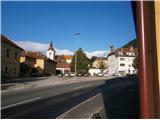 2
2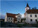 3
3 4
4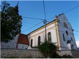 5
5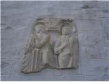 6
6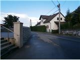 7
7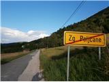 8
8 9
9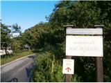 10
10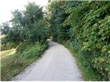 11
11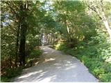 12
12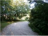 13
13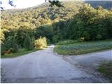 14
14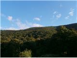 15
15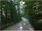 16
16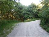 17
17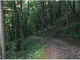 18
18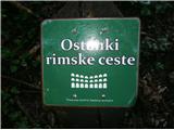 19
19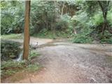 20
20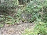 21
21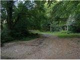 22
22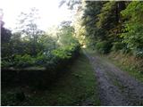 23
23 24
24 25
25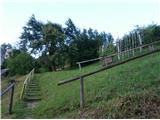 26
26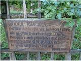 27
27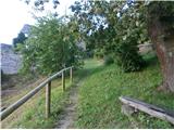 28
28 29
29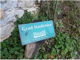 30
30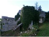 31
31
Discussion about the trail Zgornje Poljčane - Studenice castle
|
| bruny21. 10. 2014 |
Zgoraj višje na vrhu Boča ob RTV stolpu so se hitro pomikale pred dosegom izrazite severne fronte meglice. Kratka kolesarska aktivnost danes in med 1,73 - 5,15 kilometra po opisani poti...Studeniški grad s kolesom v eni krožni kombinaciji...do tja čez vinograde/planjavo Pritensko in nazaj spodaj ob Dravinji...Tja čez Zgornje Poljčane in nazaj čez Spodnje Poljčane. V obeh kombinacijah naselje Podboč in nekaj deset metrov je manjkalo do stika skozi središče naselja. Zaključni pristop na grad hoja. Zanimiv krožni presek med Poljčanami in Studenicami in nekaj malega Boča. Bilo je še nekje južnih smeri ampak čutil se je že delno severni pridih... Trasa: Studeniški grad,21.10.2014
|
|
|