Ljubelj - Srednja peč (via Vatelca or Skleda)
Starting point: Ljubelj (1058 m)
| Lat/Lon: | 46,4324°N 14,2602°E |
| |
Name of path: via Vatelca or Skleda
Time of walking: 4 h 15 min
Difficulty: partly demanding marked way, difficult pathless terrain
Altitude difference: 862 m
Altitude difference po putu: 1060 m
Map: Karavanke - osrednji del 1:50.000
Recommended equipment (summer): helmet
Recommended equipment (winter): helmet, ice axe, crampons
Views: 756
 | 1 person likes this post |
Access to the starting point:
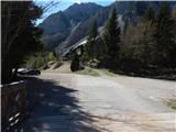
Drive to Border crossing Ljubelj, where you turn left before the tunnel towards Zelenica. Drive over a small bridge, then park in a large parking lot.
Path description:
At the beginning of the parking lot, the mountain signs for Hochstuhl, Vertatscha and Dom na Zelenici direct us to the wide cart track, which begins to climb along the torrent. When the cart track turns left a little higher up, we continue straight on along the mountain path, which continues through the forest and soon returns to cart track. Cart track turns right a little higher up and leads us out of the forest onto the ski slope of the former Zelenica ski resort. There is a short, steeper climb up the ski slope, and then the trail flattens out and leads us along the foothills of the scree below Begunjščica.
The marked trail soon branches off to the right along a service road, and we continue along the "road" to the nearby Vrtača Hut.
At the hut, the road turns right and we continue straight ahead towards the mountain trail to Zelenica. For a short time we continue under the former single-seater Zelenica II, and then the path begins to climb steeply up the slope, which is partly overgrown by dwarf pines. After a few switchbacks, we return to the service road, which we continue along, overlooking the Šentanski avalanche.
The path ahead takes you along the slopes of the Lower Plot (the summit of which was covered by a sport climbing route a few years ago), then off the road turn right onto a footpath that cuts around a long bend. Once back on the road, we are at the top station of the former Zelenica II single-seater, and it is only a few steps downhill to the Zelenica Home.
After the mountain lodge, continue left and climb halfway up the children's ski lift, then notice the signs for Vertatscha and Hochstuhl on the right, which direct you right into the lane of a forest. A little further on, cross the connecting lane between the children's ski lift and the anchor, then cross the second ski slope.
Continue along the trail to a small boulder and then cross the slopes below the Na Možeh ridge. When the crossing ends, you reach an unmarked valley where the path to Suho dwarf pines branches off to the right (usually there is a cairn at the branch).
From the crossroads onwards, we climb briefly through the forest, and then the path leads us to the slopes of Vertatscha, where we cross some scree on a slight ascent, and occasionally a really short lane of forest. Further on, the path from Dom pri izviru Završnice joins us from the left, and a little further on the path splits. At the crossroads, the path to Vertatscha branches off slightly to the right, and the upper path to Hochstuhl continues straight ahead. Continue along the right-hand path towards Vertatscha, which climbs slightly steeper. Higher up, you reach a grassy slope where the path becomes a little steeper, then turns left to steep slopes. Cross a slightly exposed gully and then climb over steep grasses to the south-western shoulder of Vrtača.
Here the marked path leading to Vertatscha turns sharp right, and we continue straight on the other side of the ridge, where we follow the path down to a nearby scree slope. When we reach the nearby scree, we continue on a slightly less well-trodden but marked mountain path (the path is marked with red lines). The path, which first descends gently and then moderately, and occasionally steeply, along the scree, almost semicircularly bypasses the nearby cirque. The path, which is also exposed to falling stones in several places, stops descending lower down and leads to a short but steep grassy slope. Climb up the steep slope for a few metres and then arrive in the plateau world around the Skleda sinkhole (also Vatelca on some maps). Follow a relatively gentle path for a few minutes and then arrive at a small crossroads, where you continue downhill to the left (to the right, the Belščica saddle, Bielschitza and Celovška koča). The path descends steeply down a ravine at first, then turns to the right, where it passes onto vast scree fields, over which it climbs steeply across the hills. Leave the scree higher up and descend gently to a nearby crossroads where you join the upper and lower trails to Hochstuhl.
From this crossroads continue sharp left in the route Zelenica (slightly right Hochstuhl), then after some 10 steps, before the path starts to descend visibly, a small cairn and a nice crossing on the trackless path towards the saddle between the Stol massif and Srednja peja can be seen on the right.
Continue along the edge of dwarf pines, along a nice transitional chasm, with individual cairns pointing in the right direction. After about 5 minutes, we arrive at a small pass to the west of Srednja peč, where we see a fainter track on the left across a scree slope. Climb up to this track and then cross the scree to the right. When the scree ends, the path leads through a narrow lane of dwarf pines, then the fainter path turns left along dwarf pines steeply uphill and ends after a few steps in relatively steep grass. The ascent continues along dwarf pines steeply upwards, and we continue in roughly the same direction until we reach the ridge, where the fainter path reappears. We continue right, a little further on also through a short lane of the burnt dwarf pines, and then climb along and along the ridge, which is occasionally precipitous to the left, to a little-visited and scenic summit. Ljubelj - Koča Vrtača 40 minutes, Koča Vrtača - Dom na Zelenici 40 minutes, Dom na Zelenici - off the marked trail 2:30, off the marked trail - Srednja peč 25 minutes.

Pictures:
 1
1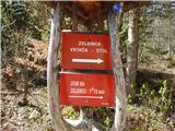 2
2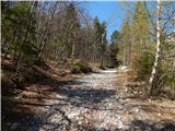 3
3 4
4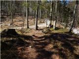 5
5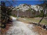 6
6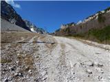 7
7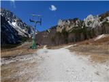 8
8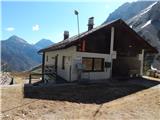 9
9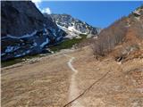 10
10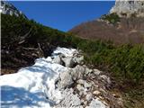 11
11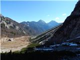 12
12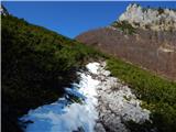 13
13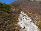 14
14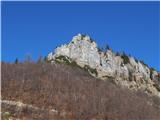 15
15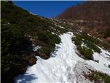 16
16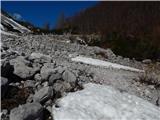 17
17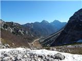 18
18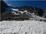 19
19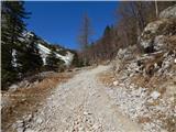 20
20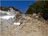 21
21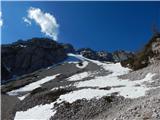 22
22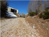 23
23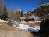 24
24 25
25 26
26 27
27 28
28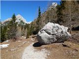 29
29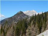 30
30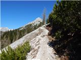 31
31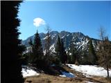 32
32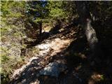 33
33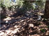 34
34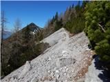 35
35 36
36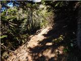 37
37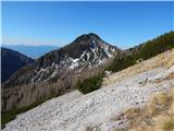 38
38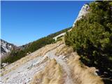 39
39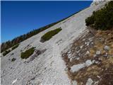 40
40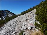 41
41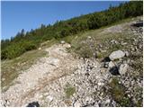 42
42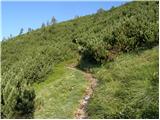 43
43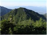 44
44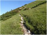 45
45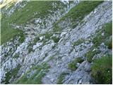 46
46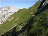 47
47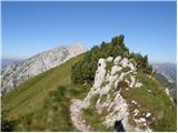 48
48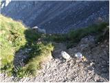 49
49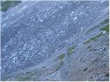 50
50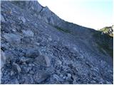 51
51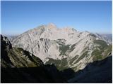 52
52 53
53 54
54 55
55 56
56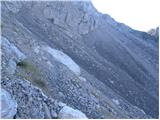 57
57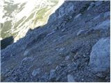 58
58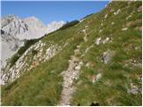 59
59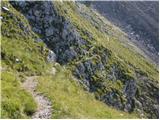 60
60 61
61 62
62 63
63 64
64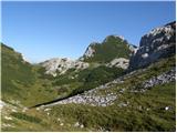 65
65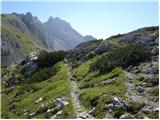 66
66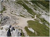 67
67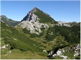 68
68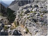 69
69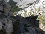 70
70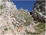 71
71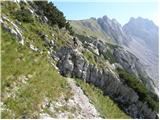 72
72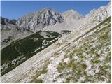 73
73 74
74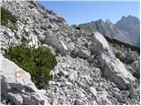 75
75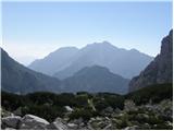 76
76 77
77 78
78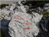 79
79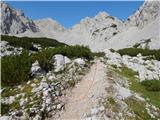 80
80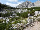 81
81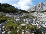 82
82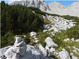 83
83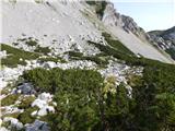 84
84 85
85 86
86 87
87 88
88 89
89 90
90 91
91 92
92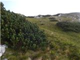 93
93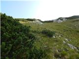 94
94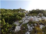 95
95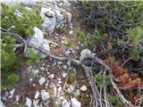 96
96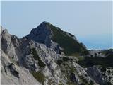 97
97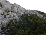 98
98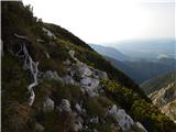 99
99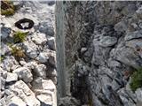 100
100 101
101 102
102 103
103
Discussion about the trail Ljubelj - Srednja peč (via Vatelca or Skleda)