Planina pod Golico - Rosenkogel/Hruški vrh
Starting point: Planina pod Golico (980 m)
| Lat/Lon: | 46,4624°N 14,0488°E |
| |
Time of walking: 2 h 30 min
Difficulty: easy marked way
Altitude difference: 796 m
Altitude difference po putu: 860 m
Map: Karavanke - osrednji del 1:50.000
Recommended equipment (summer):
Recommended equipment (winter): ice axe, crampons
Views: 16.780
 | 1 person likes this post |
Access to the starting point:
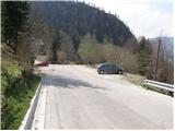
From the motorway Ljubljana - Jesenice take the exit Lipce (also Hrušica) and follow the road in the direction of Jesenice, where the signs for Planina pod Golico direct us to the ascending road (the exit is marked and is located at the health centre in Jesenice). The relatively steep road soon leads us to the above-mentioned village, where in May, in the surrounding meadows, you can admire the bloming of daffodils. Park in one of the car parks at the foot of the Španov vrh ski centre.
Path description:
From the parking lot, continue along the asphalted road, which after a few minutes' walk leads to a marked crossroads, where you continue left down towards Rožce (straight Kahlkogel, right Španov vrh). Continue along the road, which leads past the Church of the Holy Cross to an unmarked crossroads (at the cross), where you continue to the right. The way forward leads past a few houses, and then soon you will see direction signs directing you left on the footpath.
The path continues up the rather muddy cart track, then passes into a dense forest, where it continues along and along cart track. The path, which is less visible in places and which passes through the forest all the time, leads us higher up to a forest road, which we only cross. The ascent continues along the wide cart track, which initially climbs along a clearing before returning to the forest.
The track, which is getting worse, then quickly leads to a small, usually marshy clearing, where it ends.
Here we will notice a rather faded marking to the right, which will direct us to a briefly poorly visible and slightly steeper footpath. Soon, however, the path leads to a broad ridge where it widens. The ascent continues along the ridge, which is surrounded by a grazing fence. Along the grazing fence, we climb only a few 10 steps, and then the markings direct us down to the left.
There follows a folded cross-descent along a path that passes through an initially compacted spruce forest. The path then lays down, crosses two successive streams and leads us to a lesser forest road (the road from Plavški Rovto). Follow the road, which runs partly through the forest and partly through grassy hay fields (the road has a few marked shortcuts), all the way to Jeseniška planina, which offers a beautiful view.
From mountain pasture continue along a moderately steep grassy slope, across which several small paths lead. Higher up, the paths merge and you can see some faded markings along the way. After about 20 minutes of ascent from Jeseniška planina, the path turns to the left, where it enters a short lane of forest. After crossing the slopes of Klek for a few minutes, the path leaves the forest and crosses a somewhat awkward, but not difficult in the dry, passage over a ravine. From the ravine, to the hunting hut at Rožca, there is only a short walk on a very scenic grassy slope. From the hunting lodge, continue along one of the paths that ascends in a cross-country climb to the border ridge between Slovenia and Austria.
Once on the ridge, follow the well-trodden path as it continues westwards (Klek on the right). On the way along the border ridge, instead of Slovenian markings, you will see Austrian markings (markings in the colour of the Austrian flag). Follow this increasingly scenic and easy path, which sometimes climbs quite steeply, all the way to Rosenkogel, where there is a small chapel.
Mountain below Kahlkogel - Jeseniška planina 1:30, Jeseniška planina - Rosenbachsattel 30 minutes, Rosenbachsattel - Rosenkogel 30 minutes.

Pictures:
 1
1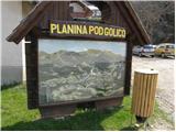 2
2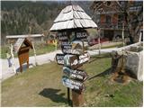 3
3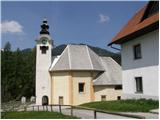 4
4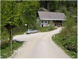 5
5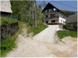 6
6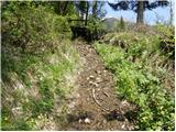 7
7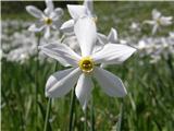 8
8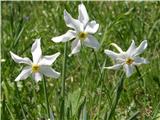 9
9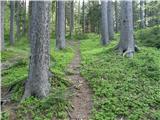 10
10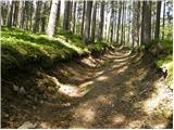 11
11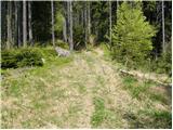 12
12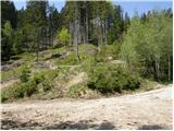 13
13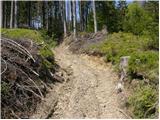 14
14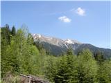 15
15 16
16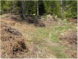 17
17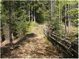 18
18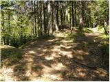 19
19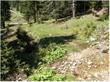 20
20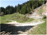 21
21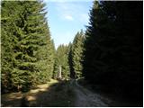 22
22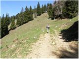 23
23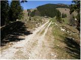 24
24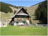 25
25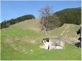 26
26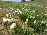 27
27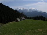 28
28 29
29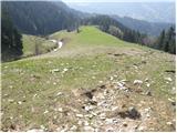 30
30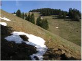 31
31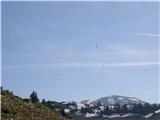 32
32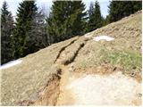 33
33 34
34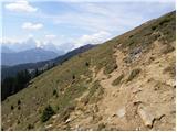 35
35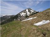 36
36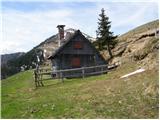 37
37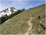 38
38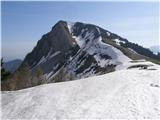 39
39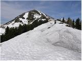 40
40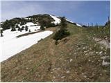 41
41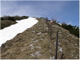 42
42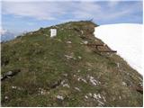 43
43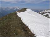 44
44 45
45
Discussion about the trail Planina pod Golico - Rosenkogel/Hruški vrh
|
| superpalčica13. 02. 2011 |
pozdravljeni, zanima me kako je kaj na tej poti s snegom. Hvala že v naprej
|
|
|
|
| Zalas14. 02. 2011 |
Bil v Torek na Dovški babi in ni bilo nobenega problema, ker je južna stran bila po poti kopna. Iz dolške babe smo se spustili tudi na Hruški vrh po grebenu! Bilo je toplo in kopno! Seveda so se včeraj razmere spremenile!
|
|
|
|
| Trox20. 06. 2023 14:10:48 |
Iz tu lahko pot podaljšate na Dovško Babo. Pot se vam podaljša za 40-60min. Je pa lahka, vendar neoznačena. Držite se grebena in nimate kaj zgrešit.
Lp,
D.T.
|
|
|