Koroška Bela - Ajdna (climbing way)
Starting point: Koroška Bela (600 m)
| Lat/Lon: | 46,4264°N 14,1031°E |
| |
Name of path: climbing way
Time of walking: 1 h 30 min
Difficulty: difficult marked way
Altitude difference: 446 m
Altitude difference po putu: 446 m
Map: Karavanke - osrednji del 1 : 50.000
Recommended equipment (summer): helmet, self belay set
Recommended equipment (winter): helmet, self belay set, ice axe, crampons
Views: 9.818
 | 4 people like this post |
Access to the starting point:
From the motorway Ljubljana - Jesenice take the exit Lipce and turn right towards Jesenice. At the first traffic lights (Javornik) turn right in the route Lj. At the second traffic-lighted junction turn left and go under the railway underpass, and at the next smaller junction turn right towards Koroška Bela. Drive into a village in the NE direction, where you can park in a suitable place (e. g. a block of flats near the fire station). You can continue driving.
Path description:
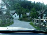
(On foot or by car) find the crossroads in the centre of the village, where the church memorial is located. From here, follow the main road through the village, which makes a slight incline northwards. After about 100 m, cross the bridge over the Bela stream on the right, where you can see the first markings in the vicinity (Stranska cesta). Continue on foot along the asphalt road between two houses (the appearance of a courtyard), which turns right here.
After a short time, before it is laid, and before we see the markings on the trees and the remains of the old "valvasor" sign, we turn off the road onto logging trail on our left. Logging trail, with a small stream running along it, quickly leads to a crossroads, where you continue straight on following the markings. The path leads us past a small spring on the left, uphill to the east, and from here on it climbs only occasionally. Only after about 10 minutes, when it turns left and loses the cart track look, does it become steeper. When the steepness subsides, rejoin the cart track and turn right onto an unmarked, but more used and well-trodden shortcut, which after a few metres turns left, uphill, through the coppice. The path heads eastwards and, higher up, leads again to logging trail, which leads into the forest. Follow it, or the many shortcuts on the right-hand side of the marked path, for some time. When the path starts to look like a forest road, cross the Sevnik stream on the flat. Keep to the widest path. Soon you will reach a crossroads in front of a forest clearing, where you will see the inscription "valvasor" on a tree on the left and an older sign "Ajdna archaeological site" on the right. Turn right into the forest, onto a less visible and marked, partly overgrown path that leads out of the forest through the clearing. Here it disappears a little, and we walk over the slope at more or less the same height to make it easier to follow. The path crosses cart track and descends only slightly. It is followed by a clearing where, among the fallen trees, it can be seen, with a little attention, that the path continues in the same direction, at the same height. It descends and ascends only a few metres at a time. Cross the stream and after a few minutes turn left, slightly downhill, under the north face of Ajdna. The path then ascends to a crossroads at a bench just below the wall. Here, head left towards the saddle between Ajdna and Malo Ajdna, where you will come across a signboard before entering the protected path. Head upwards and you will quickly come across the first rungs, ropes and crampons. We soon reach the top of the protected climbing route, where we turn right to the lookout point with the signing-in book.

Pictures:
 1
1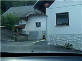 2
2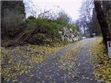 3
3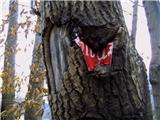 4
4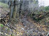 5
5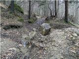 6
6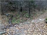 7
7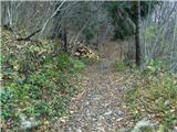 8
8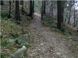 9
9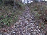 10
10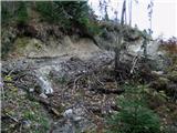 11
11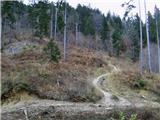 12
12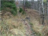 13
13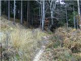 14
14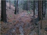 15
15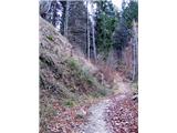 16
16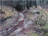 17
17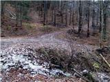 18
18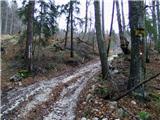 19
19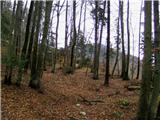 20
20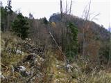 21
21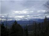 22
22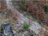 23
23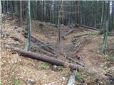 24
24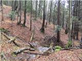 25
25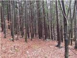 26
26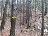 27
27 28
28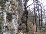 29
29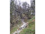 30
30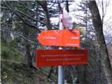 31
31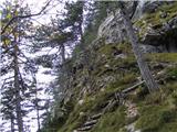 32
32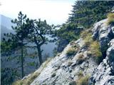 33
33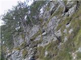 34
34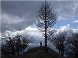 35
35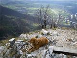 36
36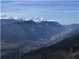 37
37
Discussion about the trail Koroška Bela - Ajdna (climbing way)
|
| heinz9. 05. 2013 |
Popravek 5. stavka od zadaj, pri opisu poti: namesto - " Prečkamo potok in čez nekaj minut zavijemo LEVO, nekoliko navzdol, pod severno steno Ajdne."- ,se stavek glasi pravilno - "Prečkamo potok in čez nekaj minut zavijemo DESNO, nekoliko navzdol, pod severno steno Ajdne.
Torej desno, namesto levo.
Za napako se opravičujem!
|
|
|
|
| matej7126. 04. 2021 22:33:04 |
Po tej poti včeraj. Ker je višje v vasi res malo prostora za parkiranje, sva avto pustila kar pri šoli. Pot se podaljša za kakih 5 do 10 minut. Od table na sliki 19 naprej je pot prehodna, vendar je na njej nekaj podrtega drevja. Za povratek sva ubrala bližnjico od vlake na sliki 3 med hišami navzdol, preko mostička in med bloki nazaj do šole. Od spodaj pot najlažje najdemo tako, da gremo mimo Mercatorja navzgor in po kakih 200 m zavijemo desno (kažipot), med bloki najdemo mostiček-brv in takoj v klanec (kažipot).
|
|
|