Ljubelj - Begunjščica (through the Central gully, snowy approach)
Starting point: Ljubelj (1058 m)
| Lat/Lon: | 46,4324°N 14,2602°E |
| |
Name of path: through the Central gully, snowy approach
Time of walking: 2 h 45 min
Difficulty: very difficult pathless terrain
Altitude difference: 1002 m
Altitude difference po putu: 1002 m
Map: Karavanke - osrednji del 1:50.00
Recommended equipment (summer): helmet
Recommended equipment (winter): helmet, ice axe, crampons
Views: 28.270
 | 1 person likes this post |
Access to the starting point:
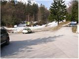
From the Ljubljana - Jesenice motorway, take the Ljubelj exit and follow the road to the border crossing. Just a few metres before the border crossing, the signs for Zelenica direct us to the left and after a further 10 metres the road leads to a parking lot under the Zelenica ski centre.
Path description:
From the parking lot, follow the footpath towards Zelenica, Vertatscha and Stol. The dirt track, which runs along the left-hand side of the ski slope, leads us after about 15 minutes of moderate ascent through the forest to the aforementioned slope along which we then climb. The path, which offers beautiful views of the extensive scree Begunjščica on the left and the ridge Ljubeljščica on the right, then leads us in a gentle ascent to the hut at Vrtača.
From the hut, continue straight along the marked path, which slowly turns slightly to the left and, after a short cross-climb, leads us to lane of dwarf pines. The path then climbs steeply for a short time and then leads to cart track (transport-rescue road), which is then followed in a moderate ascent to the mountain home at Zelenica.
Walking on the ski slope is forbidden when the ski slope is open. At that time, use the winter route, which follows the transport-rescue road.
From the hut on Zelenica, head south towards the north face of Begunjščice. The route is indicated by a wide ravine which narrows in the middle part and widens again higher up. Follow it up to the rock barrier, where it is increasingly closed by the walls on the left and right. There is a short gully on the right and a steep rocky jump on the left. In the middle is a narrow chute which you climb. After a short jump, we come to a slightly wider gully, which widens and widens. To the right, climb up to the shoulder from where you can see the Big Avalanche (Smokuški avalanche). From here you can see the summit, which can be reached in a few minutes.
The slope has a gradient of up to 45°.

Pictures:
 1
1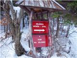 2
2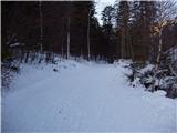 3
3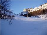 4
4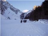 5
5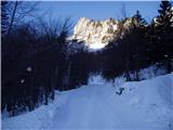 6
6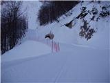 7
7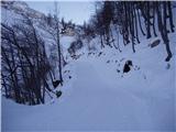 8
8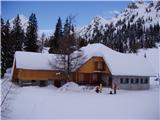 9
9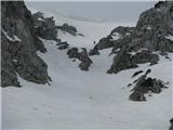 10
10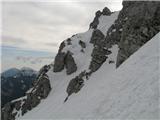 11
11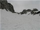 12
12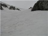 13
13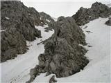 14
14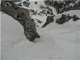 15
15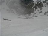 16
16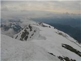 17
17
Discussion about the trail Ljubelj - Begunjščica (through the Central gully, snowy approach)
|
| JusAvgustin10. 12. 2010 |
dons sva jo odpikala. Mau čez 14. uro sva štartala iz Ljubelja, na V. vrhu sva stala točno 15. min pred sončnim zahodom. Nepojemljivo lepo opazovati sončni zahod iz najvišjega vrha obč. Radovljica...  , Ko je sonce popolnoma zašlo sva sestopila po Šentanskem plazu. Turo sva primerno zaključila ob dobrem pivu u "podnu"  Razmere: razen močnega vetra, ki naju je dobesedno prestavljal po centralni in bril v sunkih vso pot so bile razmere idealne! Sneg je sprijet s podlago, se ne predira(razen v zametih), temperatura je bila krepko pod 0, drugače pa fenomenalna pikarija od začetka do konca. Sestopila sva že v popolni temi. Oprema: dereze, cepin, čelada, čelka... Za vas uživala Jože in Juš 
|
|
|
|
| primozs22. 12. 2012 |
dans smo se odpravili na Begunščico.Turno seveda. Snega je malo, za smučanje pa premalo. Sneg je iz grape zelo zelo trd. Stegna so pa pekla kot hudič.Vrhnji del grape je pa smotan. Nepredelan sneg (kašast sneg)se vleče vse do vrha.
|
|
|
|
| gj29. 01. 2015 |
Ramere fantastočne ( škrip, škrip)
|
|
|
|
| subaru7. 04. 2015 |
Včeraj smo se s prijatelji povzpeli po Centralni grapi gor in po Šentanskem plazu dol. Razmere za pešake super. Skok v grapi je lepo zalit. Malo je motil samo močan veter, pred snežno ploho pa smo bili že v koči na Zelenici.
|
|
|
|
| Planinec48. 04. 2015 |
V soboto nameravam na Begunjščico preko centralne grape.. mi samo poveste kakšne so kaj razmere? lp
|
|
|
|
| subaru8. 04. 2015 |
Planinec4 -preberi si prejšni članek.
|
|
|
|
| matej20009. 04. 2015 |
Ja, razmere so super, sem bil včeraj.
|
|
|
|
| Barentoter19. 01. 2016 |
Živjo, zanima me kakšne so kaj razmere v centralni grapi. Ali je že lepo zalita za pikanje?
|
|
|
|
| Barentoter20. 01. 2016 |
Hvala Bojan. Vsaj temperature gredo na roke, če že snega ni dovolj
|
|
|
|
| MiG19. 03. 2017 |
Pozdrav svima. Zanima me kakva je trenutno situacija na Osrednjoj grapi? Hoće li biti moguće penjanje sljedeći vikend, 25.-26.03.2017. i je li opasno zbog plazov?
Hvala!
|
|
|
|
| MiG19. 03. 2017 |
Hvala Bojan. No kiša se predviđa za taj vikend pa sam malo pri oprezu. :/ Što ti kažeš? Ja nisam baš iskusna po pitanju grapa. Ovo bi mi bila prva.
|
|
|
|
| Prefrigan4. 01. 2020 |
Živjo, kakšne so trenutne razmere, je snega dovolj za normalen zimski vzpon? Tu gor pa čez setnjanskega nazaj? Hvala & lp
|
|
|