Bodenbauer - Hochstuhl/Stol
Starting point: Bodenbauer (1052 m)
| Lat/Lon: | 46,4678°N 14,2152°E |
| |
Time of walking: 4 h 30 min
Difficulty: difficult marked way
Altitude difference: 1184 m
Altitude difference po putu: 1300 m
Map: Karavanke - osrednji del 1:50.000
Recommended equipment (summer): helmet
Recommended equipment (winter): helmet, ice axe, crampons
Views: 13.687
 | 2 people like this post |
Access to the starting point:
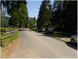
We drive to the Ljubelj border crossing and on to the Austrian side. Shortly after, when you see a small church on the left side of the road, the road to the village of Žabnica / Bodental branches off to the left. At the crossroads after Slovenji Plajberk / Windisch Bleiberg turn left towards Žabnica / Bodental. In Žabnica / Bodental you will reach the mountain signs for Celovška koča / Klagenfurter Hütte to the left and right. Turn left and follow the road to the end of the asphalt, where you will park in the parking lot near the pasture fences.
Path description:
From the parking lot, take the forest road closed to traffic and marked "Marchenwiese". The forest road leads you through the forest on a slight incline to a pleasant meadow, where you will have a nice view of the northern walls of Vertatscha and Palec. Continue across the meadow where the path is more difficult to follow and on the other side look for cart track which goes slightly upwards into the forest. After walking for a few minutes along cart track, the signs direct us to the right onto a footpath which soon crosses a torrent along which it then climbs. The path then follows the torrent slightly to the right and leads us to a small clearing where the waymarked path directs us slightly further to the right. The path continues to climb steeply and after a good 30 minutes' walk leads us to a crossroads where we continue to the left (right Ogrisalm 5 minutes).
The steepness eases here and the path passes out of the forest between dwarf pines. Cross a scree slope and then descend gently downhill with the help of a rope ladder. From here on the path is exposed to falling rocks. Further on, the well-protected path starts to climb up a steep rocky slope. At the top of this easier climbing section, you will come to a sign-in box where you can sign in. The difficulty of the route disappears after this and in a cross-climb you reach the Vrata saddle. The way forward starts to descend and in a few minutes leads us to a crossroads where we continue straight on (right Ovčji vrh) and in a few minutes of gentle descent we reach the Celovška hut.
At the hut, turn left in the direction of the Prešernova hut on Hochstuhl. The way forward first crosses grassy slopes and then descends gently to an unmarked saddle. The way ahead begins to climb steeply on scree to a slightly overgrown part of the path. A little further on, a steel cable helps us to cross a steeper slope, but this part of the path does not cause us any problems on land. Next, we climb up the scree again all the way to the border.
At the saddle, we turn to the Slovenian side, where we continue along the path that starts to descend (Svačica on the left). After this descent, join the path coming from the Ljubelj border crossing and from the Završnice valley. Continue right along the path, which leads us in a gently sloping ascent to a larger scree below Celovška špica (2105m). The path then climbs over a relatively steep scree slope and leads us to an undistinguished saddle between the Small and Large Hochstuhl. Here we continue to the right (left Prešernova koča 10 minutes) in the direction of the Stol, the top of which we reach after 10 minutes of further walking.
Starting point - Klagenfurter Hutte 2:15, Klagenfurter Hutte - Hochstuhl 2:15.

Pictures:
 1
1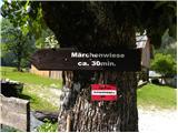 2
2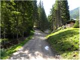 3
3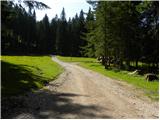 4
4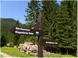 5
5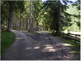 6
6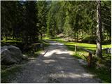 7
7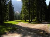 8
8 9
9 10
10 11
11 12
12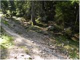 13
13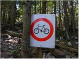 14
14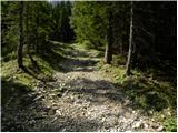 15
15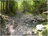 16
16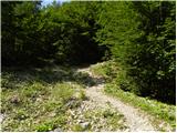 17
17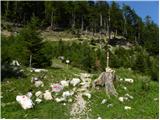 18
18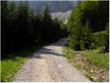 19
19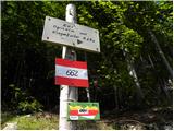 20
20 21
21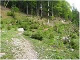 22
22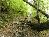 23
23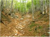 24
24 25
25 26
26 27
27 28
28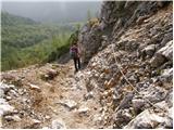 29
29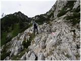 30
30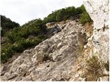 31
31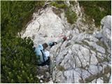 32
32 33
33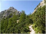 34
34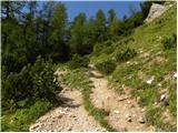 35
35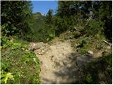 36
36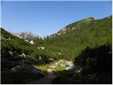 37
37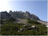 38
38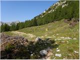 39
39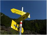 40
40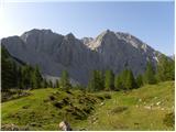 41
41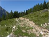 42
42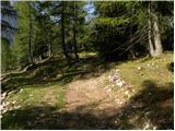 43
43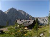 44
44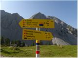 45
45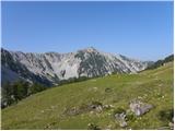 46
46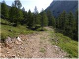 47
47 48
48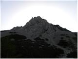 49
49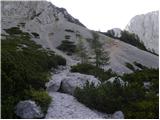 50
50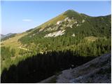 51
51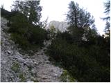 52
52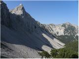 53
53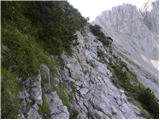 54
54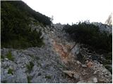 55
55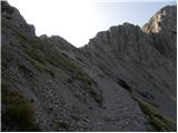 56
56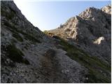 57
57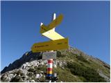 58
58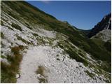 59
59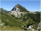 60
60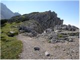 61
61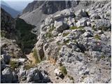 62
62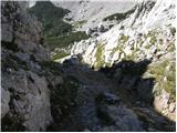 63
63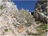 64
64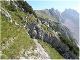 65
65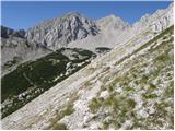 66
66 67
67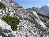 68
68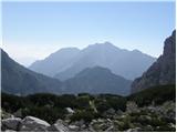 69
69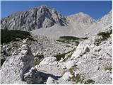 70
70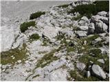 71
71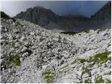 72
72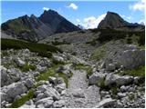 73
73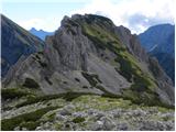 74
74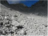 75
75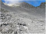 76
76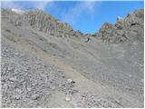 77
77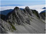 78
78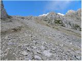 79
79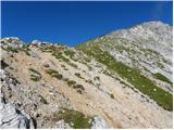 80
80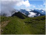 81
81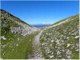 82
82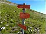 83
83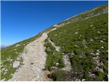 84
84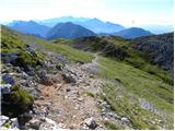 85
85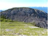 86
86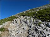 87
87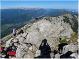 88
88 89
89
Discussion about the trail Bodenbauer - Hochstuhl/Stol
|
| malci426. 08. 2008 |
Lep, ne prezahteven izlet. Za spust priporočam ljubiteljem melišč nemarkirano stezo mimo Celovške koče. Tik pred planinskim mejnim prehodom zavijemo desno pod vrhom Svaščice, in po nekaj minutah si že na melišču, ki te po korakih pripelje vse do doline. Za spust z vrha do doline sem potreboval 2h10min, za vzpon pa 4h15min
lp
Uroš
|
|
|
|
| TinaIztok4. 10. 2011 |
Zdravo,
Uroš (malci4) oz. kdo drug, a ta pot, ki jo predlagaš za nazaj, a si to mislil tako, da na sedelcu na meji (tam, kjer iz Celovške koče pri poti navzgor prvič prideš do meje) nazaj navzdol ne zaviješ navzdol proti Celovški koči ampak greš desno pod Svaščico in potem, ko prideš mimo poti na vrh Svaščice zaviješ navzdol v dolino po malce bolj strmi poti, tako da imaš na levo vrh Svaščice, na desno pa visoke stene, mislim, da Vrtače?
Če je to ta pot, sva ravno ta vikend z ženo razmišljala, da izgleda zelo lepa in razmišljala, da bi se kdaj odpravila po njej.
LP,
Iztok
|
|
|
|
| ZoranV2. 05. 2013 |
Štart pri Podnarju ob šestih zjutraj. Sneg je mehak že od začetka, tako da po manj strmem s krpljami, v strmino pa pač brez. Snega je že zelo malo, tako da spust z vrha ni mogoč. Začel sem s sedla kjer se spustiš v krnico V kožnah. Za board je sneg odličen, edino počasen je ... Iz krnice vzpon nazaj na Belščico in spust v Poden. Nekaj utrinkov v videu. http://www.youtube.com/watch?v=y0SQiZaJBVU Panorama z vrha Stola. Za prve obiskovalce se odpre neka testna panorama kjer klikneš test ali pa skip in pokazal se bo razgled s Stola (vidljivost ne najboljša ...) http://pan0.net/upano.php?id=4870
|
|
|