Bodenbauer - Hochstuhl/Stol (on scree)
Starting point: Bodenbauer (1052 m)
| Lat/Lon: | 46,4678°N 14,2152°E |
| |
Name of path: on scree
Time of walking: 4 h
Difficulty: easy pathless terrain, easy marked way
Altitude difference: 1184 m
Altitude difference po putu: 1250 m
Map: Karavanke - osrednji del 1:50.000
Recommended equipment (summer):
Recommended equipment (winter): ice axe, crampons
Views: 4.639
 | 1 person likes this post |
Access to the starting point:
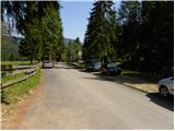
From the motorway Ljubljana - Jesenice, take the exit Ljubelj (Tržič) and then continue in the direction of Klagenfurt / Klagenfurt. After the Ljubelj tunnel, the road starts to descend and we follow it to a junction where the road to the Poden valley / Bodental branches off to the left. Take the road mentioned above, which then leads you through Slovenji Plajberk / Windisch Bleiberg and higher up to Žabnica / Bodental. Follow the road to the end of the tarmac by the Podnart / Bodenbauer guesthouse, where you can park at a suitable roadside parking place.
Path description:
From Podnart near which you park on the widened road, take the macadam forest road closed to public traffic in the direction of Mlake / Märchenwiese and Klagenfurter Hutte / Klagenfurter Hütte. The road, which begins to climb gently, soon leads us to the first crossroads, where a path branches off to the right towards the farm Vgriz / Ogrisbauer, and we continue straight on in the direction of the Klagenfurt hut. The road goes a little further into the forest and splits into two parts. Take the marked road to the left, and after about 30 minutes' walk from the starting point, it leads to Mlaka (a flat, spacious and scenic meadow).
Here the road turns slightly to the right, and we continue straight ahead on a parallel, but slightly less visible, marked path that continues across the meadow. On the other side of the meadow, the path returns to the woods and gradually begins to climb moderately. After a short climb, we reach a small crossroads where a touring-skiing path branches off to the left, and we continue straight ahead along a small torrential gully. A few 10 steps higher, the marked path turns right and we continue along the torrent, following a fainter path, which turns left a little further on and climbs through the lane of dwarf pines to the vast scree below Vertatscha. Here the track disappears and we continue along the lower part of the scree, where here and there we see some cairn. We continue to climb along the lower part of the scree below Vertatscha for a while, and then a nice passage opens up on our right to the slopes below Bielschitza. After a short cross-climb to the right, you will come to a fainter but clearly visible path that continues to climb between the scree and the dwarf pines belt. Continue your ascent along the above-mentioned path, from which you will have increasingly beautiful views of the surrounding peaks. Higher up, the track starts to disappear on the scree below Bielschitza, and if we are careful we can find a barely visible track on the right which starts to climb crosswise to the right. Further on, we climb over steeper, partly grass-covered scree, which ends, or rather begins, below the cliffs of Svacica. When you reach the lower edge of the cliffs, join the unmarked path leading from the Vrata / Matschatcher Sattel pass towards the Belščica saddle (the path that bypasses Bielschitza on the left east side). Follow this path to the left, while we climb up it over sometimes quite steep slopes. Higher up, the path flattens out and changes from scree to less steep grassy slopes, over which we climb to the border with Slovenia. Continue straight ahead (right Bielschitza, left Vertatscha) along the initially gently sloping path, from which a few 10 metres further to the right branches off a marked path to Svačico. Continue slightly left here and over a slightly steeper slope descend in a few 1o steps to the Belščica saddle, where there is a marked crossroads.
From the Belščica saddle continue left in the direction of Vertatscha, Prešernova hut and Zelenica (Celovška hut on the right). Cross the grassy slopes for a few minutes and then reach a point where the path to Vertatscha branches off to the left and we continue straight down. The path ahead descends steeply down a ravine at first, then turns to the right, where it passes onto vast scree fields, over which it climbs cross-country. Higher up, we leave the scree and descend gently to a nearby crossroads, where we join the upper and lower paths and the path from Završnice.
Here we continue straight on, and the path gradually moves from the valley between Srednja peč 1920 m (Srednja peč is the lesser-known peak on the left) and the Orlice ridge (Orlice is the more difficult to reach ridge between the Belščica saddle and Stolo) to a larger scree slope, over which we climb cross-climbing to the right, and then the path gradually changes to a steeper valley between Mali Stol on the left and Stolo on the right. Here the path climbs steeply, then gradually lays down and leads us to a marked crossroads, where a path branches off to the left to the nearby Prešernova hut, which is 5 minutes away, and we continue to the right and in 10 minutes of further walking we climb to the highest peak of the Karavanke Mountains.

Pictures:
 1
1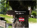 2
2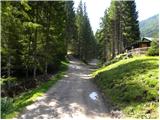 3
3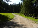 4
4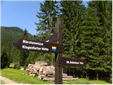 5
5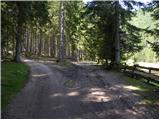 6
6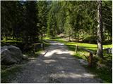 7
7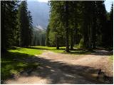 8
8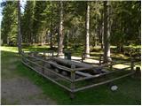 9
9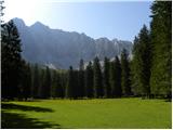 10
10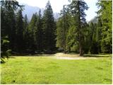 11
11 12
12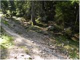 13
13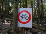 14
14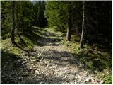 15
15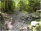 16
16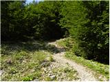 17
17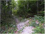 18
18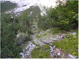 19
19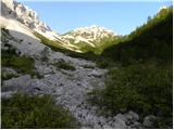 20
20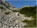 21
21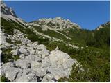 22
22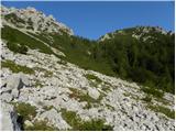 23
23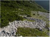 24
24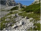 25
25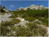 26
26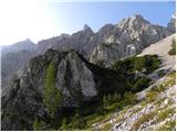 27
27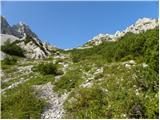 28
28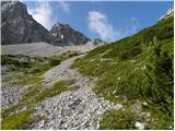 29
29 30
30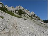 31
31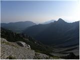 32
32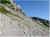 33
33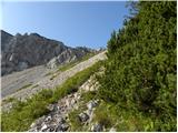 34
34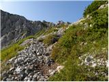 35
35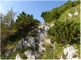 36
36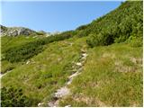 37
37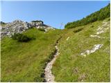 38
38 39
39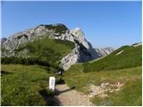 40
40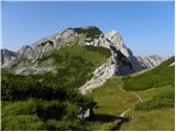 41
41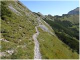 42
42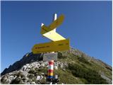 43
43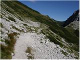 44
44 45
45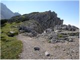 46
46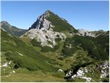 47
47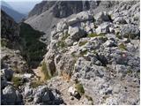 48
48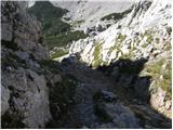 49
49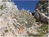 50
50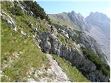 51
51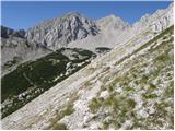 52
52 53
53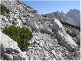 54
54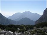 55
55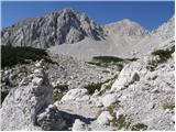 56
56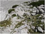 57
57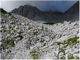 58
58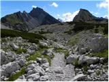 59
59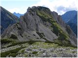 60
60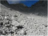 61
61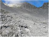 62
62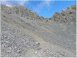 63
63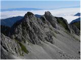 64
64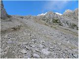 65
65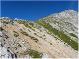 66
66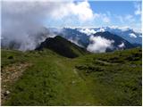 67
67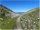 68
68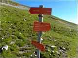 69
69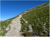 70
70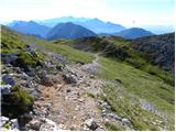 71
71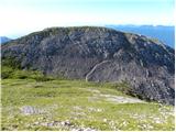 72
72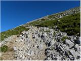 73
73 74
74 75
75
Discussion about the trail Bodenbauer - Hochstuhl/Stol (on scree)