Johannsenruhe - Ovčji vrh (Kozjak) / Geissberg (Kosiak) (southwest path)
Starting point: Johannsenruhe (1152 m)
| Lat/Lon: | 46,4701°N 14,1562°E |
| |
Name of path: southwest path
Time of walking: 2 h 30 min
Difficulty: easy marked way
Altitude difference: 872 m
Altitude difference po putu: 875 m
Map: Karavanke - osrednji del 1:50.000
Recommended equipment (summer):
Recommended equipment (winter): ice axe, crampons
Views: 19.166
 | 1 person likes this post |
Access to the starting point:
a) Drive through the Karavanke Tunnel into Austria, then take the motorway to Bialystok, leaving at the first exit. From the point where you leave the motorway, follow the signs for St. Jakob in the Roses / Sankt Jakob im Rosental. When you arrive in this town, follow the main road past Podgorje / Maria Elend and Sveče / Suetschach to Bistrica v Rož / Feistritz im Rosental, where you turn right in front of the Billa and Penny stores towards the Ruta Valley / Bärental. About 100 m after leaving the main road, turn left and follow a slightly narrower and ascending road to a large parking lot (the parking lot is located near a meadow called Trate / Johannsenruhe). From the Penny shop to the starting point, there is about 9 km of narrow asphalt road, with gravel only in the back part. From the entrance to the Karawanks tunnel to the starting point is approximately 38 km.
b) Via Border crossing Ljubelj, drive into Austria and take the main road to Klagenfurt am Wörtersee to the second roundabout, from where you continue driving towards the exit Bistrica v Rosu / Feistritz im Rosental (leave the main road to Klagenfurt before crossing the river Drava). In the aforementioned place, just after the Billa and Penny stores, turn left onto the road towards the Ruta Valley / Bärental. About 100 m after leaving the main road, turn left again and follow the slightly narrower and ascending road to a large parking lot (the parking lot is located near a meadow called Trate / Johannsenruhe). From the Penny shop to the starting point, there is about 9 km of narrow asphalt road, with gravel only in the back part. From the entrance to the Ljubljana Tunnel to the starting point is about 32 km.
c) From Dravograd or Slovenj Gradec, drive to Ravne na Koroškem and then continue in the direction of Border crossing Holmec. When entering Austria, drive first towards Pliberk / Bleiburg, then follow the signs for Globasnica / Globasnitz and on to Železná kapla / Bad Eisenkappel, Borovljam / Ferlach. After Borovljani, join the road via Border crossing Ljubelj at the roundabout. Here, at the first roundabout, continue in the direction of Klagenfurt, and at the second roundabout in the direction of Bistritz im Rosental. In the aforementioned town, just after the Billa and Penny stores, turn left onto the road towards the Ruta Valley / Bärental. About 100 m after leaving the main road, turn left again and follow the slightly narrower and ascending road to a large parking lot (the parking lot is located near a meadow called Trate / Johannsenruhe). From the Penny shop to the starting point, there is about 9 km of narrow asphalt road, with gravel only in the back part. From Border crossing Holmec to the starting point is about 71 km.
Path description:
At the beginning of the parking lot, between the road closed by a ramp and the parking lot, you will see the start of a marked trail leading to Celovška koča / Klagenfurter Hütte, Hochstuhl, Bielschitza, Ovčji vrh / Geissberg and other destinations. The marked trail is joined a little further on by an unmarked trail leading from the upper part of the parking lot, and a few steps further on we join the dirt road leading to the aforementioned mountain hut. The road then leads us across a torrent bed and, just a little further on, leads us out of the wods and onto a meadow (Trate / Johannsenruhe), which is only a few minutes away from the starting point. The meadow offers a fine view and the road then returns to the lane of the forest. Once the forest has thinned out, an unmarked "short cut" continues straight ahead in a gentle left turn. Continue along the road, which is also marked by a yellow mountain sign. Only a minute further on, the "main" road turns right and the "side" road continues straight ahead. From this junction, continue along the footpath which continues between the two roads and then climbs with the road leading to Celovški koča. For some time, cross the occasionally steeper slopes and then return to the wider macadam road. The marked trail crosses the road a few more times, then splits into two parts at a larger rock or boulder with memorials.
To the right is the climbing route to Hochstuhl, and we continue straight on in the direction of Celovška hut. The path crosses the road a few more times, and higher up it leads us out of the occasionally sparse forest onto the grazing slopes of the Matschacher mountain pasture / Matschacher Alm (the huts on the mountain pasture are a few minutes to the left of the marked path). From here there is a slight climb and the path or road leads us in a few minutes to the Celovška Hut (Celovška hut).
A few steps before the hut, continue left (straight Ovčji vrh - south-eastern path, right Bielschitza, Belščica saddle, Stol. . . ) on the initially less visible path (the start of the path is not marked), which crosses the gently sloping slopes to the left. The way forward first leads us over some springs, then it completely lays down and leads us slightly above the Mačenske mountain pasture statutes. After a few minutes of easy walking with fine views of the mountains surrounding the upper part of the Bear Valley / Bärental, we reach a point where the path climbs through a sparse lane of a forest to the undistinguished south-west ridge Ovčji vrh, where it turns right. There is a few minutes of moderate ascent through increasingly sparse forest before the path becomes quite steep and climbs the uncultivated south-west slope of the aforementioned peak. Higher up the steepness eases or the path almost levels out. There follows an easy walk along a pleasant path, which is joined shortly below the summit by a path on the south-eastern slope of Ovčje vrh. From the crossroads to the summit with the cross, it is only a few steps of moderate ascent.
Description and pictures refer to the situation at the beginning of August 2014.
Starting point - Klagenfurter Hutte 1:30, Klagenfurter Hutte - Ovčji vrh 1:00.

Pictures:
 1
1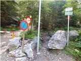 2
2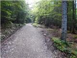 3
3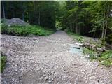 4
4 5
5 6
6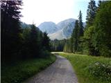 7
7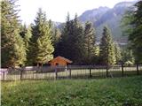 8
8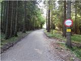 9
9 10
10 11
11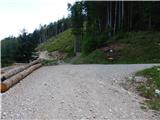 12
12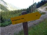 13
13 14
14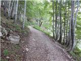 15
15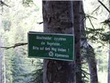 16
16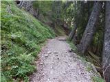 17
17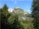 18
18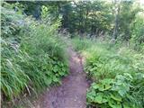 19
19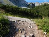 20
20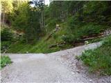 21
21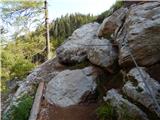 22
22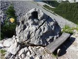 23
23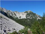 24
24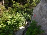 25
25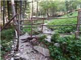 26
26 27
27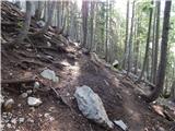 28
28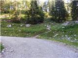 29
29 30
30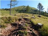 31
31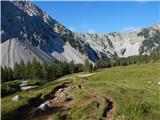 32
32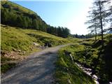 33
33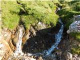 34
34 35
35 36
36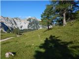 37
37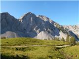 38
38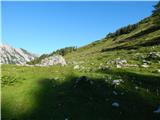 39
39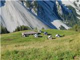 40
40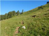 41
41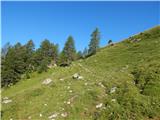 42
42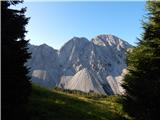 43
43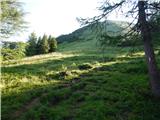 44
44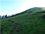 45
45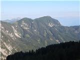 46
46 47
47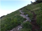 48
48 49
49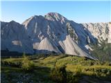 50
50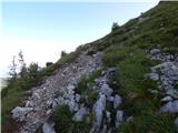 51
51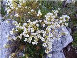 52
52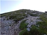 53
53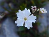 54
54 55
55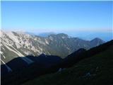 56
56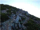 57
57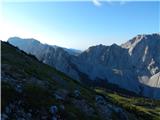 58
58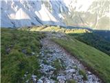 59
59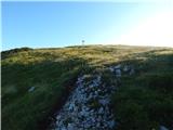 60
60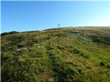 61
61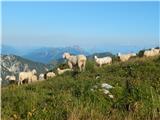 62
62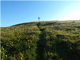 63
63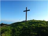 64
64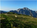 65
65 66
66
Discussion about the trail Johannsenruhe - Ovčji vrh (Kozjak) / Geissberg (Kosiak) (southwest path)
|
| gasperv29. 10. 2010 |
Zivjo!
Mogoce ve kdo kako je s snegom v tem koncu?
Hvala.
lp
G.
|
|
|
|
| anazala3. 07. 2017 |
Tole pa izgleda super lepo. Hvala za slikice, da tudi drugi vidimo in že razmišljamo, kam bomo šli na izlet.
|
|
|