Ljubelj - Bielschitza/Svačica (upper path)
Starting point: Ljubelj (1058 m)
| Lat/Lon: | 46,4324°N 14,2602°E |
| |
Name of path: upper path
Time of walking: 4 h 20 min
Difficulty: partly demanding marked way
Altitude difference: 895 m
Altitude difference po putu: 1060 m
Map: Karavanke - osrednji del 1:50.000
Recommended equipment (summer):
Recommended equipment (winter): ice axe, crampons
Views: 9.059
 | 2 people like this post |
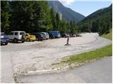
Access to the starting point:
From the Ljubljana - Jesenice motorway, take the Ljubelj exit and follow the road to the border crossing. Just a few metres before the border crossing, the signs for Zelenica direct us to the left and after a few 10 metres of further driving, the road leads to a parking lot under the Zelenica ski centre.
Path description:
From the parking lot, follow the marked footpath towards Zelenica, Vertatscha and Hochstuhla. The path initially leads along the moderately steep cart track, which climbs through the forest, then turns slightly to the right and leads out of the forest onto the ski slope. The ascent continues along the ski slope, which offers beautiful views of the Begunjščica wall and scree, with the ridge of Ljubeljšice on the right. The trail, which continues on a worse road, takes us only a little higher to Koča Vrtača, where chairlift Zelenica I ends and chairlift Zelenica II begins. Here the transport and rescue road turns sharp right, and we continue straight on in the direction of Zelenica, following the initially still sloping, then steeper path that climbs up the ski slope. Climbing higher, we pass through a rare lane of dwarf pines and then return to the road. Continue on the minor road, then, as the road turns left, continue right on a steep footpath which returns to the road just below the top station of the single-seater Zelenica II. From here there is a short descent and the path leads to Doma na Zelenica.
Just before the lodge, a path branches off to the left, leading to Begunjščica and Roblek's lodge, and we continue to the left after the lodge and start climbing alongside the Ciciban children's ski lift. Somewhere in the middle of the ski lift we reach a small crossroads, where we continue to the right over the ski slope (straight ahead Koča pri izviru Završnice, Srednji vrh and Hochstuhl - the lower path). On the other side of the Ciciban ski slope the path goes into a narrow lane of a forest, after which you reach the next lift. Cross this ski slope as well, and then, by a small boulder, find the continuation of the marked trail leading to Vertatscha and Hochstuhl. The trail continues along the slopes below the ridge of Na Možeh, then descends slightly and leads to a point where an unmarked trail branches off to the right into the valley of Suhe dwarf pines and Palcu (there is a smaller cairn at the crossroads). Beyond the crossroads, the trail gradually transitions to the slopes of Vertatscha, over which it climbs mostly cross-climbing. Higher up, an unmarked path from Koča pri izviru Završnice joins us from the left, and we continue straight on to the next marked crossroads. At the crossroads, the path to Vertatscha branches off slightly to the right and towards Hochstuhl and Bielschitza via Vatelka or the Bowl, and we continue straight on the lower path, which crosses lane of dwarf pines and raspberry groves. After a few minutes of further walking we arrive at the next crossroads, where we can go left downhill in a few minutes to the Šija saddle, from where the lower trail leads to Hochstuhl, to the right branches off a worse trail towards Vertatscha (the latter joins the above-mentioned marked trail a little higher up), and we continue straight on again, this time over occasionally steeper grassy slopes, interrupted by a few less-steep gullies. The crossing of the grassy slopes soon ends, and the path leads us to a steep gully, through which we start to descend on a path that is broken and in some places dangerous for slipping. When the gully ends, the path passes onto a scree slope, over which it descends crosswise under the cliffs to cirque in Kožne. Here the path starts to climb again, and the lower path and the path from Završnice join us on the left.
Continuing straight ahead, the path continues past several large boulders. A shorter, slightly steeper climb follows and we arrive at a crossroads where the path to Klagenfurter Hutte and Svačićica branches off to the right.
Continue in the direction mentioned above (slightly left Hochstuhl), where you will quickly reach the vast scree fields below the Orlice ridge. Cross the scree in a north-easterly direction and then reach a small ravine where you turn left. Continue up the ravine, through which a steep and in some parts slightly damaged path leads. The gully ends quickly and the path is laid on grassy slopes next to the Vatelca or Skleda sinkhole. Here the path to Vertatscha branches off to the right, or joins the path over Vatelca or Skleda, and we continue straight to the nearby Belščica saddle, where there is a marked crossroads.
From this crossroads, where there are Austrian mountain direction signs, we continue to the right (straight down Celovška koča / Klagenfurter Hütte) in the direction of Bielschitza (on the Bielschitza sign). The way forward first crosses the slopes to the right, and then leads us to the ridge of Svačice. Here continue slightly left and continue along the initially still gently sloping ridge. Some 10 metres higher, the path, which continues along the ridge, starts to climb very steeply. We continue to climb steeply along a ridge which is slightly precipitous in places, but as we have lane of dwarf pines on the right-hand side at all times, the climb does not present us with any major problems. Higher up, the ridge narrows and a slightly less steep unmarked path joins from the right. There follows a short, folded climb along a ridge that is exposed in places, and the path leads us to a scenic and precipitous summit.

Pictures:
 1
1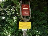 2
2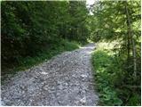 3
3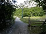 4
4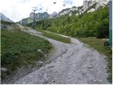 5
5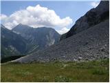 6
6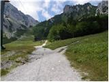 7
7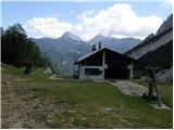 8
8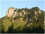 9
9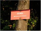 10
10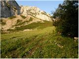 11
11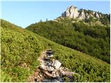 12
12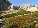 13
13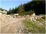 14
14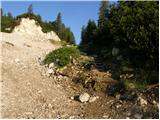 15
15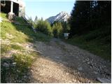 16
16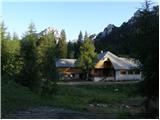 17
17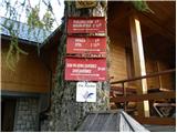 18
18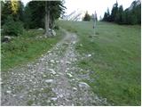 19
19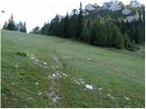 20
20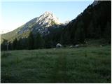 21
21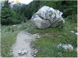 22
22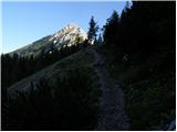 23
23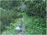 24
24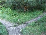 25
25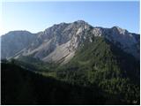 26
26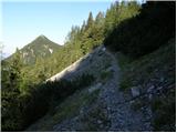 27
27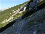 28
28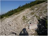 29
29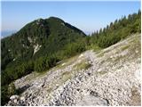 30
30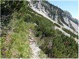 31
31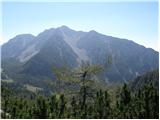 32
32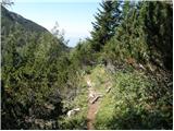 33
33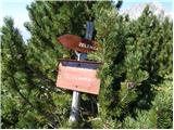 34
34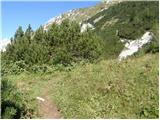 35
35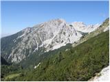 36
36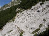 37
37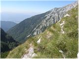 38
38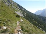 39
39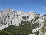 40
40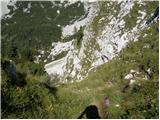 41
41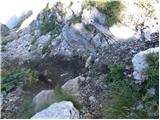 42
42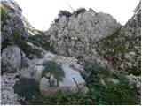 43
43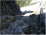 44
44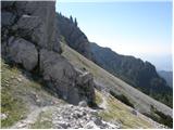 45
45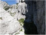 46
46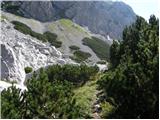 47
47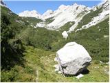 48
48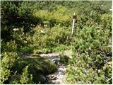 49
49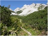 50
50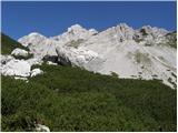 51
51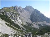 52
52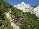 53
53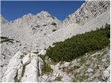 54
54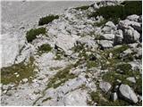 55
55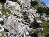 56
56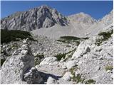 57
57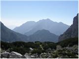 58
58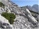 59
59 60
60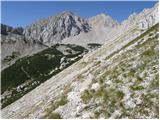 61
61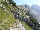 62
62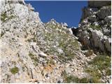 63
63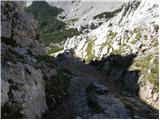 64
64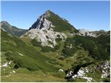 65
65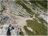 66
66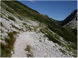 67
67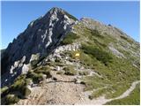 68
68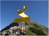 69
69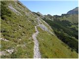 70
70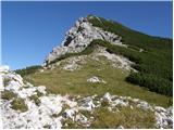 71
71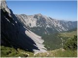 72
72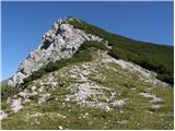 73
73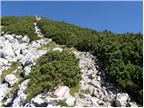 74
74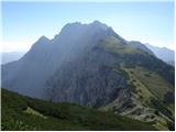 75
75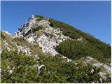 76
76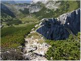 77
77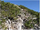 78
78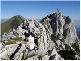 79
79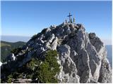 80
80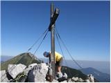 81
81 82
82
Discussion about the trail Ljubelj - Bielschitza/Svačica (upper path)
|
| robter15. 07. 2011 |
za ljubitelje žigov je v vpisni skrinjici poleg zvezka tudi žig
|
|
|
|
| Kriška29. 08. 2012 |
V zvezi s pristopom na vrh mi nekaj ni jasno: ne glede na to, po kateri poti (grebenski ali tisti, ki se vzpenja med rušjem po sredini pobočja), je zadnja slika, kjer je še nekaj metrov do križa na vrhu, enaka. Pri nobenem od opisov pristopov ni vidno, da bi se obe poti pred tem združili. Mi lahko pojasni kdo, ki je že prehodil to pot, ali opisovalec poti?
|
|
|
|
| klm29. 08. 2012 |
Obe stezici se združita tik pred vršnim skalnim grebenom. Nato pa po ozki grebenski rezi na vitek vrh, kot je razvidno na sliki.
|
|
|
|
| VanSims29. 08. 2012 |
Konkretno: vse poti iz Avstrije in Slovenije peljejo do sedla Belščica. Od tam je na vrh še 15 min. Tik pred vrhom je še kratek izpostavljen greben.
Druge markirane poti na vrh ni.
|
|
|
|
| Kriška30. 08. 2012 |
Hvala "klm", prav tega podatka (združitev stez) nisem nikjer zasledila.
VanSims, najbrž imaš prav, saj se mi zdi, da stezica, ki poteka po sredini pobočja ni markirana.
|
|
|
|
| ben30. 08. 2012 |
@Kriška: verjetno res ni markirana, je pa precej bolj prijazna za kolena v sestopu.  LP B
|
|
|
|
| Kriška30. 08. 2012 |
@Ben, tudi tvoj komentar je zame nadvse koristen - moja kolena že nekaj let precej protestirajo pri zelo strmih spustih. 
|
|
|
|
| Jst_Me20. 08. 2014 |
Zelo lep hribček, ki pa je v bistvu visok 1958 m. Vsaj sodeč po napisu na vrhu in žigu.
|
|
|
|
| klm21. 08. 2014 |
Jst me: to je izmera osterreicherjev, slovenska je pač taka, kot je navedena zgoraj. Sicer pa to ni edino odstopanje v izmeri kot med državama. V verigi karavanških vrhov je plejada takih, ki imajo različni koti...
|
|
|