 | Rudno polje - Viševnik
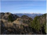
Viševnik is a 2050 m high mountain rising north-west of Rudno polje on Pokljuka. From the top of the peak where the stamp is located, you have a ...
2 h |
 | Pri Rupah - Mrežce (direct way)
Mrežce is a prominent peak near Lipanski vrh which can be seen on the other side of the ravine between the two peaks. As the slopes towards Poklj...
1 h 40 min |
 | Planina Zajavornik - Mrežce
Mrežce is a prominent peak near Lipanski vrh which can be seen on the other side of the ravine between the two peaks. As the slopes towards Poklj...
1 h 55 min |
| Šport hotel - Mrežce
Mrežce is a prominent peak near Lipanski vrh which can be seen on the other side of the ravine between the two peaks. As the slopes towards Poklj...
2 h 40 min |
 | Planina Zajavornik - Mrežce (gentle path)
Mrežce is a prominent peak near Lipanski vrh which can be seen on the other side of the ravine between the two peaks. As the slopes towards Poklj...
2 h |
 | Pri Rupah - Lipanski vrh
The summit is located above Blejska koča on the mountain pasture of Lipanca. From the summit, which descends precipitously towards the Krma valle...
1 h 45 min |
 | Pri Rupah - Debela peč
Debela peč is a 2014 m high mountain that rises steeply above the Krma valley on one side and descends gently towards the vast Pokljuka forests o...
2 h 15 min |
 | Planina Zajavornik - Debela peč
Debela peč is a 2014 m high mountain that rises steeply above the Krma valley on one side and descends gently towards the vast Pokljuka forests o...
2 h 30 min |
 | Pod Luknjo - Črna prst
On the northern slope of the Črna prst summit head, you can see the black soil from which the mountain takes its name. Črna prst is known for its...
2 h 30 min |
 | Gozd - Tolsti vrh (via Ježa)
Tolsti vrh, located to the west of Storžič, is also the highest peak of the Kriška Gora, a mountain range rising steeply above the central Gorenj...
2 h 15 min |
 | Gozd - Tolsti vrh (easier path over Kriška gora)
Tolsti vrh, located to the west of Storžič, is also the highest peak of the Kriška Gora, a mountain range rising steeply above the central Gorenj...
2 h 30 min |
 | Dom pod Storžičem - Tolsti vrh
Tolsti vrh, located to the west of Storžič, is also the highest peak of the Kriška Gora, a mountain range rising steeply above the central Gorenj...
2 h |
 | Gozd - Tolsti vrh (steep path over Kriška gora)
Tolsti vrh, located to the west of Storžič, is also the highest peak of the Kriška Gora, a mountain range rising steeply above the central Gorenj...
2 h 30 min |
 | Sviščaki - Snežnik (footpath)
Snežnik or Veliki Snežnik is the highest peak in the near and far surroundings with a height of 1796 m. It offers a beautiful view over most of S...
2 h |
 | Sviščaki - Snežnik (variant through forest)
Snežnik or Veliki Snežnik is the highest peak in the near and far surroundings with a height of 1796 m. It offers a beautiful view over most of S...
2 h |
 | Sežanje - Snežnik
Snežnik or Veliki Snežnik is the highest peak in the near and far surroundings with a height of 1796 m. It offers a beautiful view over most of S...
1 h 40 min |
 | Sviščaki - Snežnik (by road)
Snežnik or Veliki Snežnik is the highest peak in the near and far surroundings with a height of 1796 m. It offers a beautiful view over most of S...
1 h 55 min |
| Grda draga - Snežnik (via Mali Snežnik)
Snežnik or Veliki Snežnik is the highest peak in the near and far surroundings with a height of 1796 m. It offers a beautiful view over most of S...
1 h 55 min |
| Sviščaki - Snežnik (via Mali Snežnik)
Snežnik or Veliki Snežnik is the highest peak in the near and far surroundings with a height of 1796 m. It offers a beautiful view over most of S...
2 h 15 min |
 | Hibje - Dobrča (by road)
Dobrča is a 1634 m high mountain located between Begunje and Tržič. From the top, where the registration box with the stamp is located, we can se...
1 h 45 min |
 | Planina Vodol - Velika Raduha
At 2062 m, Velika Raduha is the highest peak of Raduha, a mountain range rising steeply to the east of Robanov Kot. From the summit, which has a ...
2 h 40 min |
 | Leskovica - Blegoš
Blegoš is a 1562 m high mountain located between Selška and Poljane Sora. From the grassy summit, on which there is a stamp and a registration bo...
2 h 5 min |
 | Tuškov Grič - Blegoš (via Črni vrh)
Blegoš is a 1562 m high mountain located between Selška and Poljane Sora. From the grassy summit, on which there is a stamp and a registration bo...
2 h 45 min |
 | Laze - Blegoš
Blegoš is a 1562 m high mountain located between Selška and Poljane Sora. From the grassy summit, on which there is a stamp and a registration bo...
2 h |
 | Petrovo Brdo - Možic (via Vrh Bače)
Možic is a 1602 m high peak located west of Soriška mountain pasture. It is at the highest point of the peak that there is an old military bunker...
2 h 30 min |
| Petrovo Brdo - Možic (via Lajnar)
Možic is a 1602 m high peak located west of Soriška mountain pasture. It is at the highest point of the peak that there is an old military bunker...
2 h 30 min |
 | Petrovo Brdo - Porezen
Porezen is a 1630 m high mountain located between Davča and Baška Grapa. From the top, where a large NOB monument stands, we have a beautiful vie...
2 h 30 min |
 | Hunting cottage (Davča) - Porezen
Porezen is a 1630 m high mountain located between Davča and Baška Grapa. From the top, where a large NOB monument stands, we have a beautiful vie...
1 h 45 min |
| Cimprovka (Davča) - Porezen (by road)
Porezen is a 1630 m high mountain located between Davča and Baška Grapa. From the top, where a large NOB monument stands, we have a beautiful vie...
2 h 15 min |
 | Raspet - Porezen (on ridge of Cimprovka)
Porezen is a 1630 m high mountain located between Davča and Baška Grapa. From the top, where a large NOB monument stands, we have a beautiful vie...
2 h 45 min |
 | Podhočar - Porezen
Porezen is a 1630 m high mountain located between Davča and Baška Grapa. From the top, where a large NOB monument stands, we have a beautiful vie...
1 h 50 min |
 | Preval Vrh Ravni - Porezen
Porezen is a 1630 m high mountain located between Davča and Baška Grapa. From the top, where a large NOB monument stands, we have a beautiful vie...
2 h 30 min |
| Preval Vrh Ravni - Porezen (via Dom na Poreznu)
Porezen is a 1630 m high mountain located between Davča and Baška Grapa. From the top, where a large NOB monument stands, we have a beautiful vie...
2 h 35 min |
 | Planina pod Golico - Kahlkogel/Golica
Kahlkogel is an unvegetated peak located north of Jesenice. From the top, which has a registration box, there is a beautiful view of the western ...
2 h 10 min |
 | Križovec - Kahlkogel/Golica (via mountain hut)
Kahlkogel is an unvegetated peak located north of Jesenice. From the top, which has a registration box, there is a beautiful view of the western ...
2 h |
| Dom Pristava in Javorniški Rovt - Kahlkogel/Golica (via mountain hut)
Kahlkogel is an unvegetated peak located north of Jesenice. From the top, which has a registration box, there is a beautiful view of the western ...
2 h 45 min |
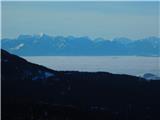
 | Planina Blato - Pršivec
Lookout Mountain is located above Lake Bohinj. The view is extensive on all sides. Triglav and the mountains around it can be seen, and on the ot...
2 h 30 min |
 | end of road on Vogar - Pršivec (via planina Viševnik)
Lookout Mountain is located above Lake Bohinj. The view is extensive on all sides. Triglav and the mountains around it can be seen, and on the ot...
2 h 20 min |
 | Planina Blato - Pršivec
Lookout Mountain is located above Lake Bohinj. The view is extensive on all sides. Triglav and the mountains around it can be seen, and on the ot...
2 h 30 min |
 | Planina Zajavornik - Brda (east path)
Brda is a scenic peak located between Pokljuka and Krma. From the top, where a stamp is attached to a metal pole, we have a beautiful view toward...
2 h 15 min |
 | Pri Rupah - Brda (west path)
Brda is a scenic peak located between Pokljuka and Krma. From the top, where a stamp is attached to a metal pole, we have a beautiful view toward...
2 h |
 | Pri Rupah - Brda (east path)
Brda is a scenic peak located between Pokljuka and Krma. From the top, where a stamp is attached to a metal pole, we have a beautiful view toward...
2 h |
 | Jekarica - Bašeljski vrh
Bašeljski vrh is a 1744 m high mountain located between Mali Grintovec and Storžič. From the top, where there is a bench and a registration box w...
2 h 5 min |
 | Ravne - Frauenkogel/Dovška Baba (footpath)
Frauenkogel is an 1891 m high peak located on the border ridge between Slovenia and Austria. The summit, which has a registration box and a stamp...
1 h 45 min |
| Ravne - Frauenkogel/Dovška Baba (by road)
Frauenkogel is an 1891 m high peak located on the border ridge between Slovenia and Austria. The summit, which has a registration box and a stamp...
1 h 50 min |
 | Erjavčev rovt - Frauenkogel/Dovška Baba (via Brvog)
Frauenkogel is an 1891 m high peak located on the border ridge between Slovenia and Austria. The summit, which has a registration box and a stamp...
2 h 45 min |
 | Tinčkova koča - Srednji vrh (above Završnica) (via Smokuška planina)
Srednji vrh is a scenic and dwarf pines mountain located between Stol, Vertatscha and Begunjščica. From the summit, which descends precipitously ...
2 h |
| Ljubelj - Srednji vrh (above Završnica) (via source of Završnica)
Srednji vrh is a scenic and dwarf pines mountain located between Stol, Vertatscha and Begunjščica. From the summit, which descends precipitously ...
2 h 40 min |
 | Ljubelj - Srednji vrh (above Završnica) (on a slope of Vrtača)
Srednji vrh is a scenic and dwarf pines mountain located between Stol, Vertatscha and Begunjščica. From the summit, which descends precipitously ...
2 h 40 min |
 | Petrovo Brdo - Slatnik (northwestern peak) (via Lajnar)
Slatnik is a scenic mountain located to the west of the Soriška mountain pasture ski resort. The grassy peak offers a beautiful view of the Škofj...
2 h 15 min |
 | Makekova Kočna - Veliki vrh
Veliki vrh is located on the north-west ridge of Koča. The summit is not so overgrown that it offers a very fine view of the neighbouring Kočna. ...
2 h 15 min |
 | Rateče - Ofen/Peč (by road)
Peč (also Tromeja), in Italian Monte Forno and in German Dreiländereck or Ofen, is a 1508 m high peak located on the tri-border between Slovenia,...
2 h |
 | Rateče - Ofen/Peč (footpath)
Peč (also Tromeja), in Italian Monte Forno and in German Dreiländereck or Ofen, is a 1508 m high peak located on the tri-border between Slovenia,...
1 h 40 min |
 | Korensko sedlo - Ofen/Peč
Peč (also Tromeja), in Italian Monte Forno and in German Dreiländereck or Ofen, is a 1508 m high peak located on the tri-border between Slovenia,...
2 h |
 | Fusine Laghi - Ofen/Peč
Peč (also Tromeja), in Italian Monte Forno and in German Dreiländereck or Ofen, is a 1508 m high peak located on the tri-border between Slovenia,...
2 h 15 min |
 | Rateče - Ofen/Peč (eastern path, past bivouac and on footpath)
Peč (also Tromeja), in Italian Monte Forno and in German Dreiländereck or Ofen, is a 1508 m high peak located on the tri-border between Slovenia,...
1 h 45 min |
| Rateče - Ofen/Peč (eastern path, past bivouac and on mule track)
Peč (also Tromeja), in Italian Monte Forno and in German Dreiländereck or Ofen, is a 1508 m high peak located on the tri-border between Slovenia,...
1 h 50 min |
 | Korensko sedlo - Ofen/Peč (on marked path)
Peč (also Tromeja), in Italian Monte Forno and in German Dreiländereck or Ofen, is a 1508 m high peak located on the tri-border between Slovenia,...
2 h |
 | Zgornje Jezersko - Virnikov Grintovec
Virnikov Grintovec is a 1654 m high mountain located north of Jezersko, on the border ridge between Slovenia and Austria. From the top, where the...
2 h 15 min |
| Trögern - Virnikov Grintovec
Virnikov Grintovec is a 1654 m high mountain located north of Jezersko, on the border ridge between Slovenia and Austria. From the top, where the...
2 h 15 min |
 | Rudno polje - Debeli vrh above Lipanca (via Kačji rob)
Debeli vrh is a 1962 m high mountain located in a ridge of mountains rising steeply above the Krma valley. From the top, where a stamp is attache...
2 h 45 min |
 | Planina Zajavornik - Debeli vrh above Lipanca
Debeli vrh is a 1962 m high mountain located in a ridge of mountains rising steeply above the Krma valley. From the top, where a stamp is attache...
2 h 30 min |
 | Grahovše - Bela peč (via Boršt)
The mountain, which is known mainly by climbers, is located north of Storžič on the slopes of Konjščice. From the top there is a beautiful view o...
2 h 30 min |
 | Grahovše - Bela peč (via rot)
The mountain, which is known mainly by climbers, is located north of Storžič on the slopes of Konjščice. From the top there is a beautiful view o...
2 h 30 min |
 | Dom pod Storžičem - Bela peč
The mountain, which is known mainly by climbers, is located north of Storžič on the slopes of Konjščice. From the top there is a beautiful view o...
2 h |
| Dom pod Storžičem - Bela peč (via Javorniški preval)
The mountain, which is known mainly by climbers, is located north of Storžič on the slopes of Konjščice. From the top there is a beautiful view o...
2 h 5 min |
 | Grahovše - Bela peč (via Rekar)
The mountain, which is known mainly by climbers, is located north of Storžič on the slopes of Konjščice. From the top there is a beautiful view o...
2 h 30 min |
 | Na kopiš - Bela peč (via Spodnja and Zgornja Konjščica)
The mountain, which is known mainly by climbers, is located north of Storžič on the slopes of Konjščice. From the top there is a beautiful view o...
2 h |
 | Ravne - Rosenkogel/Hruški vrh (direct way)
Rosenkogel is a 1776 m high mountain located between Frauenkogel and the slightly less known Klek. From the top, where there is a small chapel de...
2 h |
 | Planina pod Golico - Rosenkogel/Hruški vrh
Rosenkogel is a 1776 m high mountain located between Frauenkogel and the slightly less known Klek. From the top, where there is a small chapel de...
2 h 30 min |
 | Ravenska Kočna - Goli vrh (slovenian way)
Goli vrh is a 1787 m high mountain located between the valleys of Ravena and Belska Koča. From the uncultivated summit, on which there is a regis...
2 h 15 min |
 | Ravenska Kočna - Goli vrh (austrian way)
Goli vrh is a 1787 m high mountain located between the valleys of Ravena and Belska Koča. From the uncultivated summit, on which there is a regis...
2 h 30 min |
| Velacher Kotschna/Belska Kočna - Goli vrh
Goli vrh is a 1787 m high mountain located between the valleys of Ravena and Belska Koča. From the uncultivated summit, on which there is a regis...
2 h 45 min |
 | Petrovo Brdo - Kobla
The peak is located in the Lower Bohinj Mountains between Črna prst and Soriška mountain pasture. Just below the peak is a railway tunnel connect...
2 h 15 min |
 | Bohinjsko sedlo - Kobla
The peak is located in the Lower Bohinj Mountains between Črna prst and Soriška mountain pasture. Just below the peak is a railway tunnel connect...
2 h 35 min |
 | Koča pri izviru Soče - Vršič vrh
Vršič is a 1737 m high mountain located between the Postman's House and the Vršič Pass. From the top, where the registration box is located, we h...
2 h 40 min |
 | Zgornja Sorica - Lajnar
Lajnar is a 1549 m high mountain located north of Soriška mountain pasture. From the top, which is also the highest point of the ski resort, we h...
1 h 40 min |
 | Petrovo Brdo - Lajnar
Lajnar is a 1549 m high mountain located north of Soriška mountain pasture. From the top, which is also the highest point of the ski resort, we h...
2 h |
 | Petrovo Brdo - Šavnik
Šavnik is a grassy peak located between the Soriška planina and Kobla ski resorts. From the summit, which has a registration box with a stamp, yo...
2 h 15 min |
 | Javorje - Šija (via Zadnja Suha)
The peak is located above the Vogel ski slope in the Lower Bohinj Mountains. From the top there is a beautiful view of the neighbouring peaks in ...
2 h 30 min |
 | Koča pri izviru Soče - Sovna glava
Sovna glava is a 1750 m high grassy peak located between Prisank and the Vršič Alpine Pass. From the top, you have a beautiful view of the peaks ...
2 h 40 min |
 | Ljubenske Rastke (Vrnivšek) - Smrekovec
Smrekovec is a volcanic mountain on the eastern edge of the Smrekov Mountains. The extensive grassy summit, on which stands a pyramid with a regi...
2 h |
| Ljubenske Rastke (Kumprej) - Smrekovec
Smrekovec is a volcanic mountain on the eastern edge of the Smrekov Mountains. The extensive grassy summit, on which stands a pyramid with a regi...
2 h 10 min |
 | Dom na Smrekovcu - Komen (direct way)
At 1684m, Komen is the highest peak of the Smrekov Mountains, a mountain range bordering Styria and Carinthia. From the top, in good weather, we ...
1 h 55 min |
 | Dolina potoka Žep - Veliki Travnik
Veliki Travnik, or Turnovka as the locals call it, is located on the western edge of the Smrekov Mountains. From the top of the hill, where a woo...
2 h 45 min |
 | Predmeja - Mali Golak
Mali Golak is the highest of the Golaks. It was named not because it was the smallest but because it had the smallest mountain pasture. On the ma...
2 h |
 | Kozarnice - Srednji Golak (via Mali Golak)
Srednji Golak is located between Mali and Veliki Golak on the plateau of the Trnovo Forest above Predmeja. The summit is covered with dwarf pines...
1 h 50 min |
 | Rifugio Nordio - Osternig (Ojstrnik) (direct way)
Osternig) is the easternmost peak in Carnic Alps, exceeding 2000m. It is located on the border between Austria and Itali, near Trbiž (Tarvisio). ...
2 h 10 min |
| Rifugio Nordio - Osternig (Ojstrnik) (via Lom)
Osternig) is the easternmost peak in Carnic Alps, exceeding 2000m. It is located on the border between Austria and Itali, near Trbiž (Tarvisio). ...
2 h 15 min |
| Rifugio Nordio - Osternig (Ojstrnik) (via Sella Pleccia)
Osternig) is the easternmost peak in Carnic Alps, exceeding 2000m. It is located on the border between Austria and Itali, near Trbiž (Tarvisio). ...
2 h 10 min |
 | Johannsenruhe - Ovčji vrh (Kozjak) / Geissberg (Kosiak) (southwest path)
Ovčji vrh or Kozjak, or Geissberg or Kosiak in German, is a 2024 m high peak located north of the main ridge of the Karavanke Mountains. The peak...
2 h 30 min |
| Trate / Johannsenruhe - Ovčji vrh (Kozjak) / Geissberg (Kosiak) (southeast path)
Ovčji vrh or Kozjak, or Geissberg or Kosiak in German, is a 2024 m high peak located north of the main ridge of the Karavanke Mountains. The peak...
2 h 35 min |
 | Planina Kuk - Vogel (direct way)
When you hear the name Vogel, many people first think of the Vogel ski resort, which is located near the peak of the same name. From the north si...
2 h 45 min |
 | Ciganija - Uršlja gora (Plešivec) (winter way)
Uršlja gora or Plešivec is a lookout mountain between Slovenj Gradec and Črna na Koroškem. On the top or just below it stands the Church of St Ur...
2 h 30 min |
 | Koča na Naravskih ledinah - Uršlja gora (Plešivec)
Uršlja gora or Plešivec is a lookout mountain between Slovenj Gradec and Črna na Koroškem. On the top or just below it stands the Church of St Ur...
1 h 45 min |
 | Ciganija - Uršlja gora (Plešivec)
Uršlja gora or Plešivec is a lookout mountain between Slovenj Gradec and Črna na Koroškem. On the top or just below it stands the Church of St Ur...
2 h 15 min |
 | Andrejev dom na Slemenu - Uršlja gora (Plešivec)
Uršlja gora or Plešivec is a lookout mountain between Slovenj Gradec and Črna na Koroškem. On the top or just below it stands the Church of St Ur...
2 h 45 min |
 | Planina Zapleč - Krasji vrh (via Koluji)
Krasji vrh is located between Bovec and Kobarid on the Polovnik mountain ridge. At 1773m, Krasji vrh is also the highest peak of the ridge, offer...
2 h |
| Planina Zapleč - Krasji vrh (via snežna jama)
Krasji vrh is located between Bovec and Kobarid on the Polovnik mountain ridge. At 1773m, Krasji vrh is also the highest peak of the ridge, offer...
2 h |
 | Žabnice / Camporosso in Valcanale - Svete Višarje / Monte Lussari
Svete Višarje is a pilgrimage site for Slavs, Germans and Romans. As early as the 16th century, the mountain was called the God's Way of the Thre...
2 h 30 min |
 | Zadnji travnik - Govca (Olševa)
Govca is the highest peak of the Olševa, a mountain range rising above Koprivna, Solčava and Remschenik (Remschenik / Remschenig is a valley on t...
1 h 45 min |
 | Jezerski vrh - Kärntner Storschitz / Pristovški Storžič
Kärntner Storschitz is an extremely scenic peak above Jezersko. It offers a beautiful view of the northern flanks of the Grintovci Mountains, thr...
1 h 50 min |
 | Trögern - Kärntner Storschitz / Pristovški Storžič
Kärntner Storschitz is an extremely scenic peak above Jezersko. It offers a beautiful view of the northern flanks of the Grintovci Mountains, thr...
2 h |
 | Dolinza Alm/Planina Dolnica - Starhand
Starhand is a scenic peak on the eastern part of Carnic Alps near the better known Ojstrnik. From the top you can enjoy a beautiful view of the J...
1 h 40 min |
| Koutschitz Alm/Kočiška planina - Starhand (by road)
Starhand is a scenic peak on the eastern part of Carnic Alps near the better known Ojstrnik. From the top you can enjoy a beautiful view of the J...
2 h 15 min |
 | Franzbauer - Ferlacher Horn / Grlovec
Ferlacher Horn is a mountain with a large cross on top. From the top, you have a beautiful view of Karawanks, part of the Julian and Carnic Alps....
2 h 15 min |
 | Petrovo Brdo - Krevl
Krevl is a 1515 m high peak located to the south of the Kobla ski area, more precisely between Koble Peak and Kravje Črna Gora. From the summit, ...
2 h 30 min |
 | St. John the Baptist on Ojstrica - Huhnerkogel/Košenjak (via Bivak Piramida)
Huhnerkogel lies north of Dravograd and the River Drava on the border with neighbouring Austria. Huhnerkogel is accessible on foot or by car from...
2 h |
 | Jezero Sobote / Stausee Soboth - Huhnerkogel/Košenjak (po označeni poti)
Huhnerkogel lies north of Dravograd and the River Drava on the border with neighbouring Austria. Huhnerkogel is accessible on foot or by car from...
2 h |
 | Avsa - Monte Mataiur/Matajur
Monte Mataiur is a scenic mountain located on the border between Slovenia and Itali. From the top, you have a beautiful view of the Kobarid or Br...
2 h 30 min |
 | Masseris - Monte Mataiur/Matajur
Monte Mataiur is a scenic mountain located on the border between Slovenia and Itali. From the top, you have a beautiful view of the Kobarid or Br...
2 h 30 min |
 | Rifugio Pelizzo - Monte Mataiur/Matajur (via Ledina)
Monte Mataiur is a scenic mountain located on the border between Slovenia and Itali. From the top, you have a beautiful view of the Kobarid or Br...
2 h |
 | Avsa - Monte Mataiur/Matajur (old path)
Monte Mataiur is a scenic mountain located on the border between Slovenia and Itali. From the top, you have a beautiful view of the Kobarid or Br...
2 h 30 min |
 | Plajberški graben / Bleiberger Graben - Sinacher Gupf / Psinski vrh
Sinacher Gupf (on maps we mostly see the name Psinski vrh) / Sinacher Gupf is a peak located north of the main chain Karawanks, more precisely no...
1 h 35 min |
 | Windisch Bleiberg / Slovenji Plajberk - Singerberg / Žingarica
Singerberg is a peak located on the Austrian side of Karawanks above the village of Slovenji Plajberk / Windisch Bleiberg. The summit, which is p...
2 h |
 | Slovenji Plajberk / Windisch Bleiberg - Singerberg / Žingarica (via saddle Albink / Halbingsattel)
Singerberg is a peak located on the Austrian side of Karawanks above the village of Slovenji Plajberk / Windisch Bleiberg. The summit, which is p...
2 h 20 min |
| Plajberški graben / Bleiberger Graben - Singerberg / Žingarica
Singerberg is a peak located on the Austrian side of Karawanks above the village of Slovenji Plajberk / Windisch Bleiberg. The summit, which is p...
2 h 20 min |
 | Bistriška planina - Šentanski vrh
Šentanski vrh, located in the Dobrča mountain range, only 5 minutes away from the main peak, offers a beautiful view of the central Karawanks, th...
1 h 35 min |
 | Windische Hohe - Kobesnock
Kobesnock is a lesser-known peak located to the west of the massive Dobratsch mountain range. From the summit on which the cross stands, there is...
2 h 45 min |
 | Windische Hohe - Tschekelnock
Tschekelnock in German, Tschekelnock, is a mountain rising steeply above the idyllic mountain village of Venetski hill/Windische Hohe. From the t...
2 h 30 min |
 | Lading - Speikkogel (Saualpe)
Speikkogel is an unmarked peak in the long mountain pasture ridge of the Sow. The expansive summit offers a fine view of the nearby Großer Sauofe...
2 h 25 min |
 | Lading - Großer Sauofen (Saualpe)
Großer Sauofen is one of the most prominent peaks on the mountain pasture of the Sow/Saualpe, due to its position and its short precipitous south...
2 h 30 min |
 | Pri Rupah - Okroglež
Okroglež is a dwarf pines vegetated peak located between Debela peč and Brdy. From the summit, which has a stamp (without a registration book), w...
1 h 55 min |
 | Korensko sedlo - Kamnati vrh/Steinberg (by road)
Kamnati vrh is a 1621 m high mountain located north of Kranjska Gora. The grassy summit, on which the bench is located, is not visible due to the...
2 h |
 | Bukovnik - Lanež
Lanež is a less distinct peak located in the eastern part of Raduha. The spacious peak offers a beautiful view of the nearby Mala Raduha, Olševa,...
2 h 20 min |
 | Planina Kosmačeve Rastke - Lanež (via Durce)
Lanež is a less distinct peak located in the eastern part of Raduha. The spacious peak offers a beautiful view of the nearby Mala Raduha, Olševa,...
2 h 25 min |
| Planina Kosmačeve Rastke - Lanež (east path)
Lanež is a less distinct peak located in the eastern part of Raduha. The spacious peak offers a beautiful view of the nearby Mala Raduha, Olševa,...
2 h 25 min |
 | Koprein-Petzen - Wackendorfer Spitze
Wackendorfer Spitze is the northernmost two-thousander in the Pec mountain range. From this inconspicuous peak, in fine weather, we can enjoy a m...
2 h 30 min |
 | Mangartska planina - Šober / Monte Sciober Grande (via Stože)
Šober is a 1845 m high peak located between Remšendol and the Jezersko Valley. From the top you can enjoy a beautiful view of the nearby Rabeljsk...
2 h 20 min |
 | Prtovč - Gladki vrh (Ratitovec) (via Razor)
Gladki vrh is the most visited peak in the Ratitovec mountain range with an altitude of 1667 m. The uncultivated summit, on which the viewing pla...
1 h 35 min |
| Prtovč - Gladki vrh (Ratitovec) (via Po(v)den)
Gladki vrh is the most visited peak in the Ratitovec mountain range with an altitude of 1667 m. The uncultivated summit, on which the viewing pla...
1 h 35 min |
 | Ledine - Gladki vrh (Ratitovec) (via planina Klom)
Gladki vrh is the most visited peak in the Ratitovec mountain range with an altitude of 1667 m. The uncultivated summit, on which the viewing pla...
1 h 55 min |
| Ledine - Gladki vrh (Ratitovec) (via Kosmati vrh)
Gladki vrh is the most visited peak in the Ratitovec mountain range with an altitude of 1667 m. The uncultivated summit, on which the viewing pla...
2 h 10 min |
 | Bitenjska planina - Gladki vrh (Ratitovec)
Gladki vrh is the most visited peak in the Ratitovec mountain range with an altitude of 1667 m. The uncultivated summit, on which the viewing pla...
2 h 25 min |
 | Prtovč - Altemaver (Ratitovec) (via Razor)
Altemaver is the highest peak of Ratitovec at 1678 m. The grassy peak offers a beautiful view of Julian Alps, Jelovica, Karawanks, Kamnik Savinja...
1 h 50 min |
| Prtovč - Altemaver (Ratitovec) (via Po(v)den)
Altemaver is the highest peak of Ratitovec at 1678 m. The grassy peak offers a beautiful view of Julian Alps, Jelovica, Karawanks, Kamnik Savinja...
1 h 50 min |
| Torka - Altemaver (Ratitovec)
Altemaver is the highest peak of Ratitovec at 1678 m. The grassy peak offers a beautiful view of Julian Alps, Jelovica, Karawanks, Kamnik Savinja...
1 h 35 min |
 | Zgornje Danje - Altemaver (Ratitovec)
Altemaver is the highest peak of Ratitovec at 1678 m. The grassy peak offers a beautiful view of Julian Alps, Jelovica, Karawanks, Kamnik Savinja...
1 h 45 min |
| Bitenjska planina - Altemaver (Ratitovec)
Altemaver is the highest peak of Ratitovec at 1678 m. The grassy peak offers a beautiful view of Julian Alps, Jelovica, Karawanks, Kamnik Savinja...
2 h 30 min |
| Rotek - Altemaver (Ratitovec)
Altemaver is the highest peak of Ratitovec at 1678 m. The grassy peak offers a beautiful view of Julian Alps, Jelovica, Karawanks, Kamnik Savinja...
2 h 30 min |
 | Koprivna (Kumer) - Topitza
Topitza, or Topitza in German, is a 1649 m high peak located northeast of Železna Kapla. From the summit, on which the cross stands, we have a be...
2 h 10 min |
 | Baumgartnerhof - Maloško poldne / Mallestiger Mittagskogel
Maloško poldne or Mallestiger Mittagskogel in German is a 1823 m high peak located on the border between Slovenia and Austria, more precisely bet...
2 h 45 min |
 | Zgornje Danje - Kremant (Ratitovec)
Kremant is a 1654 m high peak located in the western part of Ratitovec. From the top, where a stamp is attached to a metal pole, we have a beauti...
1 h 45 min |
 | Soriška peč - Kremant (Ratitovec)
Kremant is a 1654 m high peak located in the western part of Ratitovec. From the top, where a stamp is attached to a metal pole, we have a beauti...
2 h 30 min |
 | Bohinjsko sedlo - Kremant (Ratitovec)
Kremant is a 1654 m high peak located in the western part of Ratitovec. From the top, where a stamp is attached to a metal pole, we have a beauti...
2 h 45 min |
| Rotek - Kremant (Ratitovec)
Kremant is a 1654 m high peak located in the western part of Ratitovec. From the top, where a stamp is attached to a metal pole, we have a beauti...
2 h 30 min |
 | Forni di Sopra - Clap Varmost
Clap Varmost is a scenic peak located north to north-west of Forni di Sopra. From the top, where there is a cross and a registration box, there i...
2 h |
 | Tuškov Grič - Medrce (by road)
Medrce is a 1410 m high peak located between Porezno and Hum. From the top, where the old bunker is located, we have a beautiful view of Kojca, P...
2 h 20 min |
 | Hebalm (Gasthaus Zur Rehbockhütte) - Weberkogel
Weberkogel is a less prominent peak located north to north-west of the Weinebene Alpine Pass. On the 1805 m high summit is a medium-sized cairn a...
2 h 35 min |
 | Fusine Laghi - Monte Coppa
Kopa (also Kopje on some maps) or after ital. Monte Coppa is a 1496 metres high peak located on the Italian side of the Karavanke Mountains. The ...
2 h |
 | Petrovo Brdo - Slatnik (southeastern peak) (via Lajnar)
Slatnik) is a scenic mountain that rises steeply above Baška Grapa on one side and descends more gently towards Soriška planina on the other side...
2 h 5 min |
 | Pod Peco (Koželj) / Koprein-Petzen (Koschiel) - Špičasti vrh / Spitzberg
Špičasti vrh is a 1551 m high peak located above Marold's mountain pasture / Maroldalm. As the peak is located in a forest, there is no better vi...
2 h 30 min |
 | Žabnice / Camporosso in Valcanale - Florjanka / Monte Florianca
Florjanka is a 1,653-metre-high mountain on the Italian side of the Julian Alps. At the top or just below it, there is a reservoir for snowmaking...
2 h 30 min |
 | Rute (Zavrh) / Bärental - Mačenski vrh / Matschacher Gupf (via 668)
Mačenski vrh is a lookout peak above Roz/Rosental. The summit has a registration box with a registration book....
2 h 15 min |
| Rute (Zavrh) / Bärental - Mačenski vrh / Matschacher Gupf (over saddle Mrzla raven / Gipssattel)
Mačenski vrh is a lookout peak above Roz/Rosental. The summit has a registration box with a registration book....
2 h 15 min |
 | Iličev rovt / Illitsch Rauth - Kamnica (Komnica) / Ferlacher Spitze
Kamnica is a lookout mountain located on the Austrian side of Karawanks, more precisely north of Kepe. From the top, where there is a cross, a re...
1 h 35 min |
 | Zadnji travnik - Obel kamen (Olševa)
Obel kamen is a 1911 m high peak located in the Olševa Ridge. On the summit there is a boundary stone marked RS XXII 1, the cross and the registr...
2 h 15 min |
 | Žabnica / Bodental - Kosmatica / Kosmatitza
Kosmatica is a 1659 m high peak located entirely on the Austrian side of Karawanks, north of Vrtača. The summit, which is partly covered by fores...
2 h 40 min |
| Bodenbauer - Kosmatica / Kosmatitza
Kosmatica is a 1659 m high peak located entirely on the Austrian side of Karawanks, north of Vrtača. The summit, which is partly covered by fores...
1 h 45 min |
 | Rehabilitation center St. Radegund at Graz - Schöckl (hiking path)
Schöckl, often spelled Schöckl, is a 1445 m high hill above St. Radegund near Graz and the southernmost of the popular peaks of the Graz Hills. W...
2 h 15 min |
 | Planina Zajzera - Krniška glavica / Jof di Sompdogna
Krniška glavica (Jof di Sompdogna) is a 1,889-metre-high peak in the Western Julian Alps, north of Jôf di Montasioa. There is a cross on the look...
2 h 30 min |
 | Parking Rote Wand (Tyrnau) - Rote Wand (via saddle Bucheben)
Rote Wand is a 1505 m high mountain in the Graz mountain range in Styria, Austria. It is named "Rote Wand" (red wall) after the southeast-facing ...
2 h |
 | Mönichkirchen - Steinerne Stiege
Steinerne Stiege is a less prominent peak in the Wechsell mountain range....
1 h 35 min |
 | Mönichkirchen - Niederwechsel (via Steinerne Stiege)
Niederwechsel is a scenic peak in the Wechsel massif. The view from the top is spectacular, reaching far in all directions, as there are no highe...
2 h 25 min |
 | Pfaffensattel - Geiereck
...
2 h 30 min |
 | Pfaffensattel - Peter-Bergner-Warte (Pretul)
...
2 h 40 min |
 | Sankt Ilgen (Der Bodenbauer) - Buchbergkogel
...
2 h 30 min |
 | Alpl (Zisleranger Weg) - Teufelstein (mimo koče Edelweißhütte)
...
2 h 40 min |
 | Niklasdorfgraben (Parkirišče Mugel) - Mugel
...
2 h |
 | Niklasdorfgraben (Parkirišče Mugel) - Rosseck (čez Mugel)
...
2 h 30 min |