Plajberški graben / Bleiberger Graben - Sinacher Gupf / Psinski vrh
Starting point: Plajberški graben / Bleiberger Graben (1000 m)
| Lat/Lon: | 46,4895°N 14,2166°E |
| |
Time of walking: 1 h 35 min
Difficulty: easy marked way
Altitude difference: 577 m
Altitude difference po putu: 577 m
Map: Karavanke - osrednji del 1:50.000
Recommended equipment (summer):
Recommended equipment (winter): ice axe, crampons
Views: 5.456
 | 3 people like this post |
Access to the starting point:
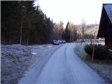
Cross the Border crossing Ljubelj into Austria, and at the Mali Ljubelj pass, turn left towards the Poden / Bodental valley. There is a bit of a climb before you reach Slovenji Plajberk / Windisch Bleiberg, and a little after the village the road turns left. In the middle of the left turn, turn right onto a side road towards Strugarje / Strugarjach. Continue through Plajberisch Graben - Bleiberger Graben, and follow the road to a crossroads where, at an interesting sign to the right, the road branches off in the direction of the Vranjica saddle / Orienzasattel and the Psinski vrh hill / Sinacher Gupf. Park in a suitable place near the crossroads.
Path description:
At the end of the parking lot, signs direct you to the road on the right, which climbs gently up a grassy slope. As you walk along the road, you can see your destination on the left, which will take an hour and a half to reach. The road then leads us within a few minutes to a chapel where there is also a sign prohibiting further driving. The road, which then climbs slightly less steeply, leads us after a 20-minute walk to the crossroads of the route at Sedlo Vranjica / Orienzasattel.
Here you continue along the road to the left, which you leave after a few steps. A marked footpath branches off the road up to the left, leading to our destination. The path then approaches a large copse of wods, which you climb along for some time. From the top of this clearing, we have a beautiful view of part of the Drava valley. The path then climbs for some time along and along a wide forested ridge, which is not to steep. Once the path passes from the ridge to the steep slopes, it begins to climb steeply towards the top of the mountain. Just a few steps below the summit, you step out of the forest and see the cross at the top of the mountain.

Pictures:
 1
1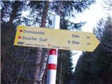 2
2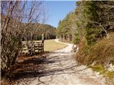 3
3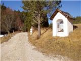 4
4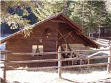 5
5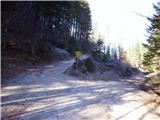 6
6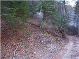 7
7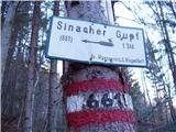 8
8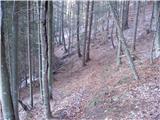 9
9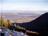 10
10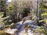 11
11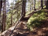 12
12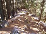 13
13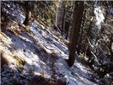 14
14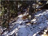 15
15 16
16
Discussion about the trail Plajberški graben / Bleiberger Graben - Sinacher Gupf / Psinski vrh
|
| Fulcrum15. 11. 2019 |
Izhodišče (slika 1) se nahaja približno 1,5 km naprej od Slovenjega Plajberka. Z istega izhodišča lahko gremo tudi na sosednjo Žingarico; poti se ločita na sedlu Vranica (slika 6).
|
|
|